Harpold & White, 2013
AGI LiDAR Handout
Harpold, A.A. and T.S. White (2013)
AGI 2013 handout National
-

Boulder, Catalina-Jemez, INVESTIGATOR
-

National, Shale Hills, INVESTIGATOR, STAFF
Abstract
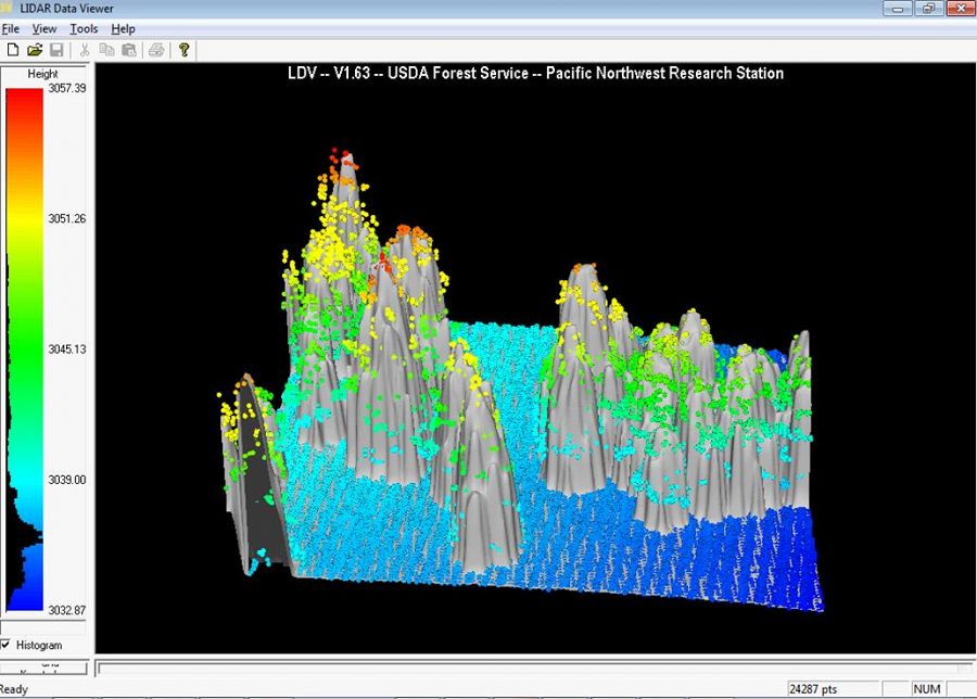
Image developed with FUSION LDV using Jemez River CZO LiDAR data. An exercise introduces high-school teachers to LiDAR and allows students re-create this image (and more!).
This is a 2-page handout given to high-school teachers through the Americal Geosciences Institute (AGI) to introduce their students to LiDAR technology and Critical Zone science. The second page has two computer-based exercises for student to explore real LiDAR datasets.
Citation
Harpold, A.A. and T.S. White (2013): AGI LiDAR Handout. AGI 2013 handout.
Associated Data
Jemez River Basin - LiDAR - Snow-off (2010)
5 components •
Jemez River Basin •
GIS / Remote Sensing •
Guo, Qinghua; Pelletier, Jon; Parmenter, Robert; Allen, Craig; Judy, Barbara; Durcik, Matej
Explore Further
