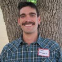
Critical Zone Profile - THEODORE BARNHART (hydrologist, PhD student)
Much of the western United States and a large portion of the global population rely upon fresh water from snowmelt. Climate warming is altering the fraction of precipitation that falls as snow, as well as the amount and timing of precipitation. The resulting changes in temperature and precipitation have the potential to greatly alter the timing and rate of snowmelt.
Theodore Barnhart is looking at how changes in snowmelt timing and rate alter the balance between forest water use and streamflow. His research addresses essential questions, such as:
(1) Does a snowpack that melts faster create more or less streamflow than a snowpack that melts more slowly?
(2) How does the timing of snowmelt alter this balance?
(3) Do different soil depths impact these relationships?
Answering these questions and understanding the processes that govern snowmelt will allow scientists and water resources managers to better forecast how much water a given snowpack will yield and whether different regions have different water yield sensitivities to changes in snowmelt rate or timing.
“The CZOs provide a window into largely un-impacted systems with measurements of nearly all the fluxes in and out. They provide a rare opportunity to advance our knowledge on a variety of fronts.” – Theodore Barnhart
When I was growing up in Seattle, I learned to ski in the Cascade Mountains. Now when I return home for the winter holidays, I seldom bring skis because I cannot count on there being enough snow to ski. During the winter of 2014-2015 the Cascades and Olympics received very little snow, and hiking routes in the Olympic National Park that usually don’t’ open until late July were already passable in June.
I attended Whitman College in eastern Washington and received my Bachelor's degree in geology and environmental studies. I went on to earn a Master's degree in geology from Idaho State University. For my Bachelor's thesis I studied glacial sediment as a proxy for glacier melt in Svalbard, and for my Master's I studied a permafrost degradation landform in Alaska. These projects honed my quantitative skills and understanding of Earth science, which made it possible for me to switch fields to hydrology for my Doctorate.
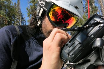
Winter fieldwork on Niwot Ridge, Colorado. I am using a field computer to download measurements from a data logger. Photo courtesy of K. Jennings.
Studying the critical zone is especially important for hydrology because the structure of the critical zone acts as a filter for water and energy inputs to the land surface. Hydrologists are often interested in the discharge of water from a catchment. Understanding how different critical zone architectures change how energy and water inputs are processed is key to understanding why different catchments may react differently to climate change.
The way in which snowmelt is partitioned between forest water use and streamflow is controlled by how quickly the snow melts. Years with a large snowpack that melts quickly partition more snowmelt to streamflow than to forest water use. Conversely, years with a small snowpack that melts slowly partition more snowmelt to forest water use than to streamflow.
My work directly addresses water resource concerns by quantitatively investigating the relationship between hydrologic partitioning of snowmelt and snowmelt rate and timing. My research will help scientists and resource managers better predict how climate warming-induced changes in the mountain snowpack will translate to changes in available water for ecosystems and downstream human uses. On the hydrology front, a clearer understanding of the balance between forest water use and streamflow could lead to tailored management strategies to maximize both streamflow and forest productivity.
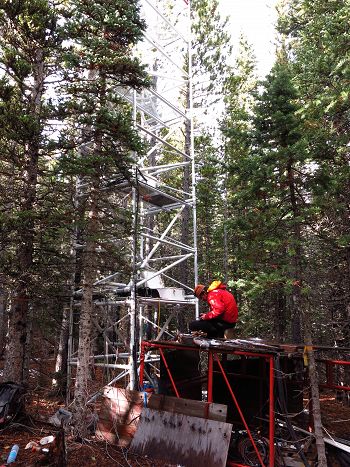
Fieldwork to maintain snow depth sensors on Niwot Ridge, Colorado. Snow depth sensors are an easy way to measure snow accumulation and melt events. Photo courtesy of E. Baker.
My project relies on long-term data sets, some of which include measurements taken more than ten years ago. Since such long-term data is required, my greatest challenge is thinking creatively about how I can weave different, complementary data sets together. To do this I have reached out to other groups working at my sites for complementary data sets and used hydrologic modeling to fill gaps in the observational record
The CZO network has provided me with opportunities to collaborate with other researchers and to add an additional site and a modeling component to my work. I’m currently working with Dr. Christina Tague at the Southern Sierra CZO to add a modeling component at Como Creek in Colorado and to expand this study to Providence Creek in California and possibly to other sites at the Reynold’s Creek and Jemez-Catalina CZOs. Additionally, working with the CZO network has allowed me to participate in workshops to learn more about wireless sensor networks, which may be helpful when I set up new research sites in the future
I am hoping to use my degree to move into a Federal Agency such as the USGS, Forest Service, or NOAA. I am also interested in exploring a career in private consulting or water resources management and forecasting.
:: By Linda Copman, staff writer ::
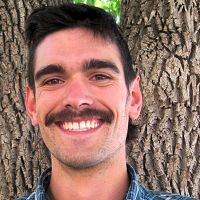
Theodore Barnhart
Winter fieldwork on Niwot Ridge, Colorado. I am using a field computer to download measurements from a data logger. Photo courtesy of K. Jennings.
Fieldwork to maintain snow depth sensors on Niwot Ridge, Colorado. Snow depth sensors are an easy way to measure snow accumulation and melt events. Photo courtesy of E. Baker.
News Category:
RESEARCH |
PEOPLE |
EDUCATION/OUTREACH
Related News
Explore Further
