Sensors & Field Instruments
The Shale Hills watershed has a comprehensive base of instrumentation for physical, chemical and biological characterization of water, energy, stable isotopes and geochemical conditions.
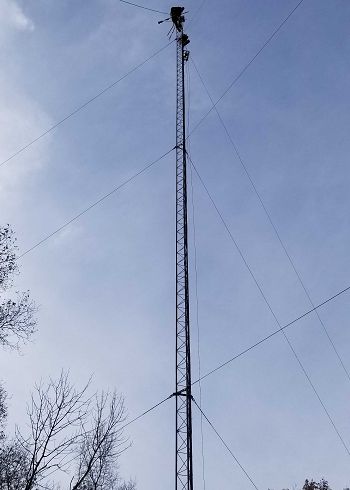
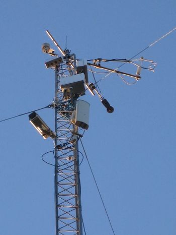
Eddy Flux tower located on the northern ridge of the catchment with the phenocam, 4-way radiation, temperature, and relative humidity sensors.
Instrumentation
The Susquehanna Shale Hills CZO consists of three sub watersheds that lay within the larger Shavers Creek Watershed that has a comprehensive base of instrumentation for physical, chemical and biological characterization of water, energy, stable isotopes and geochemical conditions. Instrumentation includes a network of soil moisture sensors at multiple depths, shallow observation wells with pressure transducers, and soil lysimeters at multiple depths, COSMOS soil moisture instruments, and research weather stations. Weather stations include eddy flux measurements for latent and sensible heat flux, CO2, and water vapor, radiation, barometric pressure, temperature, relative humidity, wind speed/direction, snow depth sensor, leaf wetness sensors, tipping bucket and a load cell precipitation gauges. Sapflow measurements are carried out as a function of tree species in Shale Hills and Garner Run. Stream discharge measurements are made using flumes, pressure transducers, and measurements with Sontek FlowTracker instruments. Geochemical measurements for cations, anions, isotopes are obtained from streams, groundwater, ponds, springs, and lysimeters. Field parameters (temperature, pH, Conductance, Specific Conductance, DO) are measured with a YSI PRO Plus.
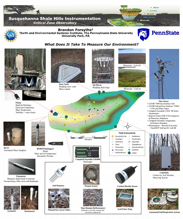
Poster of some primary sensors used throughout Shale Hills. some of the same sensor types are used in Garner Run and Cole Farm field areas.
Network
Shale Hills
A 15 amp, 120-volt power service including lightning and surge protection supply all the power throughout the watershed. Additional outlets have been installed continue to be installed as needed. 12V deep cycle batteries back up each location.
Data loggers located at the flume, CZMW_10, SPVF, SPMS, SPRT, NPMS and the tower are directly hardwired to the Penn State Network through a series of CAT6 cable connections, fiber optic, switches, and firewalls (network below). The COSMOS unit is currently setup and transmitting data through satellite telemetry. Data are automatically collected and transmitted to the database through Campbell Scientific LoggerNet and LNDB software.
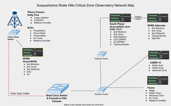
Detailed diagram of the network at Shale Hills catchment. The systems are separately wired with individual IP addresses. The NPMS, RTH1, and Flux Tower use one switch and the SP sites, flume, and CZMW 10 use another switch. All are routed to the communications shed and direct connections are made to servers on the PSU campus.
Monitoring wells throughout the catchment and hyporheic water temperature sensors require manual downloads and are accomplished on a monthly basis. Wells listed in the table show the sensor types deployed.
| Well ID | Sensor Type |
|---|---|
| CZMW 5 | HOBO |
| CZMW 6 | HOBO |
| CZMW 7 | HOBO |
| CZMW 8 | VanEssen Micro Diver |
| CZMW10 | METER HYDROS-21 |
| DCO | InSitu Level Troll 500 |
| Well ID | Sensor Type |
|---|---|
| Well 3 | HOBO |
| Well 5 | HOBO |
| Well 7 | HOBO |
| Well 9 | HOBO |
| Well 11 | HOBO |
| Well 12 | HOBO |
Other data that require manual readings/downloads include time-domain resistivity (TDR) sensors, lysimeters, and gas access tubes.
System Characteristics
1) Scalability: Additional data loggers and sensors can be added to the network either by hard wiring data loggers to the switches are linking them to other data loggers through PakBus. Data loggers can also be equipped with radios or wireless modules.
2) Web Access to Field Data: Streaming data allow users to access raw data directly through the web portal. It is also allows field managers and technicians to monitor the status of the data loggers and sensors to ensure equipment are operating. Automatic warnings and messages are triggered through Nagios and SQL agents. Nagios messages are emailed to Field Manager when an assigned IP address cannot communicate to the server and a second message is sent when the connection is made again. SQL agents are setup to email Field Manager when data thresh-holds are violated. These thresh-holds vary depending on site and data type.
3) Security: Each data logger is protected by a series passwords; one password allows user to just connect and download data – cannot make any changes, another password allows user to download data and make changes. The entire system lays behind University firewalls.
Flux Towers
Eddy Co-variance Towers
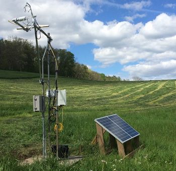
Two Li-Cor 7500A open path CO2/H2O gas analyzers are utilized to measure water and carbon exchange with the atmosphere. In Shale Hills, the system resides at the top of a 30-meter tower atop of the northern ridge. The tower also contains 4-way radiation, air temperature, and relative humidity sensors and a phenocam. This tower is powered by the 120-volt line power passing through a ac-dc converter. The second flux tower was installed at Cole Farm on a 2.5-meter tower. The Cole Farm tower is powered via solar array and battery bank.
Ground HOG – Ground Hydrologic Observation Gear
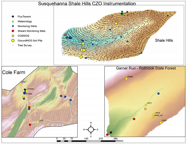
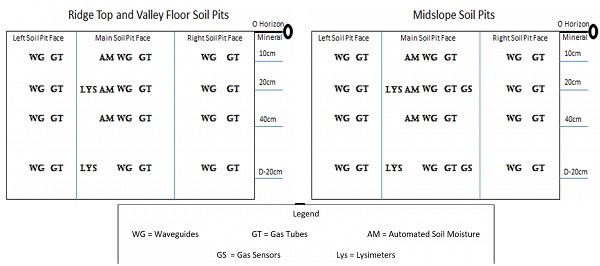
GroundHOG consists of four pits at each location; Shale Hills, Garner Run, and Cole Farm. Pits are instrumented the same across all the sub-catchments to the extent possible. Automated Stevens HydraProbe-II sensors were installed in the center uphill walls at depths of 10, 20, and 40 cm to measure and record soil moisture data at an interval of 10 minutes. Cole Farm pits have an additional soil moisture measurement at depths of 90-cm. Time-domain resistivity, or waveguide, and gas access tubes were installed on the left, center, and right faces of each pit. Lysimeters were installed in the uphill center faces of the pits. The figure below shows the summary of sensor installations.
COSMOS Soil Moisture
Three Hydroinnova, Inc. Cosmic-ray Soil Moisture Observing Systems were installed; one in each sub-catchment. These systems measure low-energy cosmic-ray neutrons that can be used to interpolate soil moisture over large areas. The Shale Hills COSMOS was installed in collaboration with University of Arizona and uses the CR-1000 model. Garner Run and Cole Farm COSMOS are CR1000/b models. All three systems use satellite telemetry to transmit data in real time.
Stream Discharge
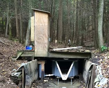
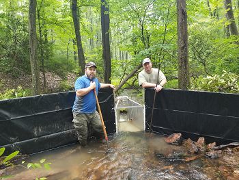
Stream discharge is measured through the catchments and the larger Shavers Creek Watershed at several locations. An OpenChanell H-flume with a 3D approach and stilling well is used in conjunction with a Meter Hydros21 sensor to monitor and measure discharge. A Parshall flume and a non-vented Onset HOBO U20 sensor monitors and records stage which can then be sued to compute discharge for the Garner Run stream. At Cole Farm a Onset HOBO U20 sensor is used to measure water level and discharge measurements are obtained using a Sontek FlowTracker. Using the measurements of from both a stage-discharge rating is developed to compute the discharge for Shavers Creek.
SSHCZO Field Instrumentation (revised 2018-12-18).
Detailed diagram of the network at Shale Hills catchment. The systems are separately wired with individual IP addresses. The NPMS, RTH1, and Flux Tower use one switch and the SP sites, flume, and CZMW 10 use another switch. All are routed to the communications shed and direct connections are made to servers on the PSU campus.
Poster of some primary sensors used throughout Shale Hills. some of the same sensor types are used in Garner Run and Cole Farm field areas.
Shale Hills Flux Tower sensors.
Cole Farm Flux Tower and solar power system.
GroundOG Sensor Layout
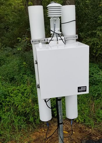
Shale Hills Hydroinnova CRS-1000.
Cole Farm Hydronniva CRS-2000B
Shale Hills stream H-flume
Garner Run stream Parshal flume
Gallery
Instruments and Sensors - SSH

Eigenbrodt NSA -181S wet only precipitation collector located on the North ridge of catchment.

Young wind monitor located on the North ridge of catchment.

The COsmic-ray Soil Moisture Observing System (COSMOS) installed by Trenton Franz, Research Scientist at the University of Arizona in July 2011.

Gamma-ray, caliper, and opticla televiewer are logged in sequence for this valley floor well, CZMW 1.

Soil access tubes are nested to sample soil gas from multiple depths.

Soil lysimeters nests are located on the ridge top, middle slope and valley floor landscape positions along planer and swale transects on both the north and south sides of the catchment.

Soil gas samplers were co-located with each of the 12 lysimeter nests to measure CO2 concentrations at varying depths from shallow (10cm) to deep (160cm).

Eddy Flux Tower, located on the North ridge, now has mounted a PhenoCam as well as a laser precipitation monitor.

Climate Monitor

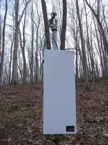
Portable climate monitiors which have been installed at all the shale transect study site.

Snow Scale SSC300 was installed spring 2012 and is a precision Snow Water Equivalent (SWE) measurement instrument.
Explore Further
