Garner Run - Sandstone Forested
Garner Run Sandstone Forested site is situated on both sides of a segment of Garner Run, a tributary of Shavers Creek, on sandstone bedrock of slopes of Leading Ridge and Tussey Mountain in Huntingdon County, PA. (1.34km2), located ~ 3.5 km north of the Shale Hills site, is a headwater catchment with a small stream flowing parallel to a syncline fold axis of Tuscarora Formation, an erosionally resistant orthoquartzic sandstone with minor interbedded shale units. Surficial geology is largely controlled by periglacial alteration, such as slumps and solifluction lobes associated with thawing permafrost soils.
Parent Field Area:
Susquehanna Shale Hills Critical Zone Observatory ▲
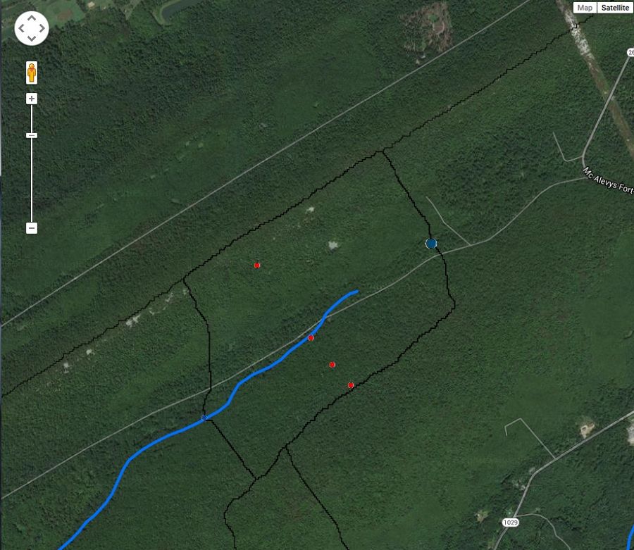
Google MapsTM satellite view of the Garner Run Sandstone Forested site.
-
Setting & Research
TBD...
-
Data
Garner Run - Sap Flow - Garner Run Sap Flow Data (2016-2018)
1 components • Garner Run - Sandstone Forested • Biology / Ecology • Eissenstat, David M.Garner Run - Soil Geochemistry (2014-2016)
1 components • Garner Run - Sandstone Forested • Geochemistry / Mineralogy • Brantley, Susan L.Garner Run - Vegetation (2014)
2 components • Garner Run - Sandstone Forested • Soil Science / Pedology • Margot KayeGarner Run (Sandstone Forested) - Groundwater Chemistry (2014-2016)
1 components • Garner Run - Sandstone Forested • Hydrology, Geochemistry / Mineralogy • Brantley, Susan L.Garner Run (Sandstone Forested) - Hydropedologic Properties, Soil Moisture, Soil Temperature (2015-2018)
4 components • Garner Run - Sandstone Forested • Soil Science / Pedology • Lin, Henry; Brantley, Susan L.Garner Run (Sandstone Forested) - Hydropedologic Properties - Real and Imaginary Dielectric Constants (2014-2016)
1 components • Garner Run - Sandstone Forested • Soil Science / Pedology • Lin, HenryGarner Run (Sandstone Forested) - Soil Gas - Gas Sample (O2 and CO2) (2015-2018)
2 components • Garner Run - Sandstone Forested • Geochemistry / Mineralogy, Soil Science / Pedology • Jason Kaye; Caitlin Hodges; Ben DillnerGarner Run (Sandstone Forested) - Soil Gas (2015)
1 components • Garner Run - Sandstone Forested • Geochemistry / Mineralogy, Soil Science / Pedology • Kaye, Jason; Hill, LillianGarner Run (Sandstone Forested) - Soil Moisture - COSMOS Probe (2015-2016)
2 components • Garner Run - Sandstone Forested • Soil Science / Pedology • Li, Li; Xiao, DachengGarner Run (Sandstone Forested) - Stream Water Temperatures - Fiber-Optic Distributed Temperature Sensor (2014)
1 components • Garner Run - Sandstone Forested • Hydrology • Russo, Tess; Hoagland, BethGarner Run (Sandstone Forested) - Groundwater Depth, Groundwater Temperatures (2015-2016)
1 components • Garner Run - Sandstone Forested • Hydrology • Russo, Tess; Hoagland, BethGarner Run (Sandstone Forested) - Geophysics, Seismic Refraction, Geomorphology (2016-2017)
6 components • Garner Run - Sandstone Forested • Geophysics, Geomorphology • Hayes, JordanGarner Run (Sandstone Forested) - Groundwater Temperatures, Barometric Pressure, Groundwater Depth (2017-2019)
1 components • Garner Run - Sandstone Forested • Hydrology • Tess Russo; Beth HoaglandGarner Run (Sandstone Forested) - Regolith Survey (2015-2016)
2 components • Garner Run - Sandstone Forested • GIS / Remote Sensing • Roman DiBiase; Joanmarie Del VecchioGarner Run (Sandstone Forested) - Precipitation - Precipitation (2018-2019)
6 components • Garner Run - Sandstone Forested • Climatology / Meteorology, Hydrology, Soil Science / Pedology • Eissenstat, David M.; Duncan, Jon; Tang, QichengGarner Run Outlet - Streamflow / Discharge, Air Temperature, Stream Water Temperatures (2014-2016)
1 components • Garner Run - Sandstone Forested • Hydrology • Russo, Tess; Hoagland, BethNational - Soil Gas - CO2 and O2 (2014-2017)
2 components • Bigelow Site (High-Elevation), Jemez 2013 Burned ZOB, Jemez Unburned Site, Calhoun CZO Research Area 1, Garner Run - Sandstone Forested, Northeastern Puerto Rico and the Luquillo Mountains • Biogeochemistry, Climatology / Meteorology, Soil Science / Pedology, Biology / Ecology • Brecheisen, Zachary; Chorover, Jon; Kaye, Jason; Silver, Whendee; Abramson, Nate; Barron-Gafford, Greg; Condon, Katherine E.; Cook, Charles W.; Hill, Lillian; Losleben, Mark; Minor, Rebecca; O'Connell, Christine; Richter, Daniel deB.; Durcik, MatejShale Hills - Soil Gas - Soil Gas Sample (O2 and CO2) (2015-2018)
2 components • Garner Run - Sandstone Forested • Geochemistry / Mineralogy, Soil Science / Pedology • Jason Kaye; Caitlin Hodges; Ben DillnerShale Hills, Garner Run (Sandstone Forested) - Vegetation, Tree Growth & Physiology (2014)
2 components • Garner Run - Sandstone Forested, Susquehanna Shale Hills Critical Zone Observatory • Biology / Ecology • Kaye, MargotShale Hills, Garner Run (Sandstone Forested) - Vegetation (2015)
1 components • Garner Run - Sandstone Forested, Susquehanna Shale Hills Critical Zone Observatory • Biology / Ecology • Brubaker, KristenShaver's Creek Watershed - Vegetation - Leaf Litter Collection Data (2015)
1 components • Garner Run - Sandstone Forested, Susquehanna Shale Hills Critical Zone Observatory • Biology / Ecology • Eissenstat, David M.; Kaye, MargotShaver's Creek Watershed - Tree Growth & Physiology - Root Distribution Data (2015)
1 components • Garner Run - Sandstone Forested, Susquehanna Shale Hills Critical Zone Observatory • Biology / Ecology • Eissenstat, David M.
Explore Further
