Susquehanna Shale Hills Critical Zone Observatory
Our interdisciplinary team works collaboratively in one observatory to advance methods for characterizing regolith, to provide a theoretical basis for predicting the distribution and properties of regolith, and to theoretically and experimentally study the impacts of regolith on fluid pathways, flow rates, and residence times.
0.08 km2 Area
256 - 310 m Elev
9.5 °C Temp
1050 mm Precip
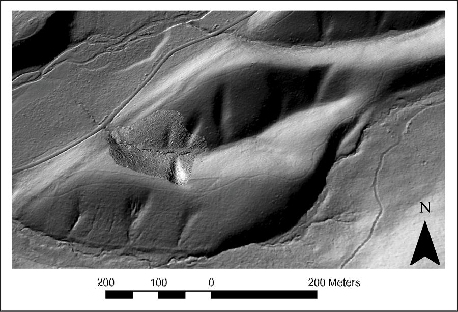
Bare earth Digital Elevation Model from the NCALM Lidar Survey
Lithology
shale
Soil Order
Inceptisol, Ultisol
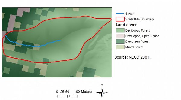
Biome
deciduous forest
Land Use
forest land
Areas within Susquehanna Shale Hills Critical Zone Observatory
-
Setting & Research
The Susquehanna Shale Hills Critical Zone Observatory (CZO) is a forested, small, temperate-climate catchment in central Pennsylvania in which the regolith is developing upon homogeneous shale. The purpose of the observatory and associated interdisciplinary research is to quantitatively predict the creation, evolution, and structure of regolith as a function of the geochemical, hydrologic, biologic, and geomorphologic processes operating in a temperate, forested landscape.
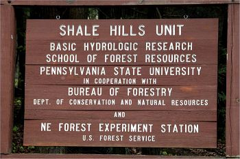
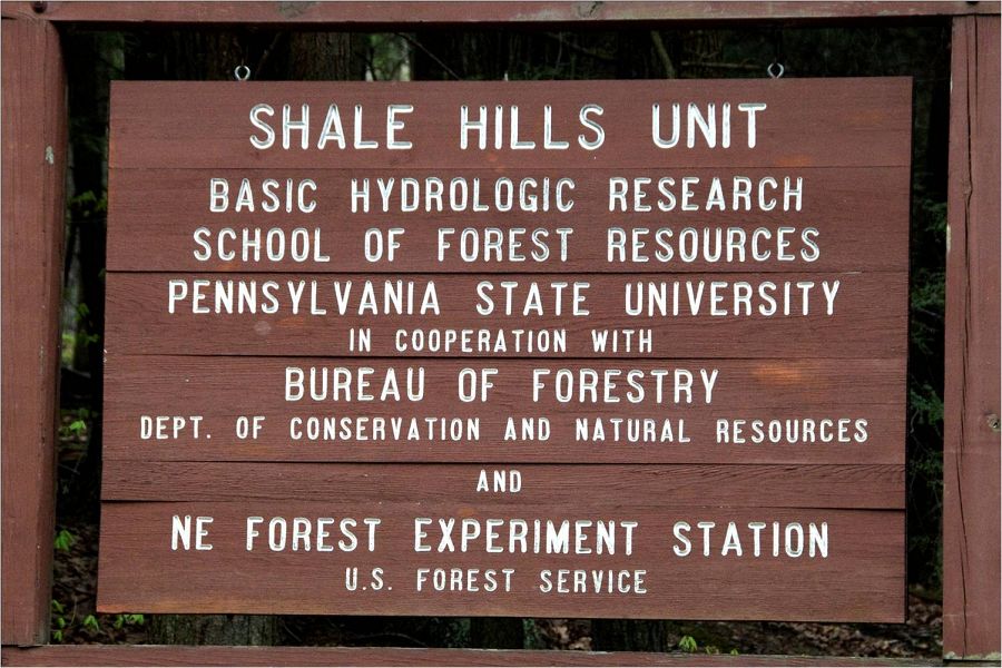
The catchment lies within the greater Penn State Forest which is managed and funded by the Pennsylvania State University, College of Agricultural Sciences, Department of Ecosystem Science and Management, Forestlands Management Office.
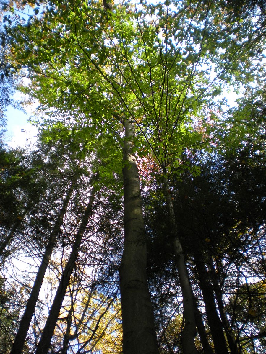
The small temperate-climate catchment hosts approximately 22 tree species.
By creating an interdisciplinary team working collaboratively in one observatory we aim to advance methods for characterizing regolith, to provide a theoretical basis for predicting the distribution and properties of regolith, and to theoretically and experimentally study the impacts of regolith on fluid pathways, flow rates, and residence times. The research site, the focus of National Science Foundation-supported research since the 1970s, has comprehensive datasets on distributed water budgets (1970-75), has served as a model test bed for hydrological response (1998-present), and will be augmented here by new geochemical, geomorphological, ecological, lidar, and soils datasets, all available to the research community.
The Shale Hills catchment is part of the Penn State Experimental Forest Lands and has been undergoing research in the 1907's.
Susquehanna Shale Hills CZO represents an opportunity to investigate the rates and mechanisms of saprolite and soil formation on a relatively simple but ubiquitous bedrock lithology that has been documented to be important in determining global fluxes of C, P, and platinum–group elements worldwide. Furthermore, the regolith at Shale Hills has experienced at least two potentially significant perturbations in the geologically recent past: a climatic perturbation from periglacial to modern conditions, and a biologic perturbation from anthropogenic clearing of forests during and repeatedly since colonial occupation. The magnitude of these perturbations and their influence on regolith generation afford an opportunity to assess the time scales of response of soil production to both long-term climate change and human activity.
This first order catchment experiences both wet and dry seasons annually.
The Susquehanna Shale Hills Observatory includes a transect of satellite study sites representing a climosequence spanning from central New York through the Appalachian Mountains to Alabama, all located on the same Silurian shale formation. Additional satellites are located in Puerto Rico and Wales. Partner institutions near each site include undergraduate only colleges as well as minority serving institutions. At each site, soil and bedrock samples have been collected, and meteorological and soil moisture/temperature instrumentation has been deployed, the focus of an ongoing Penn State Geosciences PhD pursuit.
The Shale Hills catchment is part of the Penn State Experimental Forest Lands and has been undergoing research in the 1907's.
The small temperate-climate catchment hosts approximately 22 tree species.
This first order catchment experiences both wet and dry seasons annually.
Bedrock at SSHCZO is entirely Clinton group shale.
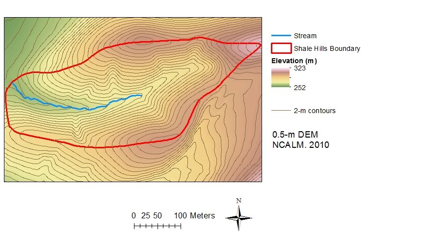
Topography at SSHCZO.
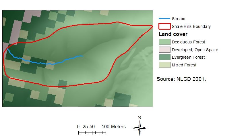
Land cover at SSHCZO (NLCD 2001).
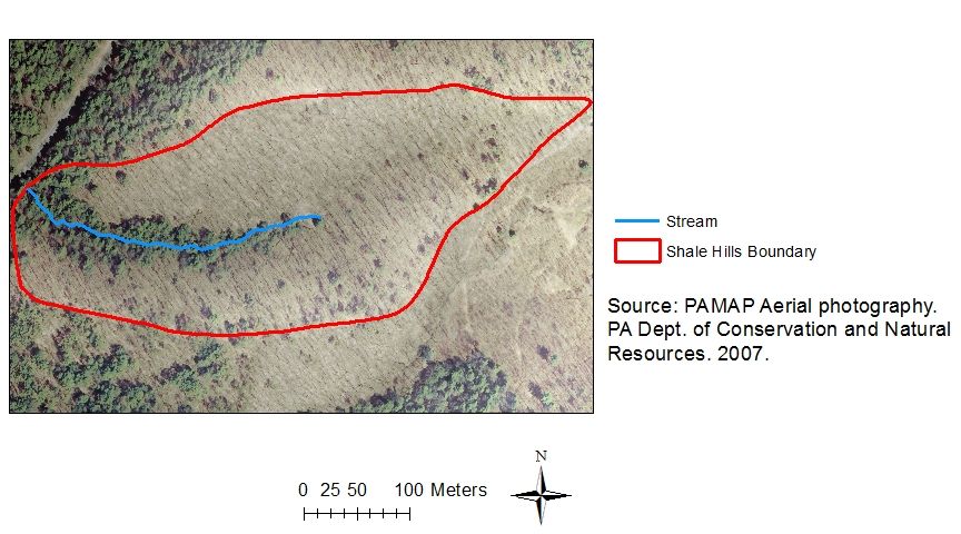
Aerial image of SSHCZO.
Tree species (DBH > 10cm) and sapflow measurements at SSHCZO.
Soil Orders at SSHCZO.
-
Overview Maps
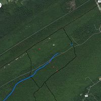
Susquehanna Shale Hills CZO
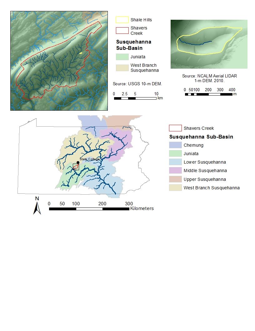
Susquehanna Shale Hills CZO. See tabs below for detailed maps pertaining to Shale Hills.
See full size (in new tab/window)
-
Dynamic Map
To fully zoom into a small area, you may need to visit the "Map" button and uncheck "Terrain" view.
-
Data
Garner Run - Electrical Conductivity, Soil Temperature (2018)
1 components • Susquehanna Shale Hills Critical Zone Observatory • Geochemistry / Mineralogy, Soil Science / Pedology • David Eissenstat; Jon Duncan; Qicheng TangGarner Run and Shale Hills - Soil Gas, Soil Moisture (2015-2016)
1 components • Susquehanna Shale Hills Critical Zone Observatory • Geophysics, Geochemistry / Mineralogy • Jason Kaye; Lillian HillNational - Air Temperature, Flux Tower, Meteorology - NADP and NOAA or other weather stations (2017)
8 components • Boulder Creek Watershed, Calhoun Critical Zone Observatory, Jemez River Basin, Susquehanna Shale Hills Critical Zone Observatory • Climatology / Meteorology • NADP; NOAA; othersNational - Climate, Flux Tower, Streamflow / Discharge - CUAHSI WDC web services (1968-2015)
7 components • Boulder Creek Watershed, Christina River Basin, Jemez River Basin, Santa Catalina Mountains, El Verde Field Station, Northeastern Puerto Rico and the Luquillo Mountains, Rio Blanco, Rio Mameyes, Susquehanna Shale Hills Critical Zone Observatory, Providence Creek Headwater Catchments (1660 - 2115 m elevation), Wolverton Basin (2230 - 2700 m elevation), Other instrumented sites • Climatology / Meteorology, Hydrology, Soil Science / Pedology • Boulder Creek Critical Zone Observatory; Catalina-Jemez Critical Zone Observatory; Luquillo Critical Zone Observatory; Shale Hills Critical Zone Observatory; Southern Sierra Critical Zone Observatory; Christina River Basin Critical Zone ObservatoryNational - Flux Tower - AmeriFlux Network data (2007-2018)
14 components • Boulder Creek Watershed, Jemez River Basin, Reynolds Creek Experimental Watershed, Susquehanna Shale Hills Critical Zone Observatory, San Joaquin Experimental Range (210-520 m elevation), Soaproot Saddle (1000-1500 m elevation), Short Hair (2670 m elevation) • Climatology / Meteorology • Boulder Creek Critical Zone Observatory; Catalina-Jemez Critical Zone Observatory; Reynolds Creek Critical Zone Observatory; Shale Hills Critical Zone Observatory; Southern Sierra Critical Zone ObservatoryNational - LiDAR, Land Cover, GIS/Map Data - OpenTopography (2010-2017)
18 components • Boulder Creek Watershed, Eel River Watershed, Jemez River Basin, Reynolds Creek Experimental Watershed, Susquehanna Shale Hills Critical Zone Observatory, Northeastern Puerto Rico and the Luquillo Mountains, Sangamon River Basin, Clear Creek Watershed, Calhoun Critical Zone Observatory, Providence Creek Headwater Catchments (1660 - 2115 m elevation) • Geomorphology, GIS / Remote Sensing, Hydrology, Biology / Ecology • National Center for Airborne Laser Mapping; Boulder Creek Critical Zone Observatory; Calhoun Critical Zone Observatory; University of Arizona; University of California Merced; Valles Caldera National Preserve; Bandelier National Monument; National Park Service; Jemez River Basin and Santa Catalina Mountains Critical Zone Observatory; Luquillo Critical Zone Observatory; Reynolds Creek CZO; Eel River CZO; Shale Hills CZONational - Stream Water Chemistry - Cations, Anions, Metals (1982-2015)
1 components • Bisley, Betasso, East Peak, Marshall Gulch (High-Elevation), Providence Creek Subcatchment P301, Providence Creek Subcatchment P303, Providence Creek Subcatchment P304, Eel River Watershed, Puente Roto, Rio Blanco, Rio Icacos, Susquehanna Shale Hills Critical Zone Observatory • Biogeochemistry, Biology / Ecology, Hydrology, Water Chemistry • Hyojin, Kim; Bishop, Jim; Dietrich, William; Fung, Inez; McDowell, William H.; Brantley, Susan L.; Hoagland, Beth; Sullivan, Pamela L.; Cain, Molly; Neal, Andrew; Fisher, Jessica; Russo, Tess; Niwot Ridge LTER; Liu, Fengjing; Chorover, Jon; Troch, Peter; McIntosh, Jennifer; Brooks, Paul; Abramson, Nate; Heidbuechel, Ingo; Amistadi, Mary Key; Alexander Pedron, Shawn; Chorover, Jon; Troch, Peter; Corley, Timothy; Zapata-Rios, Xavier; Losleben, Mark; Condon, KatherineNational - Streamflow / Discharge - USGS and USDA Data Resources (1985-2017)
22 components • Boulder Creek Watershed, Santa Catalina Mountains, Jemez River Basin, Reynolds Creek Experimental Watershed, Susquehanna Shale Hills Critical Zone Observatory, Northeastern Puerto Rico and the Luquillo Mountains, Clear Creek Watershed, Sangamon River Basin, Calhoun Critical Zone Observatory, Providence Creek Headwater Catchments (1660 - 2115 m elevation) • Hydrology • USGS National Water Information SystemShale Hills - Digital Elevation Model (DEM), GIS/Map Data, Land Cover, LiDAR, Soil Survey (2010)
16 components • Susquehanna Shale Hills Critical Zone Observatory • GIS / Remote Sensing • Guo, QinghuaShale Hills - Electrical Conductivity, Groundwater Chemistry - Solute Tracer Tests (2009)
1 components • Susquehanna Shale Hills Critical Zone Observatory • Geochemistry / Mineralogy, Water Chemistry, Hydrology • Singha, KaminiShale Hills - Electrical Conductivity, Soil Moisture, Soil Temperature (2018)
1 components • Susquehanna Shale Hills Critical Zone Observatory • Geochemistry / Mineralogy, Soil Science / Pedology • David Eissenstat; Jon Duncan; Qicheng TangShale Hills - Flux Tower (2009-2016)
1 components • Susquehanna Shale Hills Critical Zone Observatory • Climatology / Meteorology • Davis, KennethShale Hills - GIS/Map Data - Geospatial Database (2013)
1 components • Susquehanna Shale Hills Critical Zone Observatory • GIS / Remote Sensing • Neal, AndrewShale Hills - GIS/Map Data - Ground Survey (2010)
1 components • Susquehanna Shale Hills Critical Zone Observatory • GIS / Remote Sensing • Duffy, Christopher J.Shale Hills - GIS/Map Data - Control Points Survey (2010)
1 components • Susquehanna Shale Hills Critical Zone Observatory • GIS / Remote Sensing • Duffy, Christopher J.Shale Hills - Ground Penetrating Radar (GPR), Geology, GIS/Map Data - GPR Bedrock Elevation GIS Data (2008)
1 components • Susquehanna Shale Hills Critical Zone Observatory • GIS / Remote Sensing • Lin, HenryShale Hills - Ground Penetrating Radar (GPR) (2008-2009)
1 components • Susquehanna Shale Hills Critical Zone Observatory • Soil Science / Pedology • Lin, HenryShale Hills - Groundwater Chemistry, Stream Water Chemistry (2015)
1 components • Susquehanna Shale Hills Critical Zone Observatory • Geochemistry / Mineralogy, Water Chemistry • Brantley, Susan L.; Kim, HyojinShale Hills - Groundwater Chemistry, Stream Water Chemistry (2015)
1 components • Susquehanna Shale Hills Critical Zone Observatory • Geochemistry / Mineralogy, Water Chemistry • Brantley, Susan L.; Kim, HyojinShale Hills - Groundwater Chemistry (2008-2010)
3 components • Susquehanna Shale Hills Critical Zone Observatory • Water Chemistry, Hydrology • Brantley, Susan L.; Duffy, Christopher J.Shale Hills - Hydropedologic Properties, Air Temperature (2007-2014)
1 components • Susquehanna Shale Hills Critical Zone Observatory • Soil Science / Pedology • Lin, HenryShale Hills - Hydropedologic Properties, Electrical Conductivity (2009-2013)
1 components • Susquehanna Shale Hills Critical Zone Observatory • Soil Science / Pedology • Lin, HenryShale Hills - Hydropedologic Properties, Matric Potential - 229 Probes (2007-2010)
4 components • Susquehanna Shale Hills Critical Zone Observatory • Soil Science / Pedology • Lin, HenryShale Hills - Hydropedologic Properties, Matric Potential - 253 Probes (2007-2014)
1 components • Susquehanna Shale Hills Critical Zone Observatory • Soil Science / Pedology • Lin, HenryShale Hills - Hydropedologic Properties, Matric Potential - MPS Probes (2007-2014)
1 components • Susquehanna Shale Hills Critical Zone Observatory • Soil Science / Pedology • Lin, HenryShale Hills - Hydropedologic Properties, Precipitation (2007-2014)
1 components • Susquehanna Shale Hills Critical Zone Observatory • Soil Science / Pedology, Climatology / Meteorology • Lin, HenryShale Hills - Hydropedologic Properties, Soil Moisture, Soil Temperature (2015-2018)
4 components • Susquehanna Shale Hills Critical Zone Observatory • Soil Science / Pedology • Lin, HenryShale Hills - Hydropedologic Properties, Soil Moisture - Shale Hills Model Input Soil Parameters (2013)
1 components • Susquehanna Shale Hills Critical Zone Observatory • Hydrology, Modeling / Computational Science, Soil Science / Pedology • Shi, YuningShale Hills - Hydropedologic Properties, Soil Moisture (2007-2014)
1 components • Susquehanna Shale Hills Critical Zone Observatory • Soil Science / Pedology • Lin, HenryShale Hills - Hydropedologic Properties, Soil Temperature (2007-2014)
1 components • Susquehanna Shale Hills Critical Zone Observatory • Soil Science / Pedology • Lin, HenryShale Hills - Hydropedologic Properties - Real and Imaginary Dielectric Constants (2015-2016)
1 components • Susquehanna Shale Hills Critical Zone Observatory • Soil Science / Pedology • Lin, HenryShale Hills - Hydropedologic Properties - Real Dielectric Constant (2010-2011)
1 components • Susquehanna Shale Hills Critical Zone Observatory • Soil Science / Pedology • Lin, HenryShale Hills - Hydropedologic Properties - Imaginary Dielectric Constant (2010-2011)
1 components • Susquehanna Shale Hills Critical Zone Observatory • Soil Science / Pedology • Lin, HenryShale Hills - Hydropedologic Properties - Water Table (2007-2014)
1 components • Susquehanna Shale Hills Critical Zone Observatory • Soil Science / Pedology • Lin, HenryShale Hills - LiDAR, Vegetation (2010)
2 components • Susquehanna Shale Hills Critical Zone Observatory • Biology / Ecology, GIS / Remote Sensing • Qinghua GuoShale Hills - LiDAR - Terrestrial Laser Mapping (2010)
1 components • Susquehanna Shale Hills Critical Zone Observatory • Geomorphology, GIS / Remote Sensing • Kirby, Eric; Slingerland, RudyShale Hills - Meteorology (2009-2013)
6 components • Susquehanna Shale Hills Critical Zone Observatory • Climatology / Meteorology • Davis, Kenneth; Shi, YuningShale Hills - Precipitation, Meteorology (2009-2016)
1 components • Susquehanna Shale Hills Critical Zone Observatory • Climatology / Meteorology, Hydrology • Arthur, Dan K.Shale Hills - Precipitation, Meteorology (2009-2016)
1 components • Susquehanna Shale Hills Critical Zone Observatory • Climatology / Meteorology, Hydrology • Arthur, Dan K.Shale Hills - Precipitation, Meteorology - LPM Disdrometer (2009-2014)
1 components • Susquehanna Shale Hills Critical Zone Observatory • Hydrology, Climatology / Meteorology • Duffy, Chistopher; Yu, XuanShale Hills - Precipitation (2006-2013)
2 components • Susquehanna Shale Hills Critical Zone Observatory • Climatology / Meteorology, Hydrology • Duffy, Christopher J.Shale Hills - Sap Flow - Shale Hills Sap Flow Data (2016-2018)
1 components • Susquehanna Shale Hills Critical Zone Observatory • Biology / Ecology • Eissenstat, David M.Shale Hills - Sap Flow - Shale Hills Sap Flow Data (2009-2014)
13 components • Susquehanna Shale Hills Critical Zone Observatory • Biology / Ecology • Eissenstat, David M.Shale Hills - Snow Depth (2018)
1 components • Susquehanna Shale Hills Critical Zone Observatory • Climatology / Meteorology, Hydrology • Brantley, Susan L.; Forsythe, BrandonShale Hills - Soil Gas, Soil Porewater Chemistry - pCO2; CO2 Flux; N2O, NO3, NH4, DOC Concentrations (2008-2014)
11 components • Susquehanna Shale Hills Critical Zone Observatory • Geochemistry / Mineralogy • Hasenmueller, Elizabeth A.; Kaye, Jason; Weitzman, JulieShale Hills - Soil Geochemistry (2015)
1 components • Susquehanna Shale Hills Critical Zone Observatory • Geochemistry / Mineralogy • Bern, CarletonShale Hills - Soil Moisture, Hydropedologic Properties (2006-2015)
1 components • Susquehanna Shale Hills Critical Zone Observatory • Hydrology, Soil Science / Pedology, Biology / Ecology • Naithani, Kusum; Baldwin, DougShale Hills - Soil Moisture - COSMOS Probe (2011-2016)
3 components • Susquehanna Shale Hills Critical Zone Observatory • Geophysics, Hydrology • Zreda, Marek; Shuttleworth, William J.Shale Hills - Soil Moisture - Shale Hills RTH Soil Moisture Data (2009-2012)
9 components • Susquehanna Shale Hills Critical Zone Observatory • Hydrology • Duffy, Christopher J.Shale Hills - Soil Porewater Chemistry (2006-2011)
6 components • Susquehanna Shale Hills Critical Zone Observatory • Biogeochemistry, Water Chemistry, Hydrology • Brantley, Susan L.; Duffy, Christopher J.Shale Hills - Stable Isotopes, Groundwater Chemistry (2008-2011)
7 components • Susquehanna Shale Hills Critical Zone Observatory • Water Chemistry, Hydrology • Duffy, Christopher J.; Thomas, Evan M.Shale Hills - Stable Isotopes, Precipitation (2008-2011)
8 components • Susquehanna Shale Hills Critical Zone Observatory • Water Chemistry, Hydrology, Climatology / Meteorology • Duffy, Christopher J.; Thomas, EvanShale Hills - Stable Isotopes, Soil Porewater Chemistry (2008-2011)
7 components • Susquehanna Shale Hills Critical Zone Observatory • Water Chemistry, Hydrology • Duffy, Christopher J.; Thomas, Evan M.Shale Hills - Stable Isotopes, Stream Water Chemistry (2008-2011)
7 components • Susquehanna Shale Hills Critical Zone Observatory • Water Chemistry, Hydrology • Duffy, Christopher J.; Thomas, Evan M.Shale Hills - Stream Water Chemistry, Groundwater Chemistry (2015-2017)
3 components • Susquehanna Shale Hills Critical Zone Observatory • Geochemistry / Mineralogy • Brantley, Susan L.Shale Hills - Stream Water Chemistry (2006-2010)
5 components • Susquehanna Shale Hills Critical Zone Observatory • Biogeochemistry, Water Chemistry, Hydrology • Brantley, Susan L.; Duffy, Christopher, J.Shale Hills - Streamflow / Discharge, Stream Suspended Sediment (2013-2016)
1 components • Susquehanna Shale Hills Critical Zone Observatory • Hydrology • Karwan, Diana L.Shale Hills - Streamflow / Discharge, Stream Water Temperatures, Electrical Conductivity (2015-2018)
1 components • Susquehanna Shale Hills Critical Zone Observatory • Hydrology • Russo, TessShale Hills - Streamflow / Discharge, Groundwater Temperatures, Electrical Conductivity (2015-2018)
1 components • Susquehanna Shale Hills Critical Zone Observatory • Hydrology • Brantley, Susan L.Shale Hills - Streamflow / Discharge - Discharge Reanalysis (2008-2015)
1 components • Susquehanna Shale Hills Critical Zone Observatory • Hydrology, Modeling / Computational Science • Shi, Yuning; Xiao, DachengShale Hills - Streamflow / Discharge - Shale Hills Stream Flow / Discharge Data (2006-2012)
8 components • Susquehanna Shale Hills Critical Zone Observatory • Hydrology • Duffy, Christopher J.Shale Hills - Vegetation, Stable Isotopes, Soil Water Chemistry (2009-2014)
2 components • Susquehanna Shale Hills Critical Zone Observatory • Biology / Ecology, Hydrology • Gaines, Katie; Eissenstat, David M.Shale Hills - Vegetation, Stable Isotopes (2012)
1 components • Susquehanna Shale Hills Critical Zone Observatory • Biology / Ecology, Hydrology • Gaines, Katie; Eissenstat, David M.Shale Hills - Vegetation - Root Length Density (2013)
2 components • Susquehanna Shale Hills Critical Zone Observatory • Biology / Ecology • Eissenstat, David M.Shale Hills - Vegetation - Litter & Dendroband Data (2011-2013)
1 components • Susquehanna Shale Hills Critical Zone Observatory • Biology / Ecology • Kaye, Margot; Smith, LaurenShale Hills - Vegetation - Survey to Validate LiDAR (2010)
5 components • Susquehanna Shale Hills Critical Zone Observatory • Biology / Ecology • Eissenstat, David M.Shale Hills - Vegetation - Leaf Area Index (2010)
4 components • Susquehanna Shale Hills Critical Zone Observatory • Biology / Ecology • Eissenstat, David M.Shale Hills - Vegetation - Tree Survey (2008-2012)
3 components • Susquehanna Shale Hills Critical Zone Observatory • Biology / Ecology • Eissenstat, David M.; Kaye, MargotShale Hills - Groundwater Depth, Streamflow / Discharge - Watershed Reanalysis (1979-2010)
1 components • Susquehanna Shale Hills Critical Zone Observatory • Hydrology • Duffy, Christopher J.Shale Hills - Groundwater Depth, Groundwater Temperatures, Barometric Pressure, Groundwater Chemistry - Shale Hills Groundwater Depth and Groundwater Temp (2013-2019)
11 components • Susquehanna Shale Hills Critical Zone Observatory • Hydrology • Brantley, Susan L.; Kim, Hyojin; Forsythe, BrandonShale Hills - Groundwater Depth - Shale Hills Groundwater Depth Data (2009-2012)
4 components • Susquehanna Shale Hills Critical Zone Observatory • Hydrology • Duffy, Christopher J.Shale Hills - Stream Ecology - Benthic Macroinvertebrate Survey (2012)
1 components • Susquehanna Shale Hills Critical Zone Observatory • Hydrology • Susan YetterShale Hills - Geophysics, Seismic Refraction (2012-2013)
23 components • Susquehanna Shale Hills Critical Zone Observatory • Geomorphology, Geophysics • Clarke, BrianShale Hills - Geophysics - Gamma Ray Logs (2010)
1 components • Susquehanna Shale Hills Critical Zone Observatory • Geophysics • Singha, KaminiShale Hills - Geophysics (2010)
1 components • Susquehanna Shale Hills Critical Zone Observatory • Geophysics • Singha, KaminiShale Hills - Solar Radiation (2014-2016)
1 components • Susquehanna Shale Hills Critical Zone Observatory • Climatology / Meteorology • Davis, Kenneth J.Shale Hills - Geology, Sediment Transport - Sieve Data - Shale Hills & Missed Grouse (2013)
1 components • Susquehanna Shale Hills Critical Zone Observatory • Hydrology, Soil Science / Pedology • Toran, LauraShale Hills - Geology, Soil Water - Infiltrometer - Shale Hills & Missed Grouse (2013)
1 components • Susquehanna Shale Hills Critical Zone Observatory • Hydrology • Toran, LauraShale Hills - Tree Growth & Physiology, GIS/Map Data - Tree Falls (2014)
1 components • Susquehanna Shale Hills Critical Zone Observatory • Geomorphology, Biology / Ecology • White, TimShale Hills - Tree Growth & Physiology, Vegetation - Above-Ground Tree Biomass Data (2008-2012)
1 components • Susquehanna Shale Hills Critical Zone Observatory • Biology / Ecology • Kaye, Margot; Smith, LaurenShale Hills - Groundwater Temperatures, Stream Water Temperatures (2015-2016)
1 components • Susquehanna Shale Hills Critical Zone Observatory • Hydrology • Russo, Tess; Kim, HyojinShale Hills - Ecosystem model (2009-2010)
2 components • Susquehanna Shale Hills Critical Zone Observatory • Modeling / Computational Science, Climatology / Meteorology • Ken Davis; Yuting HeShale Hills, Boulder, Luquillo, JRB-SCM, Calhoun - Soil Geochemistry (2001-2013)
1 components • Susquehanna Shale Hills Critical Zone Observatory, Bisley, Boulder Creek Watershed, Northeastern Puerto Rico and the Luquillo Mountains, Santa Catalina Mountains • Geochemistry / Mineralogy, Biogeochemistry • Niu, Xianzeng; Williams, Jennifer; Brantley, Susan L.; Miller, Doug; Bills, BrianShale Hills, Garner Run (Sandstone Forested) - Vegetation, Tree Growth & Physiology (2014)
2 components • Garner Run - Sandstone Forested, Susquehanna Shale Hills Critical Zone Observatory • Biology / Ecology • Kaye, MargotShale Hills, Garner Run (Sandstone Forested) - Vegetation (2015)
1 components • Garner Run - Sandstone Forested, Susquehanna Shale Hills Critical Zone Observatory • Biology / Ecology • Brubaker, KristenShale Hills, Missed Grouse - Ground Penetrating Radar (GPR) (2013)
5 components • Susquehanna Shale Hills Critical Zone Observatory • Geophysics, Hydrology • Toran, LauraShaver's Creek - Groundwater Chemistry, Surface Water Chemistry (2014)
1 components • Susquehanna Shale Hills Critical Zone Observatory • Hydrology, Water Chemistry • Herndon, ElizabethShaver's Creek - Stream Water Chemistry - Stream Water Chemistry (2014)
2 components • Susquehanna Shale Hills Critical Zone Observatory • Hydrology, Water Chemistry • Russo, Tess; Hoagland, BethShaver's Creek - Streamflow / Discharge, Stream Water Chemistry, Stream Water Temperatures - Stream Water Discharge and Chemistry (2013-2015)
1 components • Susquehanna Shale Hills Critical Zone Observatory • Hydrology, Water Chemistry • Russo, Tess; Hoagland, BethShaver's Creek - Streamflow / Discharge, Stream Water Temperatures, Air Temperature, Electrical Conductivity, Barometric Pressure (2013-2016)
1 components • Susquehanna Shale Hills Critical Zone Observatory • Hydrology • Russo, Tess; Hoagland, BethShaver's Creek Watershed - Vegetation - Leaf Litter Collection Data (2015)
1 components • Garner Run - Sandstone Forested, Susquehanna Shale Hills Critical Zone Observatory • Biology / Ecology • Eissenstat, David M.; Kaye, MargotShaver's Creek Watershed - Tree Growth & Physiology - Root Distribution Data (2015)
1 components • Garner Run - Sandstone Forested, Susquehanna Shale Hills Critical Zone Observatory • Biology / Ecology • Eissenstat, David M. -
Photos
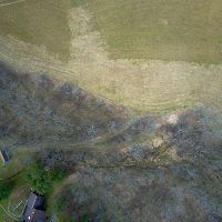
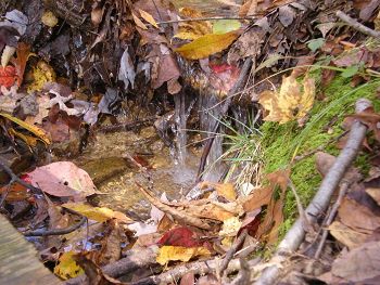
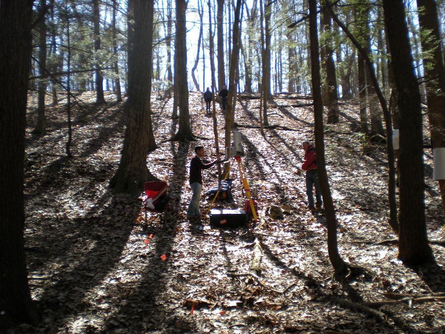
Shale Hills Field Area

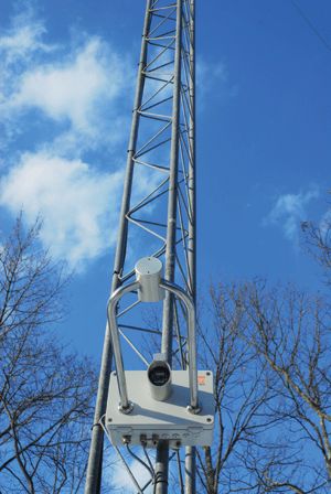
Eddy Flux Tower on northern ridge top of Shale Hills Catchment.

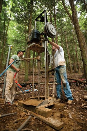
Chris Graham (Postdoctoral Fellow in Crop and Soil Sciences, Alum) and George Holmes (Civil Engineering, Alum) work together to drll a well on the valley floor.

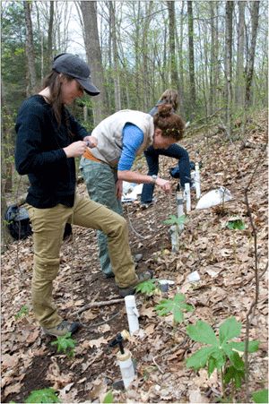
Geochemistry group, Molly Holleran (Alum), Elizabeth Herndon (PhD candidate Geosciences) and Katya Bazilveskaya (Postdoctoral Fellow, Geosciences) collect soil water from tension lysimeters in the catchment.

Katie Gaines (PhD candidate, Ecology) walks past an eKo node and tensiometer site in the catchment.

Geomorphology Team and A.J. Herrs (University of Kansas) conduct high-resolution imaging of micro-topography along hillslopes within the Shale Hills CZO catchment. Herrs used a terrestrial, tripod-mounted LiDAR (Light Detection and Ranging) to scan the topography of the catchment from multiple points; geodetically referenced prisms and reflectors were used to tie multiple scans into a single image.

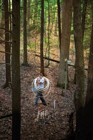
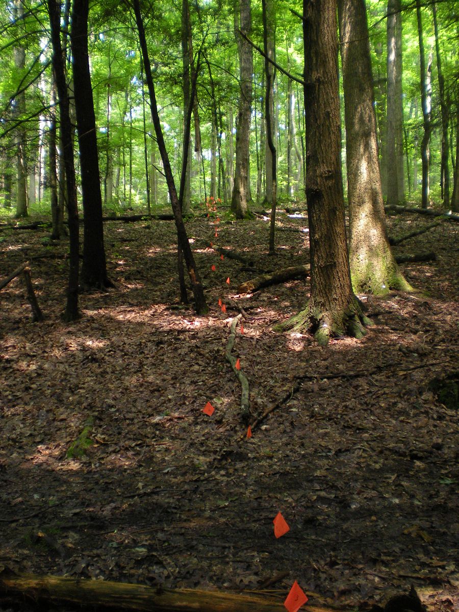
Transect from North ridge to South ridge flagged for further research.

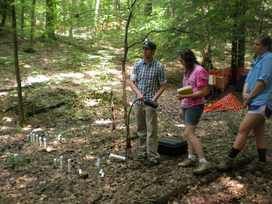
Doug Baldwin, CZO Alum, demonstrates how to collect a volumetric soil moisture content measurement with a TRIME FM TDR (time domain reflectometry) probe. Time domain reflectometry estimates the volume of moisture in the soil by observing the characteristics of reflected waveforms. Waves are emitted from the device and then reflected back to the probe by soil water.

Deborah Vazguez Ortiz, with the University of Puerto Rico Mayaguez, uses an LAI-2200, plant canopy analyzer (LI-COR Environmental) to measure leaf area index.
Shale Hills

-
Geology
- shale
Bedrock: The entire catchment is underlain by the thick (>200 m) Rose Hill shale, Silurian age.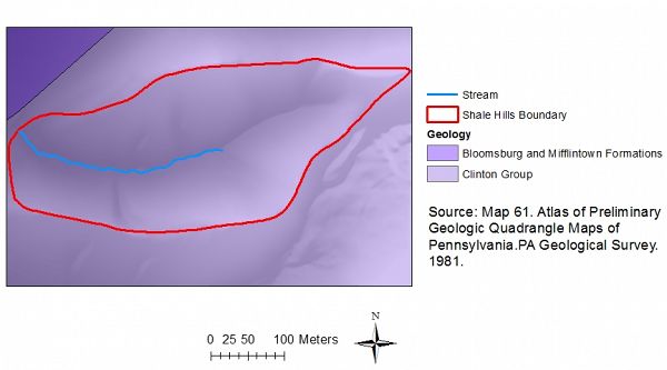
-
Topography
256 - 310 m elevation
The Susquehanna-Shale Hills Critical Zone Observatory (SSHO CZO) lies within the Valley and Ridge Physiographic Province of the central Appalachian Mountains in Huntingdon County, Pennsylvania (40º39’52. 39”N 77º54’24.23”W). It is a first order basin characterized by relatively steep slopes (25-35%) and narrow ridges. The stream is a tributary of Shavers Creek (185 km2) that eventually discharges into the Juniata River, a tributary of the Susquehanna River Basin. The SSHO basin is oriented in an east-west direction and the major side slopes have almost true north and south facing aspects. Elevation ranges from 256 meters at the outlet to 310 meters at the highest point in the watershed. The relatively uniform side slopes are periodically interrupted by seven distinct topographic depressions (swales).
-
Climate
9.5 °C Mean Annual Temp 19.0 °C Mean Warmest Month -5.4 °C Mean Coldest Month 1050 mm Mean Annual Precipitation SSHO has a humid continental climate. Temperatures average 9.5°C with large seasonal differences: January temperature is –5.4°C, July is 19.0°C. The highest temperature recorded is 33.5°C (April 27, 2009) lowest –24.8°C (January 17, 2009). Annual average relative humidity is 70.2%. Atmospheric deposition in PA is still characterized by acidic (pH~4) precipitation. 2009 water balance: Precipitation 1028 mm, Evapotranspiration 59.4 mm, Recharge 31.9 mm, Runoff 509 mm, with a runoff ratio of 49.6% and interception of 28.4 mm.
-
Ecosystems
- deciduous forest
The SSHO forest ecosystem is dominated by oak (Quercus), hickory (Carya) and pine (Pinus) species. Hemlock (Tsuga canadensis), red maple (Acer rubrum), white oak (Quercus alba) and white pine (Pinus strobus) line the deep, moist soils of the stream banks, while on the drier, shallower north and southfacing slopes, red oak (Quercus rubra), chestnut oak (Quercus prinus), pignut hickory (Carya glabra) and mockernut hickory (Carya tomentosa) are dominant, with Virginia pine (Pinus virginiana) only appearing on the north-facing ridge tops. Understory woody species include plants in the Ericaceae family (including Vaccinium spp.), service berry (Amelanchier spp.), hawthorn (Crataegus spp.), raspberry/blackberry (Rubus spp.), sugar maple (Acer saccharum) saplings and witch hazel (Hamamelis virginiana).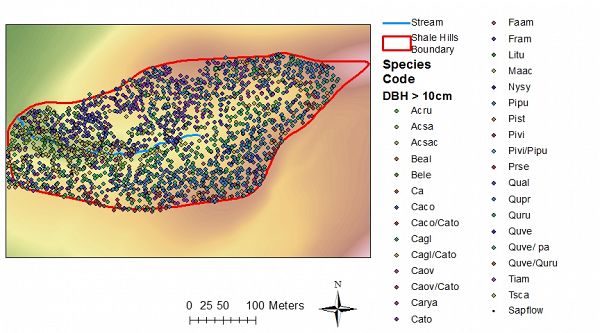
-
Soil
- Inceptisol
- Ultisol
Shallow to moderately deep, gently dipping to steep, well drained residual shale soils exist on the ridge tops, while along slopes and in the valley bottom soils have formed on a colluvial and alluvial mantle of shale chips. Typical surface soil textures are silt loam, with the percentage of channery shale increasing with depth. Effective rooting depth (depth to bedrock) ranges from 15 cm on ridge tops to 165 cm in some areas on the slopes. Soil structure is moderately developed throughout the basin. Soils are typically saturated along the stream and exhibit redoximorphic features as a result of seasonal soil saturation. A 3 – 5 cm organic layer that contains decaying leaf litter overlies all soils in the watershed.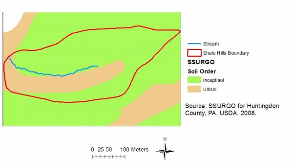
Soil Orders at SSHCZO.
-
Human Impacts
- forest land
Historically, the region was logged for charcoal to support a 19th and 20th century iron industry. Today, SSHO is a relatively pristine forest and good wildlife habitat with little human impact. The basin is primarily available for recreation, education and research. The Penn State forest, of which the basin is a part, is managed for timber with set-asides for research. There are a number of active PSU research projects within the Penn State Forest.


Explore Further
