Multiple Disciplines
© Southern Sierra Critical Zone Observatory
Critical zone science unites researchers from several disciplines and institutions. Our interdisciplinary research pairs biogeochemists with hydrologists, and ecologists with geophysicists.
Meeting the goals of Critical Zone science requires researchers with deep disciplinary knowledge as well as collaboration and integration across multiple disciplines.
- Disciplinary - Specialists are vital members of our teams since progress in Critical Zone Science requires deep knowledge of many portions of the combined physical, chemical, and biological system.
- Multidisciplinary - Close cooperation between specialists, each employing their own approach, helps to better understand interconnected Critical Zone processes.
- Interdisciplinary - Concerted integration across disciplinary boundaries has been invaluable for solving questions that require a holistic approach.
An interdisciplinary approach across an array of sciences, especially in the broad fields of geological and biological sciences, is applied to better understand the complex interconnection of Critical Zone processes. Examples include pedology, hydrology, geomorphology, geophysics, ecology, and biogeochemistry.
Close collaboration between Critical Zone Observatories has also facilitated the development of infrastructure and protocols that allow measurements to be directly compared across CZOs. See our datasets for a collection of currently available measurements.
Research groups from several institutions are involved at the Southern Sierra Critical Zone Observatory, including:
Mountain Hydrology Research Group, UC Merced
Critical Zone Lab, U. Wyoming
Intelligent Infrastructure Lab, UC Berkeley
Ecohydrology Research Lab, UC Santa Barbara
Vadose Zone Hydrology Lab, UC Davis
Ecosystem Ecology Lab, UC Irvine
Soil Biogeochemistry Lab, UC Merced
Kings River Experimental Watersheds Program, Pacific Southwest Research Station, USFS
Ecosystem Ecology Lab, UC Merced
California Soil Resource Lab, UC Davis
Environmental Systems Research Group, UC Merced
Note that this is not a comprehensive list.
Below are downloadable summaries of select multi-disciplinary activities and findings.
Vegetation‐Water‐Regolith Interactions: pdf
Outreach to CaliforniaWater Providers: pdf
Structure and Formation of Regolith: pdf
Advances in Measurement Design: pdf
SSCZO PI Roger Bales installing soil moisture probes at Upper Met Station site
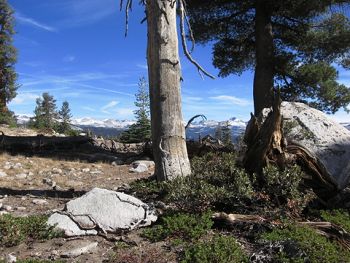
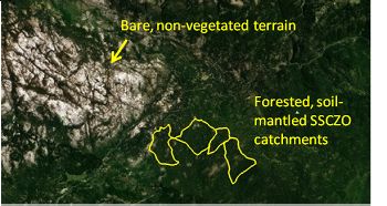
Why do dense forests of the Sierra Nevada abut bare, exposed bedrock without litte vegetation? Research on the structure and formation of regolith is exploring rates of weathering and erosion to answer this question.
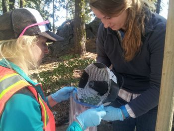
UC Merced grad students Paige Austin (left), and Morgan Barnes (right) help the dust project with the 2014 preparation for the prescribed burn.
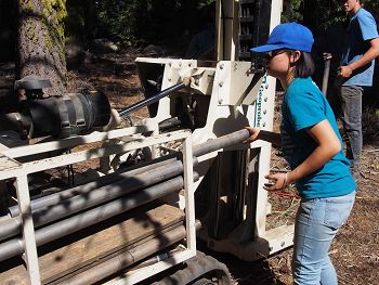
Zhiyuan Tian (Tina, UC Davis graduate student) replaces a drill casing section on the geoprobe. The team cored 4 points at this site, where we deployed a 3D Nodal seisic array a few days afterward.
© Margot Wholey December 2015
Photo by Erin Stacy, 2015
© Southern Sierra Critical Zone Observatory
© Southern Sierra Critical Zone Observatory
© Southern Sierra Critical Zone Observatory
© Southern Sierra Critical Zone Observatory
© Southern Sierra Critical Zone Observatory
© Southern Sierra Critical Zone Observatory
© Southern Sierra Critical Zone Observatory
© Southern Sierra Critical Zone Observatory
© Southern Sierra Critical Zone Observatory
© Southern Sierra Critical Zone Observatory
Photo by Erin Stacy, 2015
sierra Research Groups
View people and their activity per working group (foci and/or discipline based).
Discipline Tags
View people, news, events, publications, etc aggregated by discipline tag within and across CZOs. Most content is interdisciplinary and tagged with 2-3 disciplines.
Biogeochemistry
e.g. carbon, nitrogen
Biology / Ecology
e.g. vegetation, ecosystems
Biology / Molecular
e.g. microbes, DNA
Climatology / Meteorology
e.g. weather, air pressure
Data Management / CyberInfrastructure
e.g. databases, Q/A, portals
Engineering / Method Development
e.g. wireless networks
Geochemistry / Mineralogy
e.g. elements, isotopes
Geology / Chronology
e.g. bedrock, age dating
Geomorphology
e.g. landscape, sediment transport
Geophysics
e.g. seismic, radar, resistivity
GIS / Remote Sensing
e.g. maps, elevation, LiDAR
Hydrology
e.g. discharge, groundwater
Modeling / Computational Science
e.g. models, algorithms
Outreach / Education Research
e.g. assessment, interviews
Social Science
e.g. land-use history
Soil Science / Pedology
e.g. genesis, classification
Water Chemistry
e.g. surface water, solutes
Explore Further


