Providence Creek Subcatchment P301
The P301 subcatchment of Providence is the most intensely studied site out of our CZO's field areas. Active instruments include the P301 eddy covariance flux tower, critical zone tree, and transect of water-balance sensors.
0.992 km2 Area
1790 - 2117 m Elev
Parent Field Area:
Providence Creek Headwater Catchments (1660 - 2115 m elevation) ▲
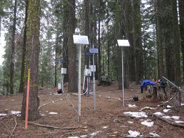
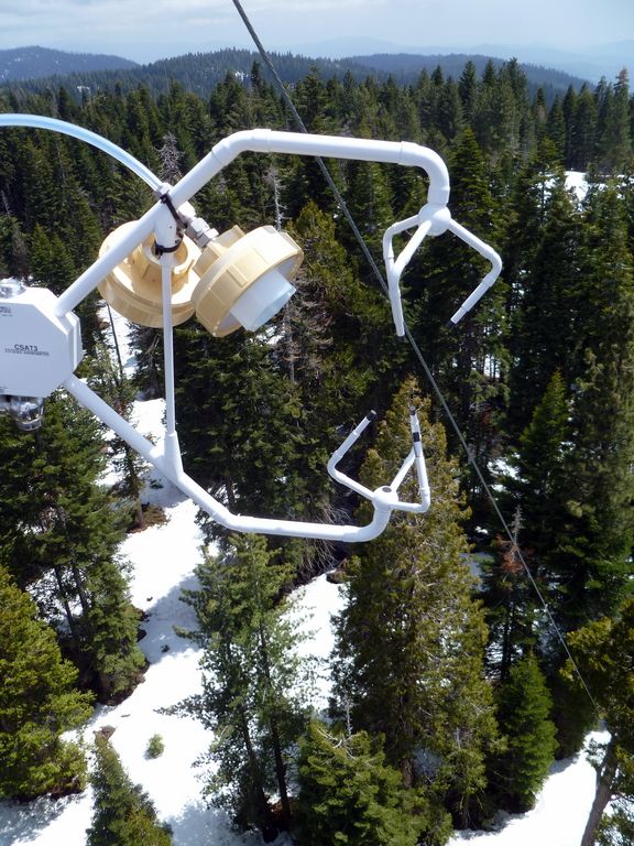
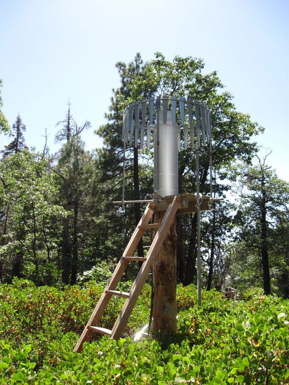
Sensors around Critical Zone Tree 1 in early spring. © Southern Sierra Critical Zone Observatory
-
Setting & Research
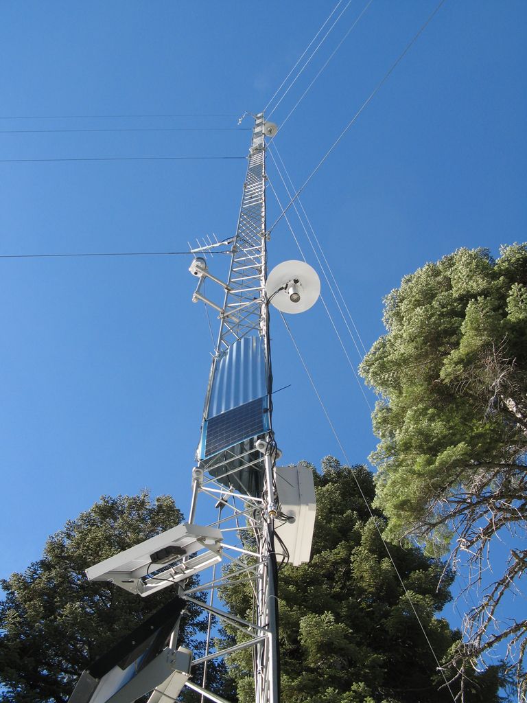
Flux Tower

The flux tower at P301.
The Southern Sierra Critical Zone Observatory installed its first flux tower near the top of the P301 subcatchments in September 2008. Three other towers were added in 2009 and 2010, creating the west-to-east transect of sites ranging from low-elevation oak savannah to high-elevation subalpine forest. The P301 tower's elevation is 2015 m.
The flux tower is used to analyze the carbon and water balance of the surrounding forest. Instruments on the tower track changes in carbon dioxide, water vapor, temperature, relative humidity, among others. Additional instruments around this tower capture snow depth, remotely-sensed and in-situ soil moisture, and visible and infrared canopy photos.
This data can be analyzed to determine the physiological responses of the site (for example, how photosynthesis increases with light) and summed over a year to determine the carbon balance of a site (how much carbon it is gaining or losing). This data is also used with the water-balance transect described below.
Water-Balance Transect
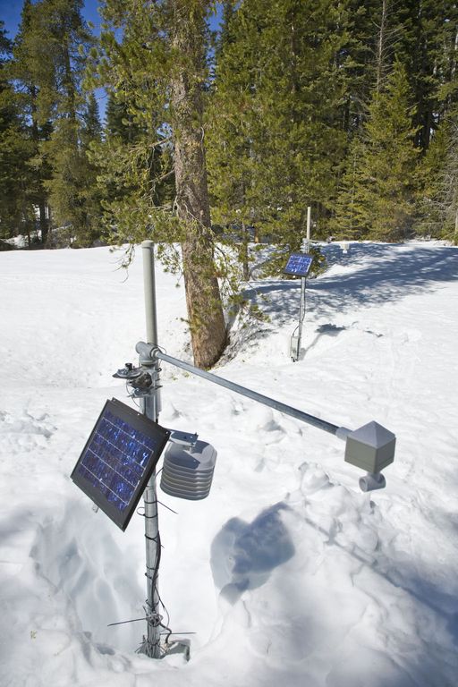
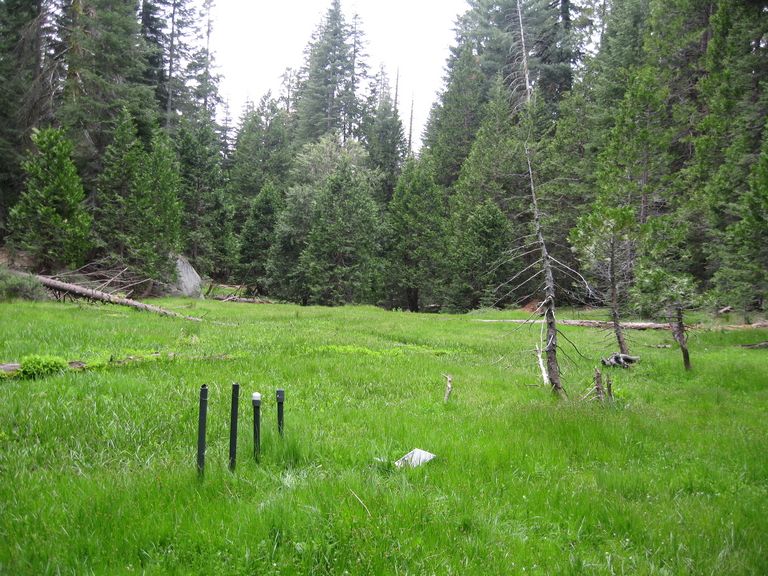
The water-balance transect at P301 was installed in December 2008 around the field area's montane meadows and forested slopes adjacent to the meadows. Water balance instrument clusters are used to monitor snow depth, solar radiation, air temperature, soil water content, and soil temperature. The instruments capture forest-cover and landscape variability through node placements under tree canopy, at drip edge, and in open areas; and on North, South, and Flat slope aspects. In addition to the instrument clusters, the transect also includes monitoring wells and piezometers in the meadows to track ground- and surface-water interactions. Elevations range between 1950 and 1990 m.
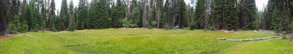
Panorama of Middle Meadow at the P301 site. July 2014.
Critical Zone Tree
_350_350_80auto.jpg)
Sensors radiate out around Critical Zone Tree-1, measuring soil temperature, soil moisture, sap flow, meteological variables, and snow pack, among other factors of interest.
Inside the P301 subcatchment, the SSCZO established the first Critical Zone Tree in 2008 (CZT-1), which Dr. Roger Bales calls the most instrumented tree in the Sierra Nevada. This White Fir (Abies concolor) has been intensely instrumented with soil moisture, temperature, and matric potential sensors; snow depth, solar radiation, and sap flow sensors, resin nutrient collectors; tension lysimeters; and time lapse photography. Several other CZ Trees were temporarily instrumented between 2008 and 2015. CZT-1 is the only remaining instrumented Critical Zone Tree. Update: The tree has died due to the most recent drought, however instruments on and around the tree are still monitoring.
Researchers were interested in addressing the following questions:
- How do trees utilize water? What is the timing of their water use? How does soil depth relate to these two questions?
- How do surface and subsurface water budgets behave in these remote settings? How does moisture and temperature variablity in the near surface soils impact the water budgets?
In designing this setup, the researchers aimed to monitor of surface and subsurface water budgets in remote landscapes, with specific attention to moisture and temperature variability in near surface soils. Another goal was to study the interactions between soil hydrology and tree root water uptake in a forested catchment, as part of a wider effort to analyze changing ecosystem response to changing environmental inputs. The Critical Zone Tree research has provided and intensive, detailed view of water use by trees in these mid-elevation areas. Combined with other projects, including data from flux towers and subsurface exploration, we have found that trees at these elevations access water from much deeper sources than previously thought, and are active through much of the winter.
A camera installed at this site captures daily changes in snow cover. Play these time lapse videos to watch the snowmelt patterns throughout the winter over multiple years.
Winter 2008-2009 time lapse video
Winter 2009-2010 time lapse video
Winter 2010-2011 time lapse video
The flux tower at P301.
Sensors radiate out around Critical Zone Tree-1, measuring soil temperature, soil moisture, sap flow, meteological variables, and snow pack, among other factors of interest.
Panorama of Middle Meadow at the P301 site. July 2014.
-
Overview Maps
Providence Creek Site
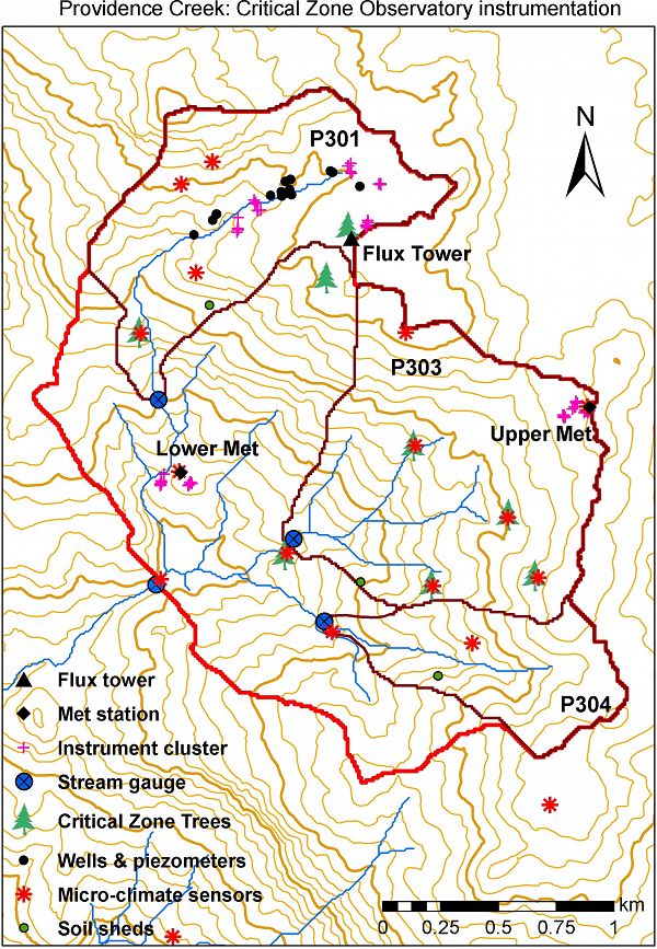
Instrumentation as of the beginning of 2013.
See full size (in new tab/window)
Providence Creek Site - old map
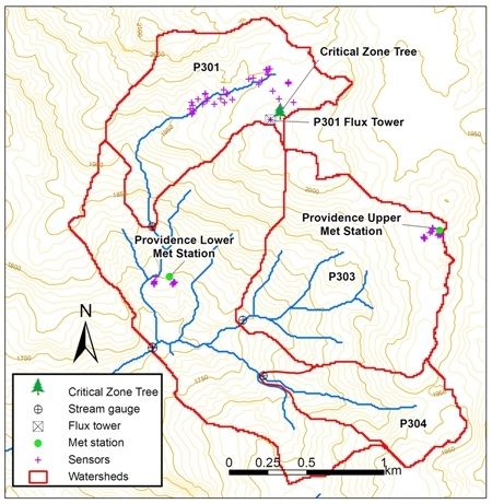
Map showing some instrumentation, including sensor network, flux tower, gauging stations, and CZT-1
See full size (in new tab/window)
-
Data
Flux Tower Transect, P301 - Flux Tower, Meteorology (2007-2018)
12 components • Providence Creek Subcatchment P301 • Climatology / Meteorology, Biology / Ecology • Mike Goulden; Anne KellyNational - Stream Water Chemistry - Cations, Anions, Metals (1982-2015)
1 components • Bisley, Betasso, East Peak, Marshall Gulch (High-Elevation), Providence Creek Subcatchment P301, Providence Creek Subcatchment P303, Providence Creek Subcatchment P304, Eel River Watershed, Puente Roto, Rio Blanco, Rio Icacos, Susquehanna Shale Hills Critical Zone Observatory • Biogeochemistry, Biology / Ecology, Hydrology, Water Chemistry • Hyojin, Kim; Bishop, Jim; Dietrich, William; Fung, Inez; McDowell, William H.; Brantley, Susan L.; Hoagland, Beth; Sullivan, Pamela L.; Cain, Molly; Neal, Andrew; Fisher, Jessica; Russo, Tess; Niwot Ridge LTER; Liu, Fengjing; Chorover, Jon; Troch, Peter; McIntosh, Jennifer; Brooks, Paul; Abramson, Nate; Heidbuechel, Ingo; Amistadi, Mary Key; Alexander Pedron, Shawn; Chorover, Jon; Troch, Peter; Corley, Timothy; Zapata-Rios, Xavier; Losleben, Mark; Condon, KatherineP301 Water Balance Transect - Soil Moisture, Soil Temperature, Snow Depth (2011-2018)
16 components • Providence Creek Subcatchment P301 • Hydrology • Roger Bales; Steven Glaser -
Photos
SSCZO - Critical Zone Trees

© Southern Sierra Critical Zone Observatory
The primary Critical Zone Tree in the Southern Sierra CZO is a White Fir (Abies concolor) that has been intensely instrumented with soil moisture, temperature, and matric potential sensors, snow depth, solar radiation, and sap flow sensors, resin nutrient collectors, tension lysimeters and time lapse photography. The Southern Sierra CZO currently has three instrumented trees.
A photo gallery of the Critical Zone Trees can be found here.
SSCZO - Water Balance Transect

© Southern Sierra Critical Zone Observatory
Within the headwaters of the P301 catchment is a series of montane meadows. The P301 water balance transect is comprised of monitoring wells, piezometers, soil sensors, and meteorological sensors.
A photo gallery of the P301 water balance transect can be found here.
SSCZO - Instruments

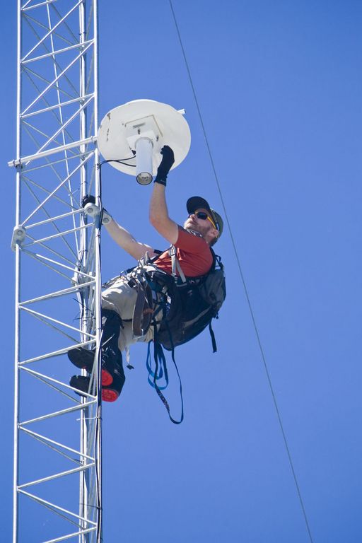
Matt Meadows (Field Manager, UC Merced) checks on an instrument on the P301 flux tower.

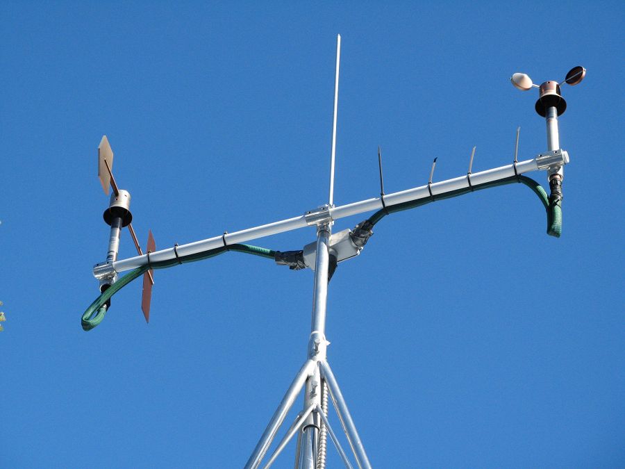
Anemometer measuring wind speed and direction.

Ultrasonic anemometer on the P301 flux tower measures wind speed and direction in 3 dimensions. Data is connected to gas samples taken every quarter second at the filters on the left (beige circles).

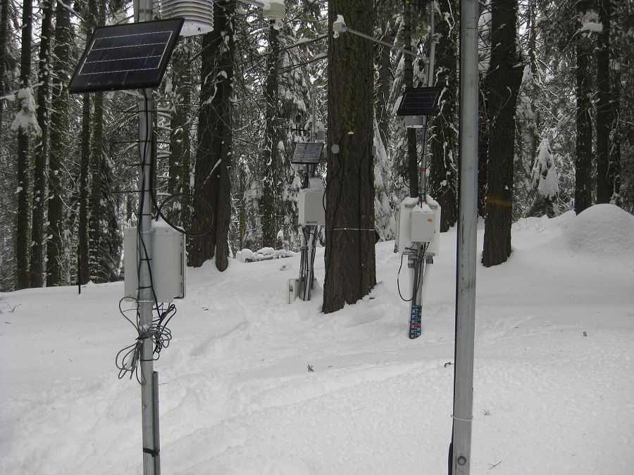
Instrument cluster featuring a relative humidity sensor, ultrasonic snow depth sensor, co-located soil moisture and temperature sensors at different depths, and a solar panel to power it all.

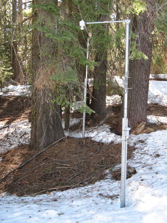
Instrument cluster at the P303 Upper Met site with ultrasonic snow depth sensor and co-located soil moisture and temperature sensors.

Instrument cluster at the P300 Lower Met site with ultrasonic snow depth sensor and co-located soil moisture and temperature sensors. The pole also psupports a solar panel, and an enclosure with a backup power supply and the data logger.

Instruments installed in the P301 meadows include wells and piezometers, at different locations to assess surface and groundwater flows.
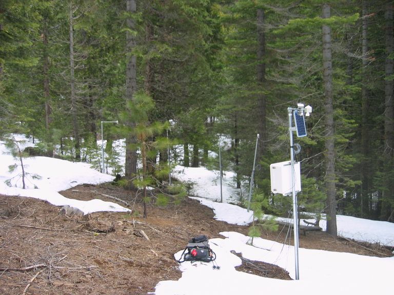
Several clusters of instruments measure the water balance. These clusters each contain soil moisture and temperature sensors, an air temperature sensor, relative humidity sensor, and an ultrasonic snow depth sensor.
These water balance instruments are clustered at two different elevations, with north, flat, and south facing aspects. Conditions are measured under canopy, at drip edge, and at open canopy. Water balance measurements are also made in the wireless sensor network that stretches along the P301 meadow.

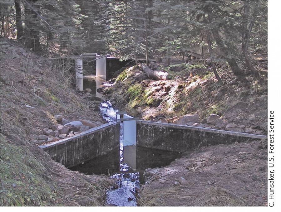
The eight subcatchments and two integrating catchments in the KREW project have flumes to measures discharge.

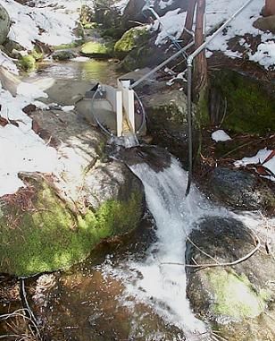
The large KREW flumes are complemented by small flumes for low flow.

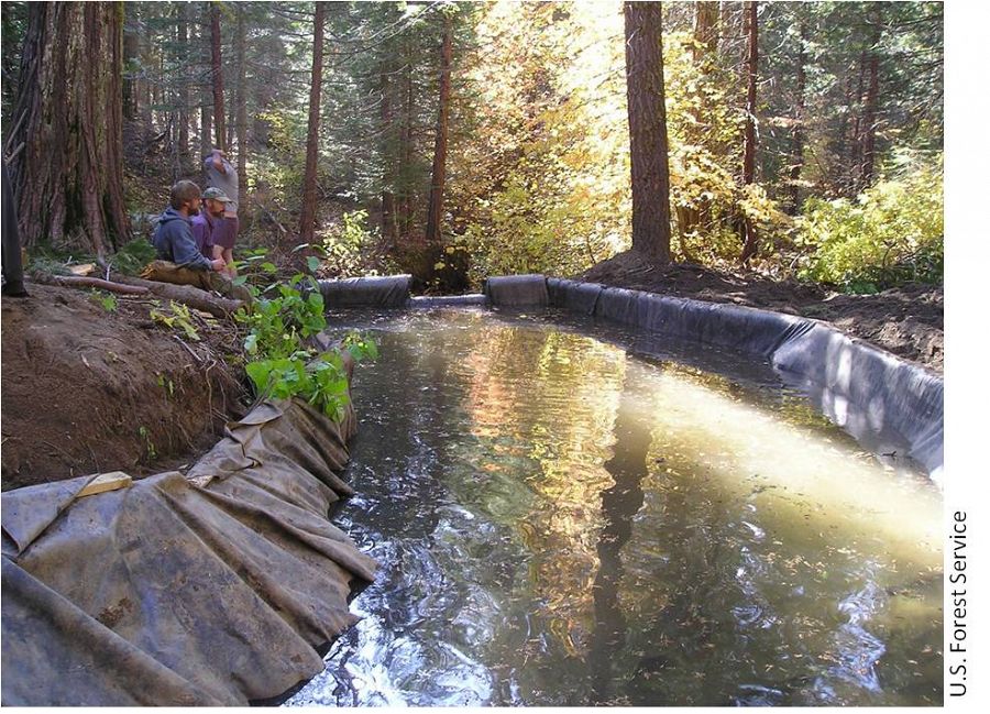
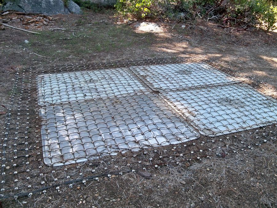
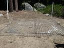
Each of those eight KREW subcatchments also has a plastic-lined settling basin to capture sediment.

There are two meteorological stations in the Providence catchment - one at the lower elevation range and one near the crest. Each meteorological station has a rain gauge.

At the upper meteorological station, there is a snow pillow. This snow pillow tracks the weight of snow above it. Combined with the snow depth measurements, the two permit the calculation of amount of water in the snow pack.

Another view of the snow pillow.
Hundreds of instruments and sensors have been deployed in the primary SSCZO research site of the Providence Creek watershed as well as in Wolverton basin. Additional SSCZO flux towers and instruments have also been installed at the San Joaquin Experimental Range, Soaproot Saddle, and Short Hair Creek.
Explore more photos of the intstuments and sensors used by SSCZO.

_900_900_80auto.jpg)
Explore Further
