K-12 Education
_900_443_80auto.jpg)
© Southern Sierra Critical Zone Observatory
SSCZO promotes student and educator understanding of critical zone science, research methods, and careers through our work with regional schools and national educational organizations. We reach and teach K-12 students through several types of programming, such as outdoor learning events and mentored research projects. We also provide educators with activities, training, and resources related to critical zone science and our ongoing research. Explore our work and resources below.
Our Partners


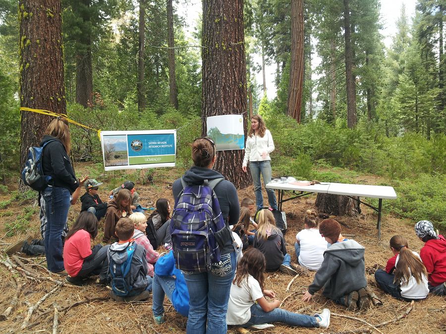
School Presentations & Project Mentorships

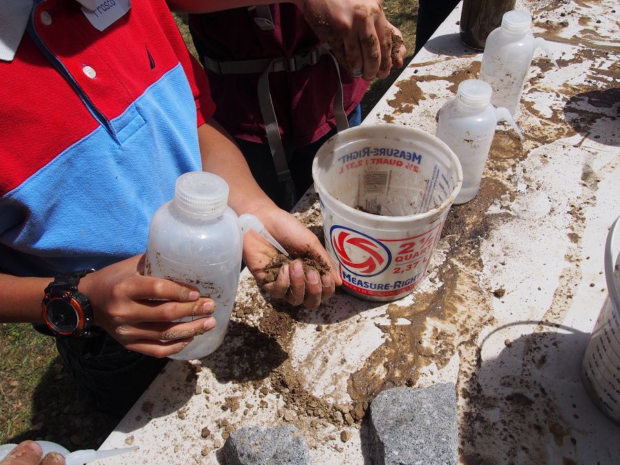
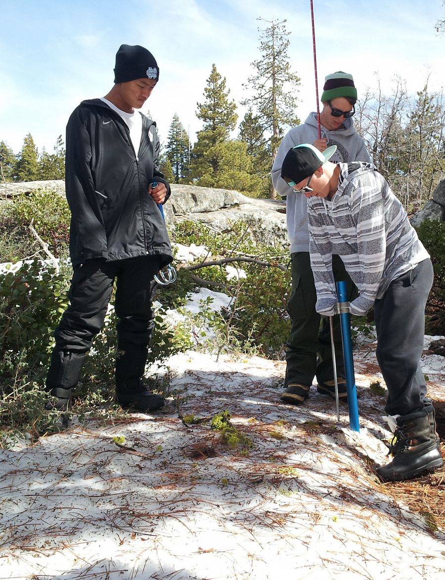
High school students weigh a snow sample to determine its water content and density.
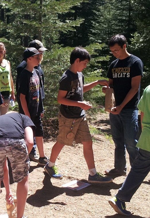
SSCZO works to inspire and train future critical zone scientists and workers in STEM fields. We combine science content with hands-on experiences through one-day presentations and longer-term programming with educational organizations in the San Joaquin Valley, Foothill, and Mountain regions. Our longer-term programs are research project partnerships that allow students to gain experience in the process of professional research. We have annually mentored projects with the Center for Advanced Research and Technology since 2011 and partnered with smaller classes like Fresno Christian High School’s AP Biology class.
Our classroom presentations and student-driven research projects by SSCZO can be designed to align with the goals of Next Generation Science Standards.
Contact us for more information on classroom presentations and project partnerships.
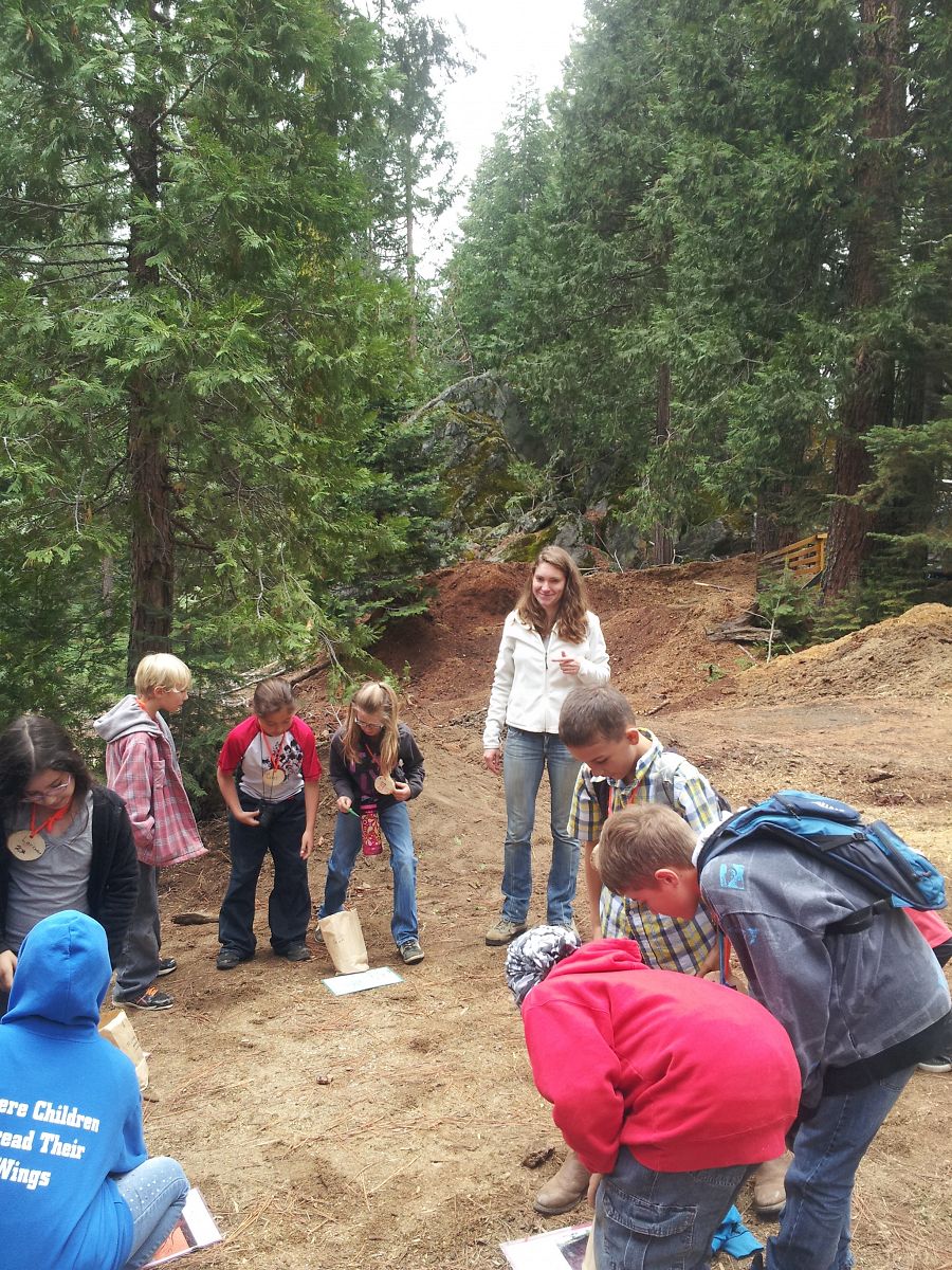
Out-of-School Learning
Sierra foothill fifth graders test soil texture.
Our staff, researchers, and students present hands-on activities covering soil science, water cycling, landscape evolution, tree function, and other topics related to critical zone science at out-of-school learning events. We present at several regional student-focused events, reaching hundreds of students every year:
- Southern California Edison’s Science Days
- American Association of University Women’s Girls Science Camp
- Society of American Foresters’ High Sierra Conservation Day
- NatureBridge at Yosemite special events
- Stanislaus National Forest Lake Alpine Junior Rangers
We are always looking for new places to share the wonder and excitement of critical zone science. Contact us if you’d like us to present at an upcoming event.
Educator Training & Resources

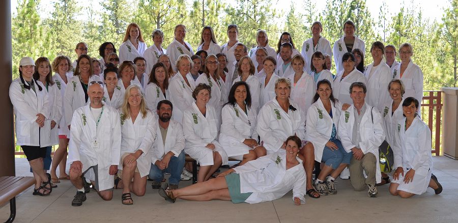
Lynn Sullivan and Michelle Gilmore show Merced County teachers how to use a computer model to simulate ecosystem dynamics.
We are working with educators to bring critical zone science into their indoor and outdoor classrooms. SSCZO informs and trains classroom teachers and informal educators on research methods and findings in the emerging field of critical zone science. Our students, staff, and faculty provide content presentations and activity trainings, and can offer advice on how to incorporate critical zone topics in lessons.
Educator training events include:
- Merced County Office of Education Teaching, Experimentation, and Mentoring in Engineering and Science (TEAM-E Science)
- Tuolumne, Calaveras, and Amador Counties Science, Technology, Engineering, and Mathematics Teacher Resources for Achievement, Collaboration, Knowledge, and Standards (STEM-TRACKS)
- NatureBridge at Yosemite outdoor educator seminars
Email us more information about teacher trainings, content development, and educator resources.
Educational Activity Resources
SSCZO designs lesson plans and activity guides for K-12 educators that incorporate critical zone science topics and research methods. Activities focus on topics such as matter and energy flow through ecosystems, floral structures and functions, and vegetation survey methods and incorporate several STEM disciplines.
Several lesson plans contain original activities, while others are guides for adapting or adding to activities designed by other earth and environmental science organizations. All of these resources are publicly available and listed below.
Critical zone science content and activities presented by SSCZO align well with Next Generation Science Standards (NGSS). We are working to update our existing resources to list NGSS alignment for each activity.
The hydrologic, or water cycle is the movement of water on, above, and through the earth’s surface. In this activity designed for K-12th graders, students will be introduced to the hydrologic cycle, how water is collected and is used in California, and how scientists measure the water cycle. By the end of this activity students will be able to define parts of the cycle, describe how the cycle changes seasonally, and identify the ways scientists measure the water cycle.
In this activity designed for K-6th graders, students will focus on a specific part of the water cycle called evapotranspiration. Students will take a journey as a water molecule moving throughout the tree’s water cycle. Students will learn the main parts of the water cycle in and around a tree and become familiar with proportions of water in each part of the cycle.
In this activity designed for K-6th graders, students can explore the concept of how fire can spread quickly in a dry densely populated forest. The students will be learning the meaning of density, the difference between wet year, dry year, and a critically dry year, and the basic concepts of how a tree draws water up out of the soil in order to grow.
Soil Infiltration and Texture
Soil is made of a mixture of broken down pieces of rock, organic material, air and water. In this activity designed for 4th-12th grade, students will understand how different materials affect how fast water moves through a soil column, and determine the texture of different soils.
Take a look at the process of runoff water by examining watershed and catchment basins. This activity designed for 4th-12th graders, students explore the concepts of watersheds, catchment basins, and introduces California’s Water resources. Through this fun, hands-on activity students will learn basic stream features and flow properties, while understanding the sources of water in California.
Snow water equivalent (SWE) is the depth of liquid water in a known volume of snow if it were to be melted. In this activity designed for 6th-12th graders, students will use measurement tools and mathematics to determine the volume of water contained in snow of a certain density. Students will be able to define terms such as SWE, density, and volume, use measurement tools to find the density of snow, and understand the need and importance of monitoring snowpack.
Tools of the Trade: Methods for Measuring Trees
Trees can be small, and trees can be big. How do we determine a tree’s size? How can we size up one tree versus another? In this activity designed for 3rd-8th graders, students work in teams and use one or several different methods to measure and compare the sizes of trees.
Note: Proposed NGSS alignment and 5E lesson structure (less Evaluate) are included in the activity guide. This activity was originally developed for Merced County Office of Education's TEAM-E Science Training for elementary and middle school teachers.
Carbon's Adventures Around The Forest
Carbon is found nearly everywhere on Earth. In this activity designed for 3rd-8th graders, students explore where and how carbon travels in an ecosystem, and make a model of carbon cycling in a forest. Students also learn how certain events in a forest can change the timing and routing of carbon.
Note: Proposed NGSS alignment and 5E lesson structure (less Evaluate) are included in the activity guide. This activity was originally developed for Merced County Office of Education's TEAM-E Science Training for elementary and middle school teachers.
- Activity Guide
- Student Travel Log Handout
- Carbon Station Movement Sheets, Version A
-
Carbon Station Movement Sheets, Version B
Grass, Rabbits, and Wolves-- Oh My! Understanding Food Chains and Ecosystem Interactions
In a food chain, producers and consumers transfer energy throughout an ecosystem. In this activity designed for 3rd-8th graders, students use a game of tag and a computer model to understand energy transfer through an ecosystem, and predict how changes in species functions and interactions can impact the system.
Note: Proposed NGSS alignment and 5E lesson structure (less Evaluate) are included in the activity guide. This activity was originally developed for Merced County Office of Education's TEAM-E Science Training for elementary and middle school teachers.
SimWater: Simulating Water Supply, Demand, and Management
Water managers balance water needs with water availability. In this activity designed for 10th-12th graders, students work through water budgeting calculations and allocate land and water, simulating the some of the issues water managers solve as they regulate complex systems of water storage, delivery, and consumption.
Note: This activity was originally developed for an American Geosciences Institute teacher workshop.
- Activity Worksheet & Instructions
- Scenario Maps & Allocation Pieces
-
Budgeting Calculation Spreadsheets
Virtual Fieldwork Experience Presi
Why do the mountainous forests of the southern Sierra Nevada look the way they do? What does a Critical Zone Observatory do? And what's a critical zone anyways? Explore our field areas while learning about the critical zone, water cycling, soil weathering, and more in this Virtual Fieldwork Experience presentation for 7th-12th graders.
Southern California Edison
AAUW: Empowering women since 1881
NatureBridge:Connecting Youth to the Natural World
American Geosciences Institue: Connecting earth, science, and people
Society of American Foresters
The Center for Advanced Research and Technology
Merced County Office of Education
Science, Technology, Engineering, and Mathematics. STEM-track
The 2013 CART cohort ends their data collection campaign at the Providence Creek eddy covariance flux tower.
High school students weigh a snow sample to determine its water content and density.
2012 CART students present their soil survey findings at an end-of-semester symposium.
Lynn Sullivan and Michelle Gilmore show Merced County teachers how to use a computer model to simulate ecosystem dynamics.
Sierra foothill fifth graders test soil texture.
Gallery
SSCZO - Field visit with the STEM-TRACKS group
STEM-TRACKS group from the 2015 intensive summer week.
The STEM-TRACKS initiative is a local curriculum development for K-8 teachers.
SSCZO - Science Days
Erin Stacy (Education and Outreach Coordinator) listens to a student explain the water cycle at the 2013 Science Days event.

Erin talks about how animals from the region depend on water flows from the mountains. Some of the animals were the Foothill Yellow-legged Frog (Rana boylii), the Aboreal Salamander (Aneides lugubris), and the Fisher (Martes pennanti).
Student play a water cycle game at Science Days, 2013.

Billy Mayse and Jeff Laird (left and right, respectively, both 2013 summer staff) quiz students on local wildlife that are dependent on streams and other waterbodies.
Billy Mayse (right) helps the students through the water cycle game.
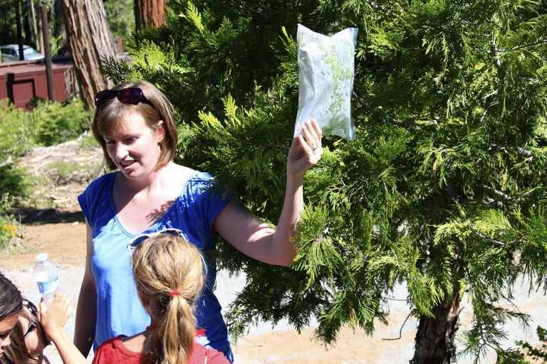
Allyson Smith (former staff with SSCZO) demonstrates how much water trees transpire with a sealed plastic bag.
Every year, SSCZO presents to hundreds of grade school students as part of Southern California Edison's Science Days in Shaver Lake. At the 2013 event, Southern Sierra staff presented on how the water cycle impacts local wildlife, and discussed several special local species with more than 500 students. Students, grades K-8 from 3 local schools, also learned about forest products, birds, and other topics at the other stations. Education and Outreach Coordinator Erin Stacy presented at all three days, but new summer employees also had a chance in front of the students.
In May and June of 2012, SSCZO staff participated in the Southern California Edison Science Days. Elementary and middle school classes traveled to Camp Edison (outside Shaver Lake) and visited stations set up to teach about nature and science. The event theme in 2012 focused on plants. SSCZO staff facilitated an activity describing the water cycle in and around a single tree.
In 2011, the SCE Science Days theme was water. Southern Sierra CZO colleagues gave a presentation on hydrologic cycle and how researchers use various instruments to measure the water cycle.
SSCZO - CART Spring 2013 student group
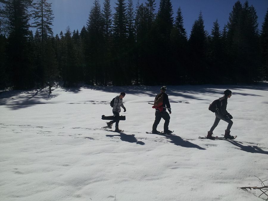
Students cross a meadow on their way to the sampling site, 11 March 2013. Much of the snow in this meadow had melted by just a week later.
CART students and teachers on their first trip to the field, 11 March, 2013 (L to R): Trever Colver, Sergio Chairez, CZO staff Matt Meadows, CART teacher Steve Wilson, Chong Vue, Tristan Palmer, Darrel Her, and Devan Liles.
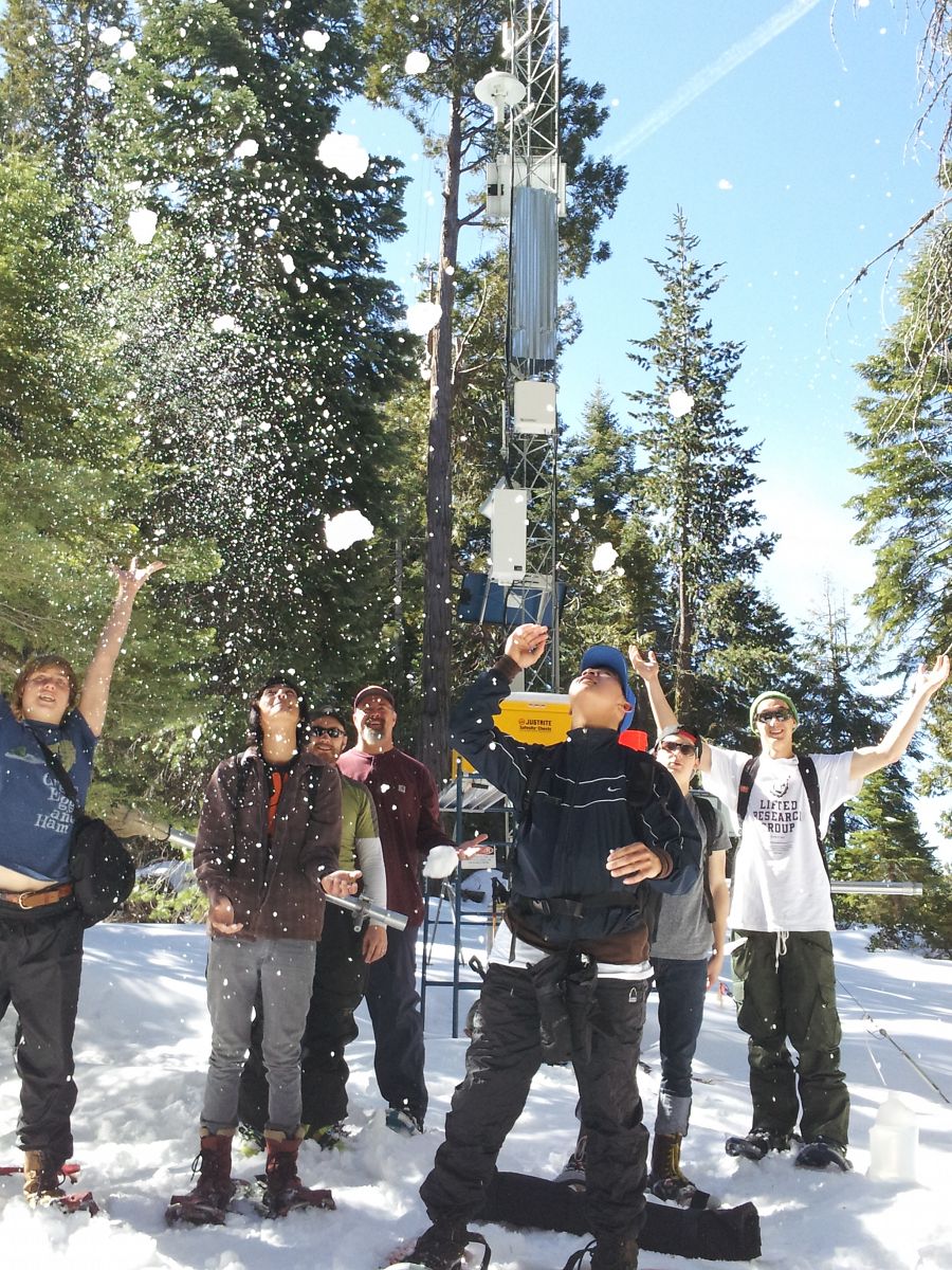
Matt Meadows, Chong Vue and Sergio Chairez pause for a picture while weighing a snowtube.
On March 11th, the snow was deep enough at some points to need an extension on the snow tube (about 1 m snow depth shown here, on the shaded south side of a meadow).
Sergio and Devan squeeze under branches to reach a sampling point.
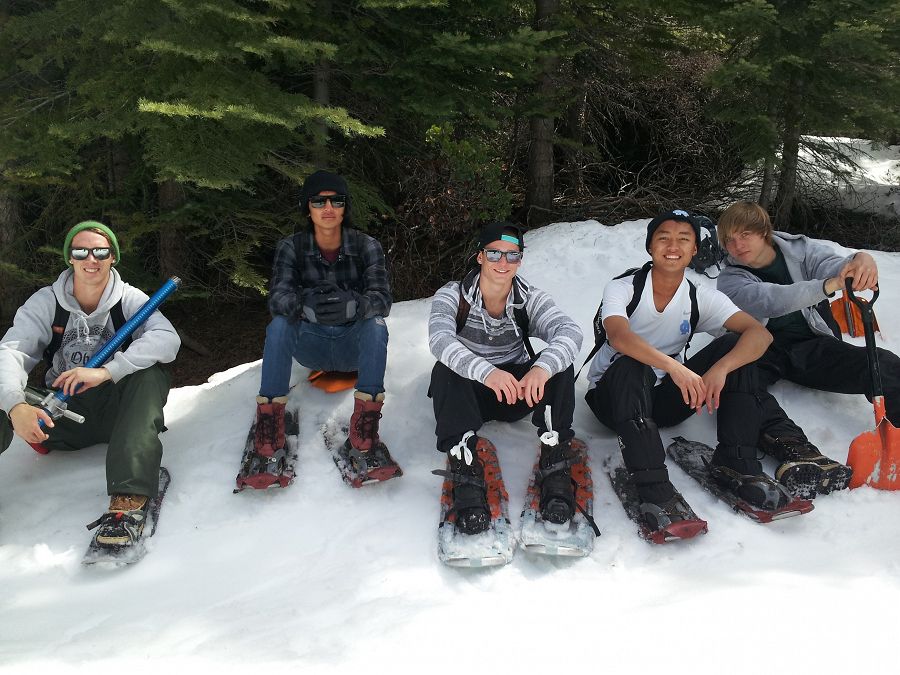
CART students on their second trip to the field, 18 March, 2013 (L to R): Devan Liles, Sergio Chairez, Tristan Palmer, Darrel Her, and Trever Colver.
CZO staff Matt Meadows points out the ice layers revealed in the snow pit. After a week of warm weather, snow was melting quickly.
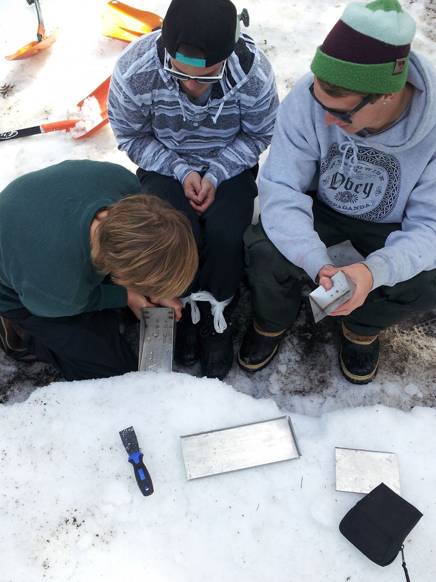
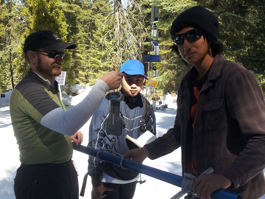
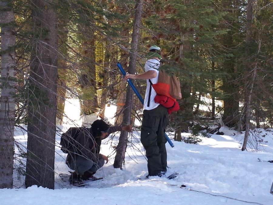
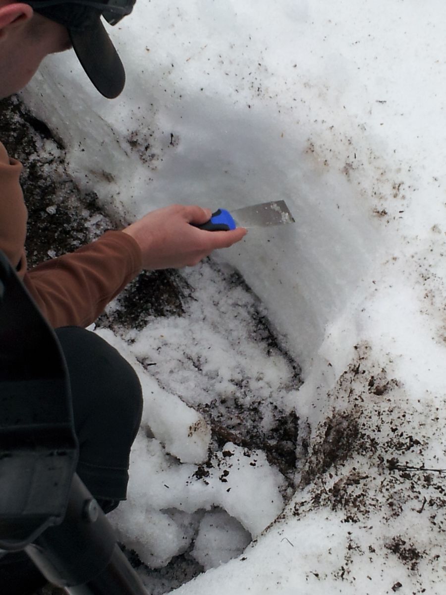
Three of the CART students take a sample from the exposed face of the snow pit with a metal wedge in order to quantify snow density in a certain layer.
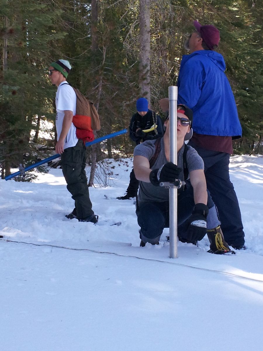
The 2013 project was designed to measure the distribution and snow water equivalent of snowpack around the trees. Darrel and Devan wait as Tristan takes a snow sample on the west side of the tree. Snow was very patchy and shallow in comparison to just a week before.
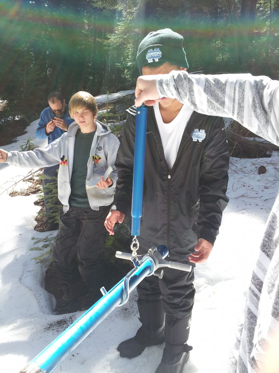
Trever watches as Darrel (middle, black hat) and Tristan (right, striped sweater) weigh the snow in the snow tube.
The Spring 2013 student group from the Center for Advanced Research and Technology (CART). Six students from CART designed and exectued a research project looking at differences in snow depth and density in relation to trees (including slope aspect, cardinal direction from tree trunk and tree canopy). The students learned how to use a federal snow sampler, and to dig a snow pit for refined snow density analysis. Two trips to the CZO Providence site offered the students onsite experience with CZO staff Matt Meadows and Erin Stacy and CART teacher Steve Wilson. Students will present final work in May.
News
FEATURED
Southern Sierra CZO Videos
04 May 2020 - Onward California - University of California television spots showcase Southern Sierra CZO research
_200_200_80auto_s_c1.jpg)
Research Program Updates: January 2018
17 Jan 2018 - Recent activities and findings, funding opportunities, upcoming events, and other updates
Observatory scientists volunteer with students at new STEAM Center in Merced
02 Nov 2017 - UC Merced scientists are sharing their research, stories, and expertise at Merced City School District's new STEAM Center.
Earth Science Week 2017 Video Contest
15 Aug 2017 - For Earth Science Week 2017, the American Geosciences Institute invites you to enter the Earth Connections video contest. Submit a brief, 30-90...
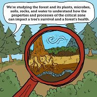
New SSCZO comic artfully communicates research
19 Jul 2017 - Wonder what soils and sponges have in common? Or why some trees in the Sierra Nevada are dying while others are surviving? Find out in our new comic.
2017 CZO Webinar Series: Critical Zone and Society
06 Apr 2017 - 2017 CZO Webinar Series: Critical Zone and Society.
Explore Further
