Jemez River Basin
The Jemez River Basin is located in the transition zone between the southwestern desert and the Rocky Mountains.
2060 - 3433 m Elev
3 - 9 °C Temp
480-850 mm Precip
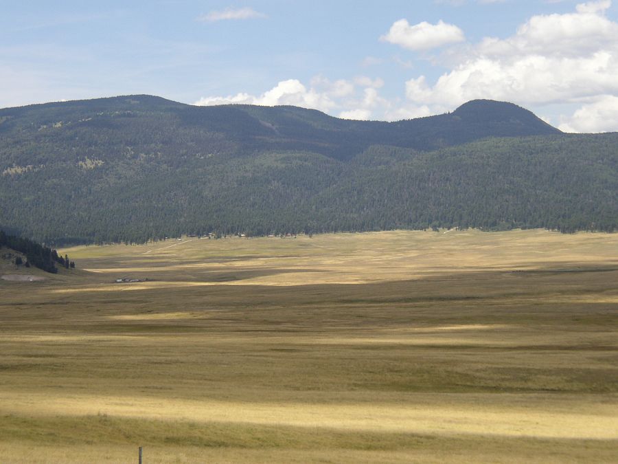
The Redondo Peak from the Valle Grande.
Areas within Jemez River Basin
-
Setting & Research
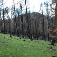
The Jemez River Basin is located in northern New Mexico (USA), at the southern margin of the Rocky Mountains ecoregion between 1700 and 3432 m. Vegetation ranges from semi-arid juniper savanna to high elevation mixed conifer forest, with soil types that are characteristic of the region, including aridisols, alfisols, mollisols and inceptisols. The geological and geomorphic history of the basin, which is underlain by rhyolitic parent material ranging in age from 1.13 Ma to 0.13 Ma, is well characterized.
A central feature of the Jemez River Basin is the Valles Caldera located at the top of the watershed. The caldera is a collapsed magma chamber, 25 km in diameter, that encloses several resurgent lava domes formed after the chamber collapsed ca. 1.2 Ma. The caldera interior is a single watershed unit draining through a breach in the caldera wall. The largest of the resurgent domes, Redondo Peak, is located in the center of the caldera resulting in the unique situation where headwater streams of the Jemez River originate on different aspects of the same mountain, providing the opportunity to probe contrasting microclimates on a uniform parent material with a common precipitation regime.
-
Overview Maps
Map Overlays
-
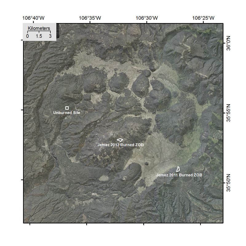
Valles Caldera Satellite Map
-
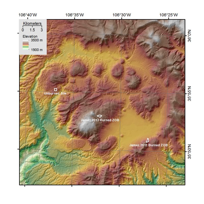
Valles Caldera Elevation Map
-
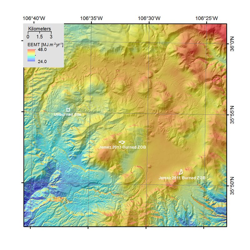
Valles Caldera Environmental Energy and Mass Transfer (EEMT) Map
-
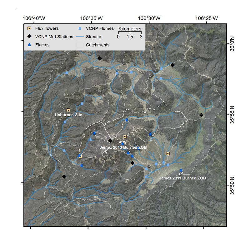
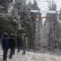
Valles Caldera Instrumentation Map
-
-
Dynamic Map
To fully zoom into a small area, you may need to visit the "Map" button and uncheck "Terrain" view.
-
Data
Catalina-Jemez - GIS/Map Data (2010-2014)
2 components • Santa Catalina Mountains, Jemez River Basin • GIS / Remote Sensing • Durcik, MatejJemez River Basin - Flux Tower - Mixed Conifer (2007-2012)
14 components • Jemez River Basin • Biology / Ecology, Climatology / Meteorology • Marcy Litvak; Paul BrooksJemez River Basin - Flux Tower - Ponderosa Pine (2007-2012)
14 components • Jemez River Basin • Biology / Ecology, Climatology / Meteorology • Marcy Litvak; Paul BrooksJemez River Basin - GIS/Map Data - EEMT-topo (2010-2011)
1 components • Jemez River Basin • Biology / Ecology, Climatology / Meteorology, GIS / Remote Sensing, Hydrology • Durcik, Matej; Rasmussen, CraigJemez River Basin - GIS/Map Data - Raster Datasets (2010-2014)
1 components • Jemez River Basin • GIS / Remote Sensing • Durcik, MatejJemez River Basin - GIS/Map Data - EEMT (2010)
1 components • Jemez River Basin • Biology / Ecology, GIS / Remote Sensing • Rasmussen, Craig; Durcik, MatejJemez River Basin - LiDAR - Post-Fire (2012)
2 components • Jemez River Basin • Geomorphology, GIS / Remote Sensing • Jon PelletierJemez River Basin - LiDAR - Terrestrial Laser Scan (2011-2013)
3 components • Jemez River Basin, Jemez 2011 Burned ZOB • GIS / Remote Sensing, Geomorphology • Caitlin Orem; Jon PelletierJemez River Basin - LiDAR - Snow-off (2010)
5 components • Jemez River Basin • GIS / Remote Sensing • Guo, Qinghua; Pelletier, Jon; Parmenter, Robert; Allen, Craig; Judy, Barbara; Durcik, MatejJemez River Basin - LiDAR - Snow-on (2010)
4 components • Jemez River Basin • GIS / Remote Sensing • Guo, Qinghua; Pelletier, Jon; Durcik, MatejJemez River Basin - Stream Water Chemistry (2005-2018)
10 components • Jemez River Basin • Water Chemistry • Jennifer McIntosh; Jon Chorover; Peter Troch; Paul Brooks; Mary Key Amistadi; Timothy Corley; Xavier Zapata-Rios; Mark Losleben; Katherine Condon; Shawn Alexander PedronJemez River Basin - Streamflow / Discharge (2007-2018)
16 components • Jemez River Basin • Hydrology • Troch, Peter; Broxton, Patrick; Zapata-Rios, Xavier; Losleben, Mark; Durcik, MatejJemez River Basin - Soil Water Chemistry (2011-2017)
8 components • Jemez River Basin • Geochemistry / Mineralogy, Water Chemistry • Jon Chorover; Julia Perdrial; Jennifer McIntosh; Peter Troch; Mary Key Amistadi; Mark Losleben; Katherine Condon; Shawn Alexander PedronJemez River Basin - Precipitation Chemistry (2011-2018)
9 components • Jemez River Basin • Water Chemistry • Jennifer McIntosh; Jon Chorover; Peter Troch; Paul Brooks; Mary Key Amistadi; Timothy Corley; Xavier Zapata-Rios; Mark Losleben; Katherine Condon; Shawn Alexander PedronNational - Air Temperature, Flux Tower, Meteorology - NADP and NOAA or other weather stations (2017)
8 components • Boulder Creek Watershed, Calhoun Critical Zone Observatory, Jemez River Basin, Susquehanna Shale Hills Critical Zone Observatory • Climatology / Meteorology • NADP; NOAA; othersNational - Climate, Flux Tower, Streamflow / Discharge - CUAHSI WDC web services (1968-2015)
7 components • Boulder Creek Watershed, Christina River Basin, Jemez River Basin, Santa Catalina Mountains, El Verde Field Station, Northeastern Puerto Rico and the Luquillo Mountains, Rio Blanco, Rio Mameyes, Susquehanna Shale Hills Critical Zone Observatory, Providence Creek Headwater Catchments (1660 - 2115 m elevation), Wolverton Basin (2230 - 2700 m elevation), Other instrumented sites • Climatology / Meteorology, Hydrology, Soil Science / Pedology • Boulder Creek Critical Zone Observatory; Catalina-Jemez Critical Zone Observatory; Luquillo Critical Zone Observatory; Shale Hills Critical Zone Observatory; Southern Sierra Critical Zone Observatory; Christina River Basin Critical Zone ObservatoryNational - Flux Tower - AmeriFlux Network data (2007-2018)
14 components • Boulder Creek Watershed, Jemez River Basin, Reynolds Creek Experimental Watershed, Susquehanna Shale Hills Critical Zone Observatory, San Joaquin Experimental Range (210-520 m elevation), Soaproot Saddle (1000-1500 m elevation), Short Hair (2670 m elevation) • Climatology / Meteorology • Boulder Creek Critical Zone Observatory; Catalina-Jemez Critical Zone Observatory; Reynolds Creek Critical Zone Observatory; Shale Hills Critical Zone Observatory; Southern Sierra Critical Zone ObservatoryNational - LiDAR, Land Cover, GIS/Map Data - OpenTopography (2010-2017)
18 components • Boulder Creek Watershed, Eel River Watershed, Jemez River Basin, Reynolds Creek Experimental Watershed, Susquehanna Shale Hills Critical Zone Observatory, Northeastern Puerto Rico and the Luquillo Mountains, Sangamon River Basin, Clear Creek Watershed, Calhoun Critical Zone Observatory, Providence Creek Headwater Catchments (1660 - 2115 m elevation) • Geomorphology, GIS / Remote Sensing, Hydrology, Biology / Ecology • National Center for Airborne Laser Mapping; Boulder Creek Critical Zone Observatory; Calhoun Critical Zone Observatory; University of Arizona; University of California Merced; Valles Caldera National Preserve; Bandelier National Monument; National Park Service; Jemez River Basin and Santa Catalina Mountains Critical Zone Observatory; Luquillo Critical Zone Observatory; Reynolds Creek CZO; Eel River CZO; Shale Hills CZONational - Streamflow / Discharge - USGS and USDA Data Resources (1985-2017)
22 components • Boulder Creek Watershed, Santa Catalina Mountains, Jemez River Basin, Reynolds Creek Experimental Watershed, Susquehanna Shale Hills Critical Zone Observatory, Northeastern Puerto Rico and the Luquillo Mountains, Clear Creek Watershed, Sangamon River Basin, Calhoun Critical Zone Observatory, Providence Creek Headwater Catchments (1660 - 2115 m elevation) • Hydrology • USGS National Water Information System
Explore Further
