Caitlin Orem

Geosciences PhD Student at University of Arizona
MS, Geology, Central Washington University, 2010
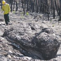
Measuring erosion rates using suspended sediment and cosmogenic nuclide methods in the Valles Caldera within the Jemez River Basin Critical Zone Observatory. Quantifying erosion in Las Conchas fire-affected areas using terrestrial and airborne LiDAR.
-
CZO Publications
Papers/Books
2018
A net ecosystem carbon budget for snow dominated forested headwater catchments: linking water and carbon fluxes to critical zone carbon storage. Perdrial J., Brooks P.D., Swetnam T., Lohse K.A., Rasmussen C., Litvak M., Harpold A.A., Zapata-Rios X., Broxton P., Mitra B., Meixner M., Condon K., Huckle D., Stielstra C., Vázquez-Ortega A., Lybrand R., Holleran M., Orem C., Pelletier J., Chorover J. (2018): Biogeochemistry 138{3): 225–243 Cross-CZO
2016
Constraining frequency–magnitude–area relationships for rainfall and flood discharges using radar-derived precipitation estimates: example applications in the Upper and Lower Colorado River basins, USA. Orem C.A. and Pelletier J.D. (2016): Hydrology and Earth System Sciences 20: 4483-4501
2016
The predominance of post-wildfire erosion in the long-term denudation of the Valles Caldera, New Mexico. Orem C.A. and Pelletier J.D. (2016): Journal of Geophysical Research: Earth Surface 121(5): 843–864
2015
Quantifying the time scale of elevated geomorphic response following wildfires using multi-temporal LiDAR data: An example from the Las Conchas fire, Jemez Mountains, New Mexico. Orem C.A. and Pelletier J.D. (2015): Geomorphology 232: 224–238
2015
Climate and landscape as drivers of carbon storage in forested headwater catchments: Insights from a complete C budget. Perdrial, J., Brooks, P., Swetnam, T., Lohse, K., Rasmussen, C., Litvak, M., Harpold, A., Zapata-Rios, X., Broxton, P., Mitra, B., Meixner, T., Condon, K., Huckle, D., Stielstra, C., Vazquez-Ortega, A., Lybrand, R., Holleran, M., Orem, C., Pelletier, J., and J. Chorover (2015): Global Change Biology
2014
How do sediment yields from post-wildfire debris-laden flows depend on terrain slope, soil burn severity class, and drainage basin area? Insights from airborne-lidar change detection. Pelletier J.D. and Orem C.A. (2014): Earth Surface Processes and Landforms 39(13): 1822–1832
2011
Calibration and testing of upland hillslope evolution models in a dated landscape: Banco Bonito, New Mexico, USA . Pelletier J.D., McGuire L.A., Ash J.L., Engelder T.M., Hill L.E., Leroy K.W., Orem C.A., Rosenthal W.S. Trees M.A. Rasmussen C., and Chorover J. (2011): Journal of Geophysical Research, 116: F04004,
Papers and books that explicitly acknowledge a CZO grant are highlighted in PALE ORANGE.
Other CZO Publications
2014
The frequency and magnitude of flood discharges and post-wildfire erosion in the southwestern US. Orem C.A. (2014): Disertation in Geosiences. University of Arizona, Tucson, Arizona, 196 pp
2013
Using airborne and terrestrial LiDAR to quantify and monitor post-fire erosion following the Las Conchas fire, Jemez Mountains, New Mexico. Orem C.A. and Pelletier J.D. (2013): Abstract presented at Chapman Conference on Post-wildfire Runoff and Erosion Response, Estes Park, Colorado, 25 - 31 August
2013
Do fire disturbances account for missing C in snow dominated headwater catchments in NM?. Perdrial J.N., Brooks P.D., Swetnam T., Lohse K.A., Rasmussen C., Harpold A.A., Litvak M.E., Broxton P.D., Mitra B., Condon K., Huckle D.M., Vazquez A., Lybrand R.A., Holleran M., Orem C.A., Meixner T., Chorover J. (2013): Abstract B33E-0531 presented at 2013 Fall Meeting, AGU, San Francisco, CA, 9-13 Dec. Cross-CZO
-
News

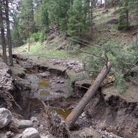
Post-Wildfire Erosion Can Sculpt Forested Mountains
19 Apr 2016 - Researchers from the UA Santa Catalina Mountains & Jemez River Basin Critical Zone Observatory did before-and-after studies of how severe...

Predicting post-wildfire erosion better
08 Dec 2014 - Jon Pelletier and his graduate student Caitlin Orem's research on the post Las Conchas fire erosion was highlighed in the Arizona Daily Star...
-
Events
Dissertation Defense
The Frequency and Magnitude of Flood Discharges and Post-wildfire Erosion in the Southwestern U.S
ENRB 253.
Explore Further

