Other instrumented sites
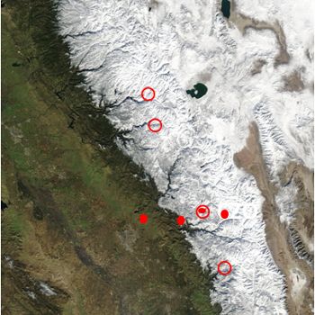
Other instrumented sites have been established in the Southern Sierra Nevada and are suitable for comparative research, including: Kings River Experimental Watersheds, Sierra Nevada Adaptive Management Project, and the American River Hydrologic Observatory.
-
Setting & Research
Kings River Experimental Watersheds (KREW)
Kings River Experimental Watersheds (KREW) is a research program of the U.S. Forest Service, Pacific Southwest Research Station. KREW consists of two sets of four ~1-km2 headwater catchments, plus two larger catchments that encompass three headwater catchments each. The Southern Sierra Critical Zone Observatory is co-located with KREW at one of these areas, Providence Creek Catchments site. The second catchments site is located some miles to the southeast, approximately 400 m higher in elevation. These four ~1-km2 catchments comprise parts of the Bull Creek headwaters and the Teakettle Experimental Forest. Learn more on the KREW website.Sierra Nevada Adaptive Management Project (SNAMP)
Data from two additional pairs of instrumented headwater catchments are available for comparative research, though measurements have stopped. One pair lies just north of the main CZO site, in the Sierra National Forest just south of Yosemite National Park. The second pair lies in the American River basin. There is also an east-west transect of instrumented sites in Yosemite National Park, along Tioga Pass Road. Read more about this project on the SNAMP website.American River Hydrologic Observatory (ARHO)
Based on wireless-sensor measurement technology developed at the CZO, a basin-scale (> 2000 km2) observatory was developed in the American River basin. Twenty groups of wireless sensors similar to that in P301 were deployed to make representative measurements of snow properties and soil moisture across the landscape. Visit the ARHO website and the UC Water Security and Sustainability Research Initiative to learn more. -
Data
KREW, Bull Creek - Streamflow / Discharge (2003-2010)
20 components • Other instrumented sites • Hydrology • Carolyn HunsakerMet Stations, KREW, Bull Creek, Lower - Meteorology (2003-2011)
17 components • Other instrumented sites • Climatology / Meteorology • Carolyn HusakerMet Stations, KREW, Bull Creek, Upper - Meteorology (2003-2011)
16 components • Other instrumented sites • Climatology / Meteorology • Carolyn HunsakerNational - Climate, Flux Tower, Streamflow / Discharge - CUAHSI WDC web services (1968-2015)
7 components • Boulder Creek Watershed, Christina River Basin, Jemez River Basin, Santa Catalina Mountains, El Verde Field Station, Northeastern Puerto Rico and the Luquillo Mountains, Rio Blanco, Rio Mameyes, Susquehanna Shale Hills Critical Zone Observatory, Providence Creek Headwater Catchments (1660 - 2115 m elevation), Wolverton Basin (2230 - 2700 m elevation), Other instrumented sites • Climatology / Meteorology, Hydrology, Soil Science / Pedology • Boulder Creek Critical Zone Observatory; Catalina-Jemez Critical Zone Observatory; Luquillo Critical Zone Observatory; Shale Hills Critical Zone Observatory; Southern Sierra Critical Zone Observatory; Christina River Basin Critical Zone ObservatorySouthern Sierra Nevada - LiDAR, Digital Elevation Model (DEM), Snow Survey - Snow-on, Snow-off Flyover (2010)
2 components • Providence Creek Headwater Catchments (1660 - 2115 m elevation), Wolverton Basin (2230 - 2700 m elevation), Other instrumented sites • GIS / Remote Sensing, Hydrology • Qinghua Guo; Roger Bales; National Center for Airborne Laser MappingSpatial Data - GIS/Map Data (2003-2011)
11 components • Wolverton Basin (2230 - 2700 m elevation), Providence Creek Headwater Catchments (1660 - 2115 m elevation), Other instrumented sites • GIS / Remote Sensing • Meadows, M.; Stuemky, M.
Explore Further

