Critical Zone Profile - LAURA KEEFER (fluvial geomorphologist, senior investigator)

Laura Keefer is a senior investigator for the Intensively Managed Landscapes (IML) CZO and serves as the Upper Sangamon River Site Coordinator. Most of Laura’s research involves assessing and quantifying the movement of water, sediment, and nutrients as they are transported through a network of streams and rivers. The methods and approaches Laura develops to measure and quantify the movement of water, sediment, and nutrients are designed to better understand the transport processes.
Laura typically works with agriculture-oriented agencies, such as the Natural Resources Conservation Service, USDA, Illinois Department of Agriculture, Farm Bureau, and county soil and water conservation districts. She also works with natural resources organizations, such as the USFWS, Illinois Department of Natural Resources, The Nature Conservancy, locally organized watershed stakeholder groups, and private non-governmental organizations. Laura’s research provides science-based information for these organizations to use as they design policies and programs to manage natural resources.
“Though people perceive intensively managed landscapes as static, this couldn’t be further from the truth. Stream channels and riparian zones are adjusting to watershed inputs constantly, in beneficial and in detrimental ways.” - Laura Keefer
Water has the capacity to carry sediment and nutrients downstream based on the power it is given by the slope of the land and gravity. The availability of sediment and nutrients to be carried depends on the type and extent of land cover in the watershed. Common land covers are forests, grass covered lands, pastures, parking lots, or your own front lawn. When water carries too much sediment and nutrients, it reduces crop production upstream and deposits them downstream in drinking water reservoirs or in areas of the stream bed that support fish and aquatic life. If too much water travels downstream too fast, we get floods. I’ve returned to stream sites 15-20 years later and have sometimes seen increases in vegetation and wildlife, but I’ve also seen major stream bank failures and sandbars swallow up areas that used to be productive aquatic habitat.
The landscape is constantly changing, but the way we manage the landscape alters the magnitude of these changes. Best management practices (BMPs) are used to slow the water down—thereby reducing its ability to carry sediment and nutrients. Understanding how to measure, quantify, and assess the interactions between a stream’s carrying capacity and the availability of sediments and nutrients helps determine if BMPs are doing their job or whether we may need to adjust our management practices.
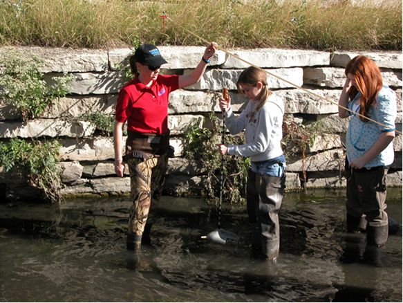
Teaching Urbana Middle School students how to take depth integrated suspended sediment samples in Boneyard Creek on the University of Illinois Engineering Quad. Using these samples in combination with streamflow measurements, the students are taught to compute the sediment load. Photo by Daniel Webb.
In my work for the Illinois State Water Survey (ISWS), interacting with the public is part of our mission and legislative mandate. As public scientists, my colleagues and I are committed to provide the information needed by the citizens of Illinois to make well-informed natural resource management decisions. My investigations typically start and finish with stakeholders—whether through formal meetings, informal gatherings in coffee shops, or chats in a machine shed. I also serve as a technical advisor to many watershed planning committees organized by citizens.
The ISWS has been located on campus for 120 years, and we employ university students to work on our research studies. From time to time I give guest lectures to university classes. My involvement with the CZO has also allowed me to work directly with students by teaching them how to collect data.
To make critical zone issues a higher priority at the national level, we need to translate what is learned and published in journals into material that is understandable and useful to everyone.
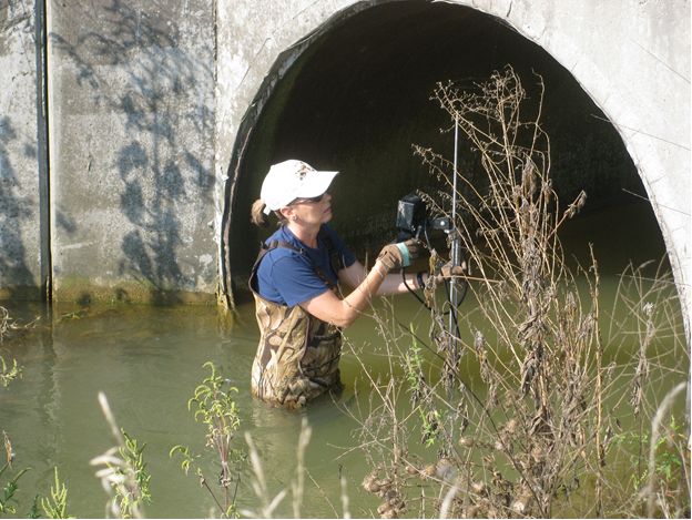
Chris Wilson, University of Tennessee, and Laura Keefer, Illinois State Water Survey, demonstrate how to take soil samples to be used to calibrate hyperspectral flights in the Upper Sangamon River watershed part of the Intensively Managed Landscapes – CZO. Photo by Kevin Roche.
The CZO network has benefitted my work by fostering the sharing of ideas and perspectives, collaboration, and collective planning of future research. My collaborations with the researchers in my CZO, who represent about ten different universities, have contributed to the expansion of my professional network and potential future research.
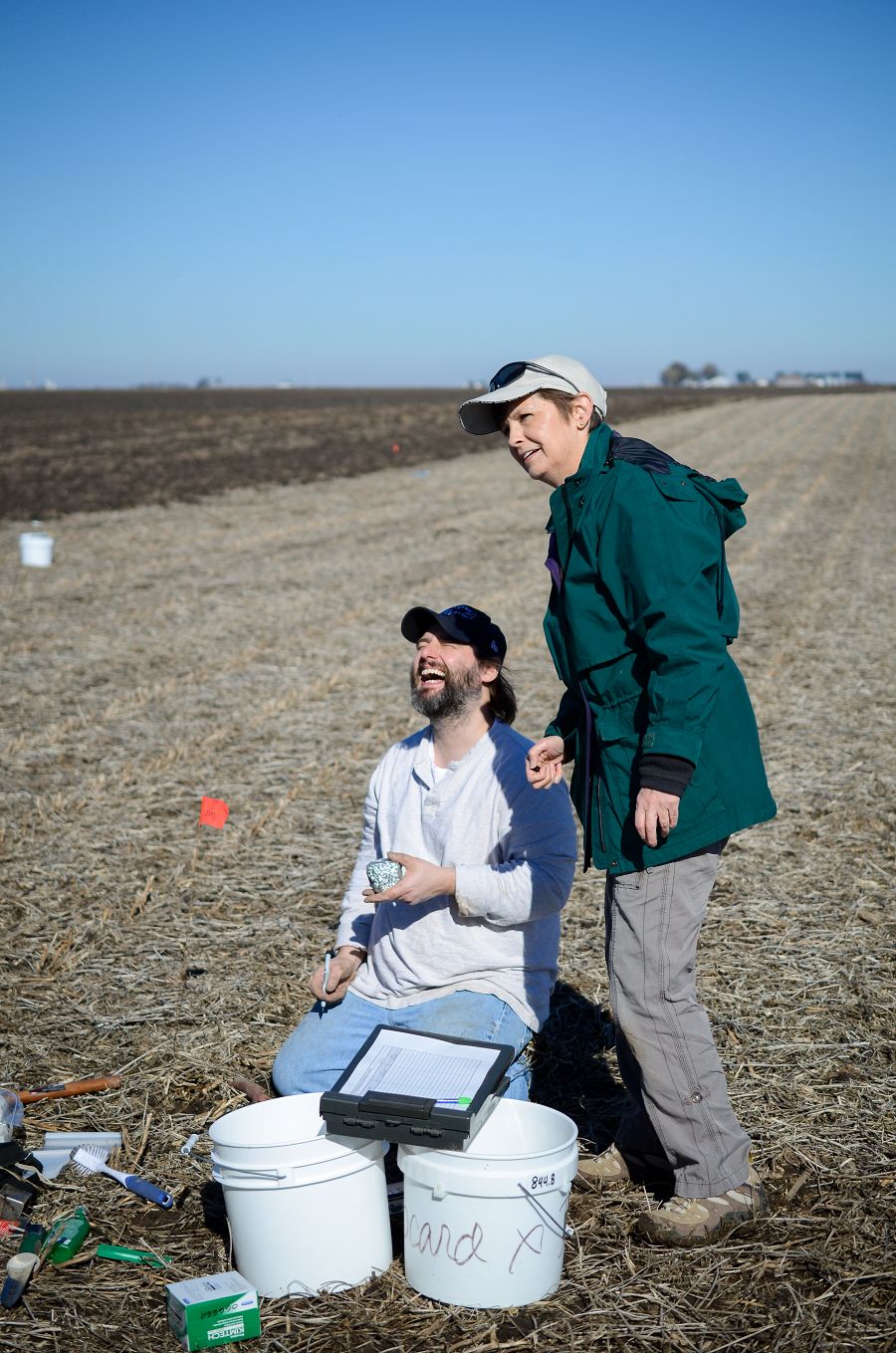
The greatest challenges in my work are lack of continuity in funding to collect long-term, detailed datasets. I have participated in only three studies in my 30 years of professional experience that have lasted more than five years. Short-term sampling is very important to capture processes at a specific time, but nature is variable and those variabilities shape the processes we observe. Long-term, intense data collection can provide a framework for understanding the critical zone. Long-term data collection, over decades, can reveal trends in erosion rates or show whether sediment concentrations in a river have changed during high flow events. Evaluating these outcomes requires different water sampling frequency and instrumentation to monitor streamflow continuously—something that is expensive and labor intensive—but which is critical to our understanding of the underlying processes.
:: By Linda Copman, staff writer ::
Laura Keefer. Photo by Erin Bauer.
Teaching Urbana Middle School students how to take depth integrated suspended sediment samples in Boneyard Creek on the University of Illinois Engineering Quad. Using these samples in combination with streamflow measurements, the students are taught to compute the sediment load. Photo by Daniel Webb.
Chris Wilson, University of Tennessee, and Laura Keefer, Illinois State Water Survey, demonstrate how to take soil samples to be used to calibrate hyperspectral flights in the Upper Sangamon River watershed part of the Intensively Managed Landscapes – CZO. Photo by Kevin Roche.

Related News
Explore Further
