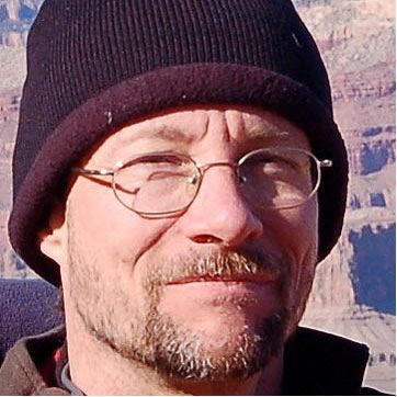
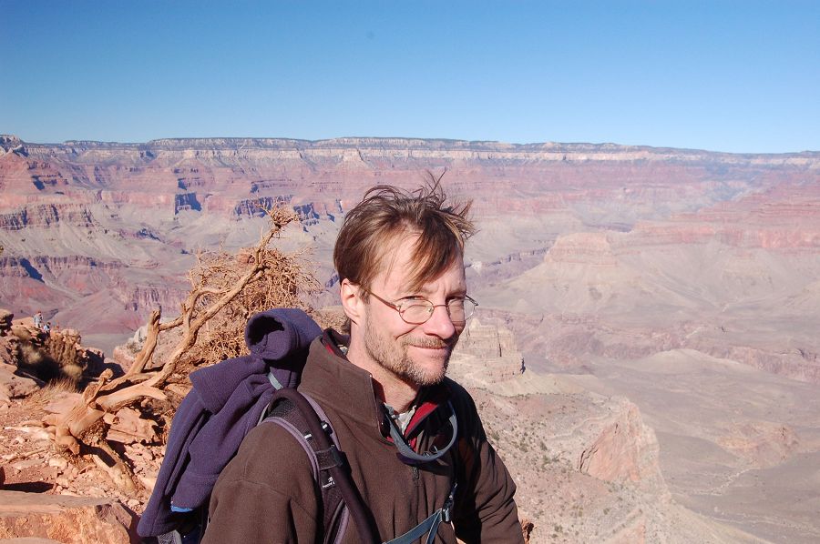
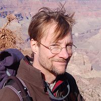
Critical Zone Profile - GREG TUCKER (geomorphologist, professor)
One of the most fundamental and fascinating questions in Earth Science is how the landscape takes shape, over years to eons. Greg Tucker studies the processes that shape the Earth's surface, including floods and landslides. Much of Tucker’s work focuses on river basins, where the vast majority of Earth's population lives. The structure and dynamics of river basins pose some fascinating research questions:
(1) How might erosion and sedimentation patterns in a river basin respond to climate change?
(2) How do patterns of tectonic motion influence drainage and erosion patterns and thereby create the distinctive terrain of places like the Italian Apennines, the mountains of Taiwan, or the Colorado High Plains?
(3) How does natural variability and heterogeneity – such as the mixture of grain sizes on a streambed or the quasi-random nature of rainstorms – influence river basin form and dynamics?
Tucker’s approach to answering these questions involves a range of methods, with an emphasis on mathematical modeling and computation. Answering these questions has many practical implications. From the point of view of infrastructure, soil erosion can be an expensive nuisance – undermining roads, fields, and fences, and clouding downstream waterways with fine suspended sediment.
“The critical zone is the Earth’s skin, and we happen to live – and derive our livelihoods – on that skin.” – Greg Tucker
I grew up on top of a terminal glacial moraine in New Jersey – not that I knew this at the time. I went to Brown University and majored in anthropology, with a focus on prehistoric archaeology. Meanwhile, I had a summer job gardening and landscaping in northern New Jersey. The job involved digging a lot of holes, which led me to notice that soils and landforms were strikingly different from one place to another. I became really curious about these patterns. After I graduated, I worked for a year as a contract archaeologist, and my interest in geology and landforms continued to deepen. Meanwhile, I had also always had an interest in computer programming. I ended up combining these two interests in graduate school at Penn State, where I studied Geosciences with an emphasis on computer modeling applications in geomorphology.
As the 18th century founders of geology recognized, our planet's surface is continually sculpted by processes that obey the basic laws of physics and chemistry. The field of geomorphology seeks to develop a quantitative theoretical understanding of how landscapes and landforms evolve over time, whether it be from soil erosion in the months after a wildfire, or the result of evolution of a mountain range over millions of years. The first type of problem has obvious direct relevance for how we live sustainably on the planet and keep ourselves safe from natural hazards. The second is one small part of humankind’s ongoing quest to understand the universe and our places in it.

Aerial photo that I took from a small plane showing the flatirons and some of their flanking terraces. One CZO activity has been study of the morphologic evolution of these mountains and adjacent foothills.
The enormity of “deep time” is always a challenge in studying the geologic processes. We can climb on landforms and drill into rocks, but it isn’t (usually) easy to watch them evolve or squeeze them into a laboratory. To address these challenges, we use a variety of tools, including computer models, which allow one to compress time, experiment with different hypotheses, and compare theory with observations. Together with colleagues at Tulane and the University of Washington, my group has been developing a programming library called Landlab to make it easier for researchers to build, explore, combine, and modify models of landscape processes at a variety of space and time scales.
The task of creating, testing, and refining mathematical models of landscape evolution is among the most exciting challenges in the field. Yet models alone are not enough. Understanding the physics behind landscape evolution requires careful measurement of processes, landforms, and rates of change. To fulfill this need, my research group uses a wide array of techniques, including: digital terrain analysis, field surveying, ground- and aircraft-based laser mapping, luminescence dating of sedimentary deposits, aerial photograph analysis, sediment tracers, and process monitoring (measuring things like rainfall, stream flow or water height, taking automated time-lapse photos, measuring soil moisture, etc.). Each of these methods yields insight into processes, as well as data for formulating and testing mathematical models.
Lately there has been an explosion of digital data that represent the Earth's surface as a series of points with varying height above sea level – what’s known in the trade as digital elevation models. You can learn a lot by analyzing these digital datasets, for example, by measuring how steep stream channels and hillslopes are, or by comparing two different terrain models taken before and after a large event such as a flood.
One of my favorite field areas is a site on the Colorado High Plains about an hour's drive east of Boulder, where - as in many spots across the High Plains - the landscape hosts featherlike networks of active gullies. If you walk along one of these grass-lined valleys, you'll occasionally come across a sudden cliff, maybe one or a few meters high,that marks a step in the channel. These steps migrate relatively quickly - we've clocked one example moving at an average of around half a meter per year. So despite the "flat" nature of the High Plains, there are places where the terrain evolves quite rapidly.
For nearly a century, a debate has raged in the scientific community about the origin of these gullies. Are they natural or the result of people over-taxing the land? Or both? Throughout the dry southwest, ranchers and settlers in the late 19th century saw new gullies form, slicing deeply and abruptly into the floors of broad, gentle valleys. With the larger channels, the big arroyos like Rio Puerco and Arroyo Chico in New Mexico, the carving of a new canyon could mean disaster for a ranch, as the water table fell, crops withered, and wells dried up. Some have blamed over-grazing for making the land impervious to rainfall from summer storms, leading to erosive flash floods. Others have blamed subtle changes in climate that brought fewer, but bigger storms.
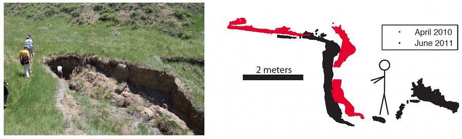
Gullies at the West Bijou Creek study site, Colorado High Plains. On the right are two laser scans of the site
The best conclusion we have come to so far is this: nature makes her own gullies, but people have a choice about whether to encourage the process or not.
The Critical Zone Observatories (CZOs) give us an integrated picture of water, sediment, geochemistry, and biology. The data collected can inform management decisions in a variety of ways, not least of which is providing an improved understanding of how the system functions and responds to various perturbations. From the perspective of a scientist inside a particular discipline, the CZO network does at least two valuable things. First, it generates a wealth of data on modern processes and ancient events – data that would be too expensive for any single investigator to collect by him or herself. Second, the network brings together scientists from a wealth of backgrounds. I’ve learned, for example, a new appreciation for biogeochemistry and also more about new technology for environmental sensing and measurement.
:: By Linda Copman, staff writer ::
Greg Tucker
Aerial photo that I took from a small plane showing the flatirons and some of their flanking terraces. One CZO activity has been study of the morphologic evolution of these mountains and adjacent foothills.
Gullies at the West Bijou Creek study site, Colorado High Plains. On the right are two laser scans of the site


Related News
Explore Further
