ARCHIVED CONTENT: In December 2020, the CZO program was succeeded by the Critical Zone Collaborative Network (CZ Net)
×
Shale Hills Tree Survey, Google Earth File
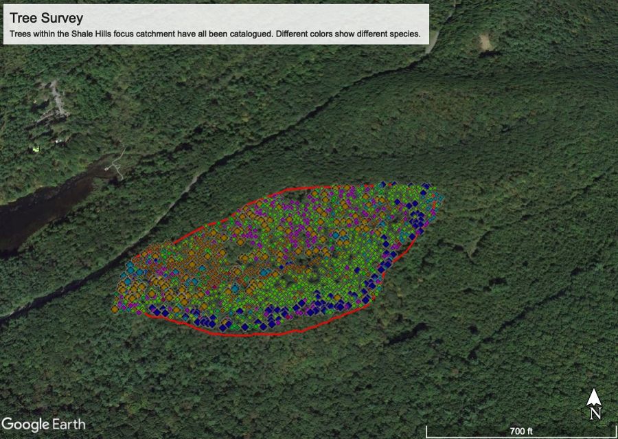
Trees within the Shale Hills focus catchment have all been catalogued. Different colors show different species.
This kmz file contains basic data on every large tree within the Shale Hills catchment, including species and Diameter at Breast Height (DBH). Explore the data and look for patterns of species distributions by clicking on and off different species. This file is included within the Shale Hills VFE.
Grades 3 -
16
Biology/Ecology • GIS/RemoteSensing • SoilScience/Pedology
Virtual Fieldwork • Computer Activity • Demo • Dataset
Educational Objectives
The listed objectives are suggestive. Teachers may design activities using the dataset with their own objectives.
- Describe how distribution of trees varies by species.
- Speculate what factors determine species' affinity for particular placement within the Shale Hills catchment.
- Design investigations to test hypotheses about species distribution.
The survey can also serve as a model for surveying trees (or other elements) in your local environment.
Audience
K-12
General Public
Higher Education


Explore Further
