ARCHIVED CONTENT: In December 2020, the CZO program was succeeded by the Critical Zone Collaborative Network (CZ Net)
×
Mapping Earth systems
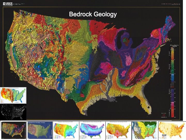
Very colorful map of Bedrock Geology for the U.S. Maps of very different characteristics in the landscape can reveal surprising connections.
View ten maps of the contiguous 48 states, each highlighting different geographic features. Viewing the maps collectively reveals connections among different Earth systems.
Grades 6 -
14
All Disciplines
Information • Dataset • Activity
Educational Objectives
- Describe similarities in the geographic distribution of different characteristics of the landscape.
- Speculate on relationships among these different characteristics.
Audience
K-12
General Public
Higher Education
NGSS Crosscutting Concepts: Patterns | Systems and System Models
NGSS Science & Engineering Practices: Developing and Using Models
NGSS Disciplinary Core Ideas: ESS2 - Earth’s Systems | ESS3 - Earth and Human Activity
Observatory: National CZO
Author(s): Don Haas (PRI)

Explore Further
