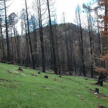
Jemez 2011 Burned ZOB
Jemez River Basin 2011 Burned Zero Order Basin (ZOB) is located in the east rim of the Valles Caldera (Rabbit Mountains). Upper part of the catchment was burned in the Las Conchas fire in July 2011.
0.13 km2 Area
2664 - 2934 m Elev
5.1 °C Temp
670 mm Precip
Parent Field Area:
Jemez River Basin ▲
Upper part of the burned ZOB.
-
Setting & Research
Jemez River Basin 2011 Burned Zero Order Basin (ZOB) is located in the east rim of the Valles Caldera (35o50'57"N, 106o27'3"W). The basin is north oriented with dominant northwest and northeast facing slopes. Steep slopes in the upper part with the average value of 21.8 degrees (0.1 - 47.5 degrees). Elevation ranges from 2664 m to 2934 m with the average value of 2778 m. The drainage area of the ZOB is 0.13 km2. ZOB was instrumented in the fall 2011 after the Las Conchas fire (July 2011) where the most of the catchment was burned and only a lower part covered by mountain grasses survived.
Note. This site was formerly called Jemez River Basin Mid-Elevation ZOB (Burned ZOB) and was renamed after the 2013 fire.
-
Overview Maps
Map Overlays
-
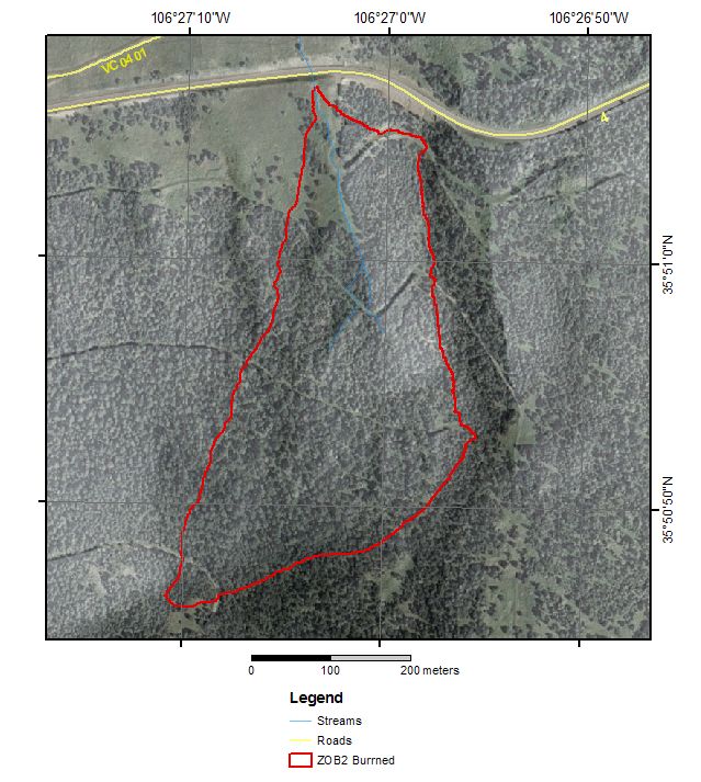
Burned ZOB satellite view.
-
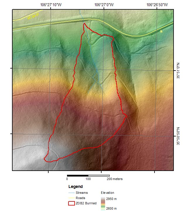
Burned ZOB elevation map.
-
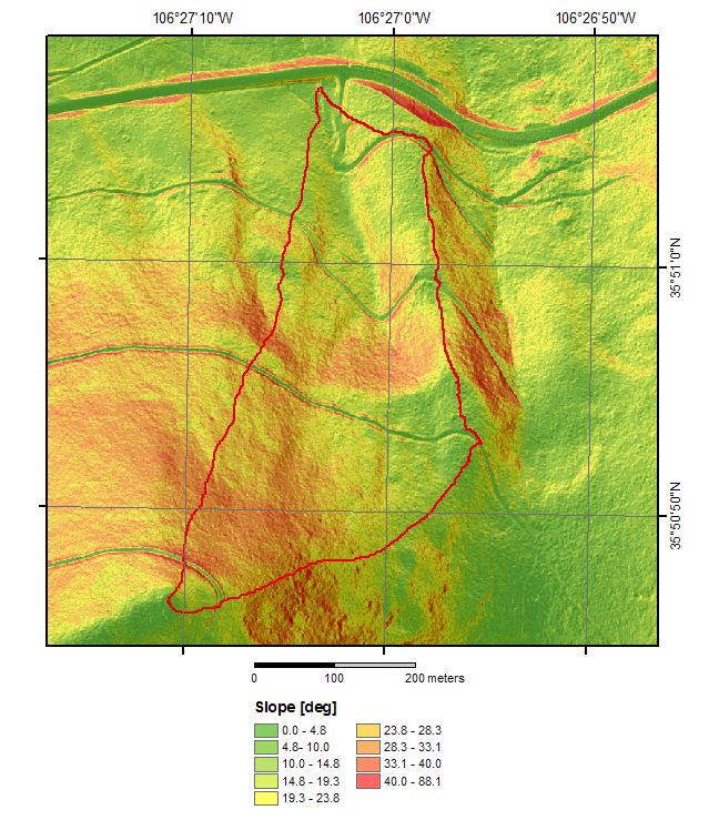
Burned ZOB slope map.
-
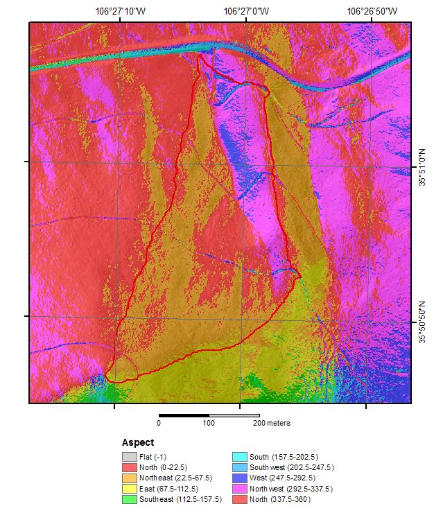
Burned ZOB aspect map.
-
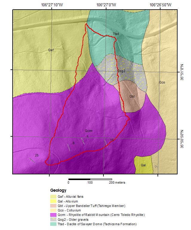
Burned ZOB geology map.
-
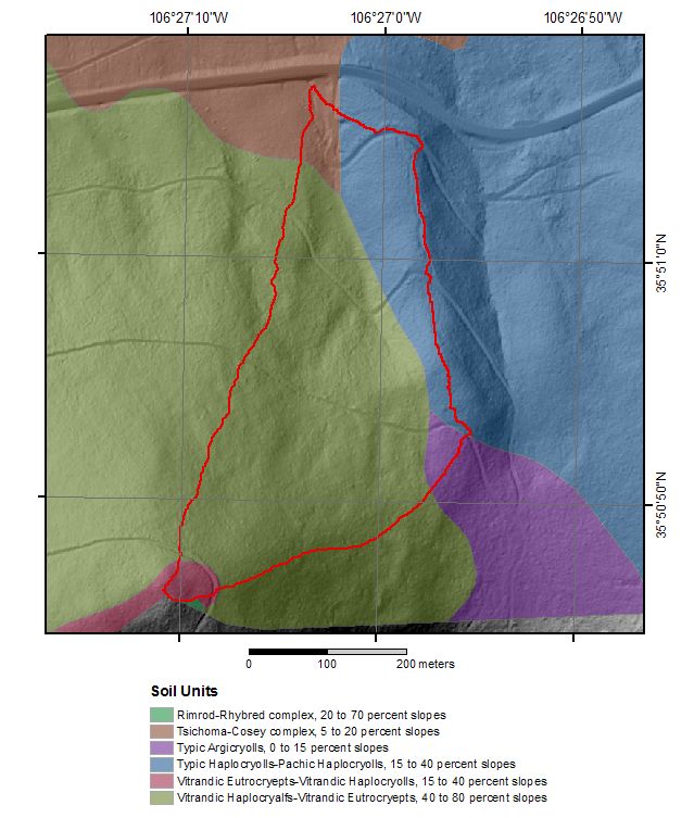
Burned ZOB soil map.
-
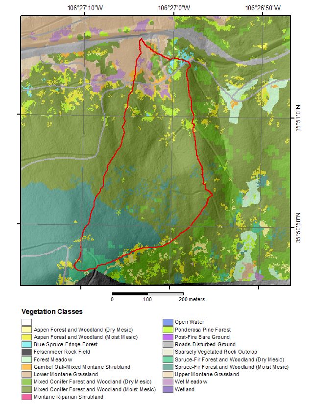
Burned ZOB vegetation map.
-
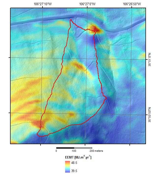
Burned ZOB EEMT map.
-
-
Dynamic Map
To fully zoom into a small area, you may need to visit the "Map" button and uncheck "Terrain" view.
-
Data
Jemez 2011 Burned ZOB - Meteorology - Lower Site (2011-2019)
10 components • Jemez 2011 Burned ZOB • Climatology / Meteorology, Hydrology • Shirley Papuga; Mark Losleben; Jessica SwetishJemez 2011 Burned ZOB - Meteorology - Upper Site (2011-2019)
10 components • Jemez 2011 Burned ZOB • Climatology / Meteorology • Shirley Papuga; Mark Losleben; Jessica SwetishJemez 2011 Burned ZOB - Soil Moisture, Soil Temperature, Electrical Conductivity, Water Potential (2011-2019)
55 components • Jemez 2011 Burned ZOB • Hydrology, Soil Science / Pedology • Schaap, Marcel; Condon, Katherine; Durcik, Matej; Losleben, MarkJemez 2011 Burned ZOB - Groundwater Depth, Piezometer (2011-2019)
4 components • Jemez 2011 Burned ZOB • Hydrology • Chorover, Jon; McIntosh, Jennifer; Durcik, Matej; Losleben, Mark; Killebrew, AdamJemez River Basin - LiDAR - Terrestrial Laser Scan (2011-2013)
3 components • Jemez River Basin, Jemez 2011 Burned ZOB • GIS / Remote Sensing, Geomorphology • Caitlin Orem; Jon Pelletier -
Partner Organizations
Explore Further
