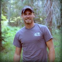
Jacob Flanagan

My research is focused on remote sensing of the environment with my main focus on Lidar such as the data collected at the CZO. This data has been used to create the common products such as DEMs (digital elevation models) that are used by nearly all the groups in the CZO network. The Lidar is also being used to create products that help make cross-site comparisons for better understanding the differences across the CZO sites from a remote sensing standpoint as well as research into future products.
-
CZO Publications
Papers/Books
2014
LiDAR-derived snowpack data sets from mixed conifer forests across the Western United States. Harpold, A.A., Q. Guo, N. Molotch, P. D. Brooks, R. Bales, J.C. Fernandez-Diaz, K.N. Musselman, and T.L. Swetnam, P. Kirchner, M. Meadows, J. Flanagan, R. Lucas (2014): Water Resources Research 50(3): 2749-2755 Cross-CZO
2014
LiDAR measurement of seasonal snow accumulation along an elevation gradient in the southern Sierra Nevada, California. Kirchner, P.B., Bales, R.C., Molotch, N.P., Flanagan, J., Guo, Q (2014): Hydrology and Earth System Sciences 18: 4261-4275 Cross-CZO
Papers and books that explicitly acknowledge a CZO grant are highlighted in PALE ORANGE.
Other CZO Publications
2011
"Seeing the Snow Through the Trees: Accumulation in forested catchments as determined from snow depth sensor and LiDAR measurements. Kirchner, P. B., Bales, R. C., Musselman K. N., Flanagan J., and Guo, Q. (2011): National CZO Program 2011 All Hands Meeting
Explore Further
