Southern Sierra Headwaters Tour
PRESENTATION/TALK | EDUCATION/OUTREACH
Presented by Southern Sierra Critical Zone Observatory, UC Water, & USDA Forest Service Pacific Southwest Research Station
Prather & Shaver Lake CA. REGISTRATION REQUIRED.
-
Sierra, INVESTIGATOR
-
Sierra, INVESTIGATOR
-
Sierra, STAFF
Please join us for a tour of the Sierra Nevada headwaters guided by researchers from the Southern Sierra Critical Zone Observatory, UC Water, and USDA Forest Service Pacific Southwest Research Station.
This tour will follow water from sky to stream in the Sierra National Forest, in the headwaters of the Kings River watershed. We will tour an array of instruments monitoring several components of the water cycle-- including meteorology, snowpack, streamflow, soil moisture, and vegetation water use.
SIERRA NEVADA: CALIFORNIA'S LARGEST WATER TOWER
Two-thirds of California's water comes from the Sierra Nevada. The importance of this water's quantity and quality is vital to the prosperity of California's communities and economies.
Measurements of water contained in the snow, soil, streams, and vegetation in the Sierra Nevada headwaters can provide critical information for water and forest management decisions across the state. This tour is ideal for resource managers and researchers interested in water accounting, dam release timings, integrated surface- and groundwater management planning, and forest health monitoring. Feel free to forward this event invitation to any colleagues who may also be interested.
REGISTRATION REQUIRED. CLICK HERE TO VIEW MORE INFORMATION AND SIGN UP.
Discipline Tags, CZOs, and Links
Hydrology
Outreach / Education Research
Water Chemistry
Climatology / Meteorology
Engineering / Method Development
Sierra
_200_200_80auto_s_c1.jpg)
Photos
SSCZO - Instruments
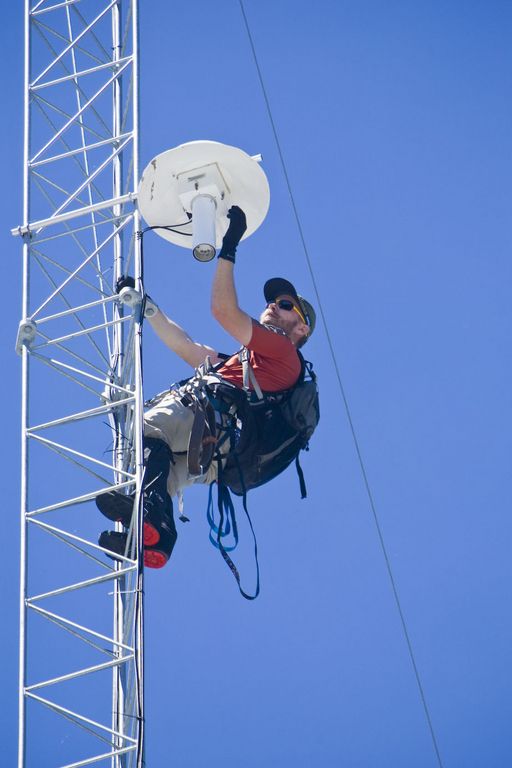
Matt Meadows (Field Manager, UC Merced) checks on an instrument on the P301 flux tower.
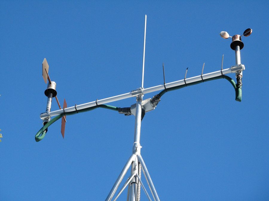
Anemometer measuring wind speed and direction.
Ultrasonic anemometer on the P301 flux tower measures wind speed and direction in 3 dimensions. Data is connected to gas samples taken every quarter second at the filters on the left (beige circles).
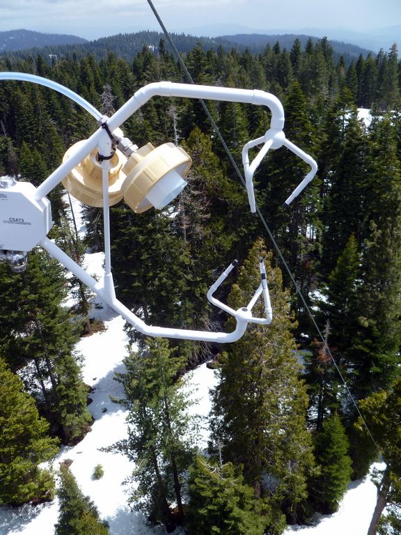
Instrument cluster featuring a relative humidity sensor, ultrasonic snow depth sensor, co-located soil moisture and temperature sensors at different depths, and a solar panel to power it all.
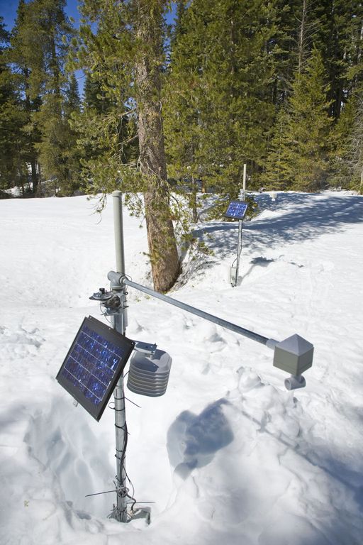
Instrument cluster at the P303 Upper Met site with ultrasonic snow depth sensor and co-located soil moisture and temperature sensors.
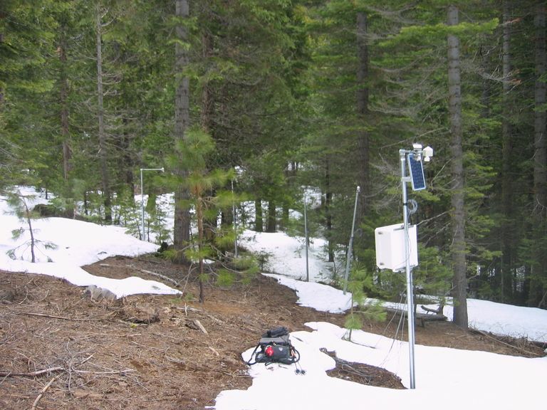
Instrument cluster at the P300 Lower Met site with ultrasonic snow depth sensor and co-located soil moisture and temperature sensors. The pole also psupports a solar panel, and an enclosure with a backup power supply and the data logger.
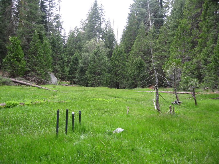
Instruments installed in the P301 meadows include wells and piezometers, at different locations to assess surface and groundwater flows.
Several clusters of instruments measure the water balance. These clusters each contain soil moisture and temperature sensors, an air temperature sensor, relative humidity sensor, and an ultrasonic snow depth sensor.
These water balance instruments are clustered at two different elevations, with north, flat, and south facing aspects. Conditions are measured under canopy, at drip edge, and at open canopy. Water balance measurements are also made in the wireless sensor network that stretches along the P301 meadow.
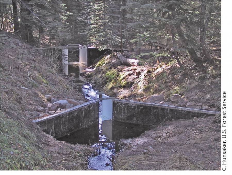
The eight subcatchments and two integrating catchments in the KREW project have flumes to measures discharge.
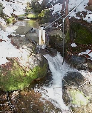
The large KREW flumes are complemented by small flumes for low flow.
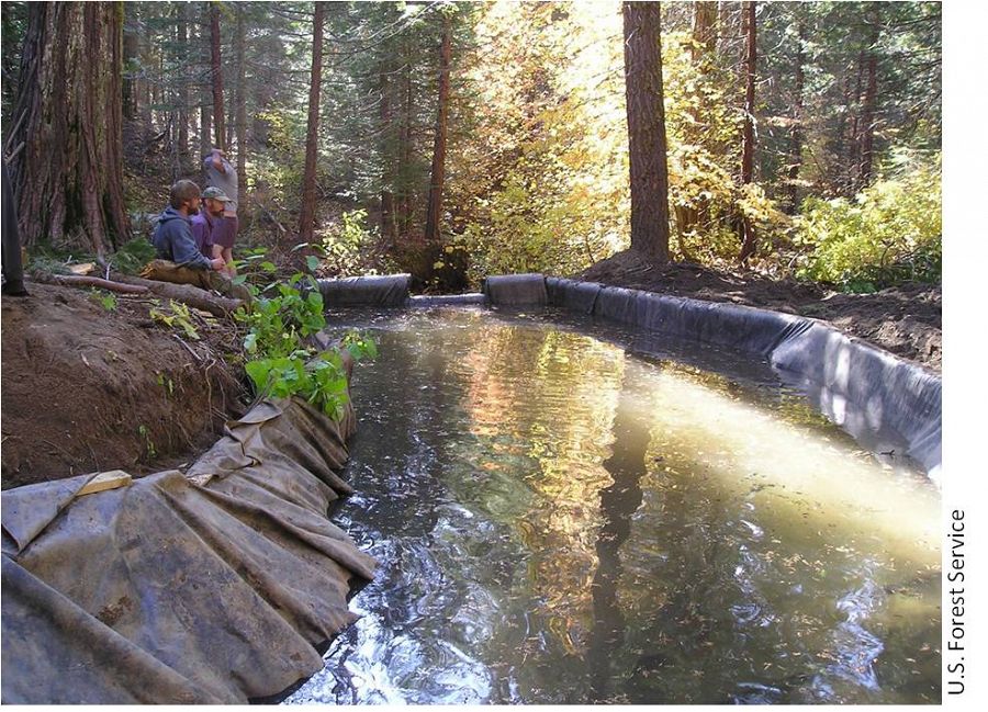
Each of those eight KREW subcatchments also has a plastic-lined settling basin to capture sediment.
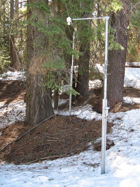
There are two meteorological stations in the Providence catchment - one at the lower elevation range and one near the crest. Each meteorological station has a rain gauge.
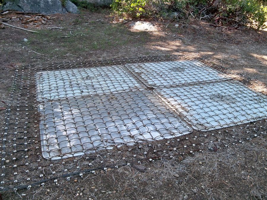
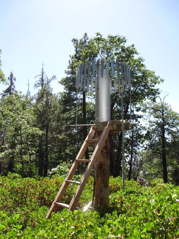
At the upper meteorological station, there is a snow pillow. This snow pillow tracks the weight of snow above it. Combined with the snow depth measurements, the two permit the calculation of amount of water in the snow pack.
Another view of the snow pillow.
Hundreds of instruments and sensors have been deployed in the primary SSCZO research site of the Providence Creek watershed as well as in Wolverton basin. Additional SSCZO flux towers and instruments have also been installed at the San Joaquin Experimental Range, Soaproot Saddle, and Short Hair Creek.
Explore more photos of the intstuments and sensors used by SSCZO.
Explore Further
