GIS / Remote Sensing Tag
GIS / Remote Sensing is one of more than 16 discipline tags that we use to categorize and aggregate our interdisciplinary information within and across CZOs. Much of our information has been tagged with 2-3 disciplines.
-
Reynolds People - GIS / Remote Sensing
7 People
.(JavaScript must be enabled to view this email address)
Remote sensing
INVESTIGATOR
.(JavaScript must be enabled to view this email address), 208-426-4061
Ecohydrologic Modeling; Data Assimilation; Remote Sensing; Cyberinfrastructure; Landscape Evolution
INVESTIGATOR
.(JavaScript must be enabled to view this email address), 208-426-4061
Remote Sensing; Geo-Engineering; Cyberinfrastructure
.(JavaScript must be enabled to view this email address)
Lidar remote sensing for vegetation applications.
.(JavaScript must be enabled to view this email address)
I am an early career scientist interested in the influence of hydrology on landforms and ecological
INVESTIGATOR, PostDoc
.(JavaScript must be enabled to view this email address)
Terrestrial ecosystem modeling; Forest biometrics; Spatial statistics; Remote sensing; GIS
STAFF, Data Manager
.(JavaScript must be enabled to view this email address)
GIS, Landscape Modeling, Population Ecology
-
-
Reynolds Data - GIS / Remote Sensing
National - LiDAR, Land Cover, GIS/Map Data - OpenTopography (2010-2017)
18 components • Boulder Creek Watershed, Eel River Watershed, Jemez River Basin, Reynolds Creek Experimental Watershed, Susquehanna Shale Hills Critical Zone Observatory, Northeastern Puerto Rico and the Luquillo Mountains, Sangamon River Basin, Clear Creek Watershed, Calhoun Critical Zone Observatory, Providence Creek Headwater Catchments (1660 - 2115 m elevation) • Geomorphology, GIS / Remote Sensing, Hydrology, Biology / Ecology • National Center for Airborne Laser Mapping; Boulder Creek Critical Zone Observatory; Calhoun Critical Zone Observatory; University of Arizona; University of California Merced; Valles Caldera National Preserve; Bandelier National Monument; National Park Service; Jemez River Basin and Santa Catalina Mountains Critical Zone Observatory; Luquillo Critical Zone Observatory; Reynolds Creek CZO; Eel River CZO; Shale Hills CZOReynolds Creek - Digital Elevation Model (DEM), Land Cover, LiDAR (2007)
1 components • Reynolds Creek Experimental Watershed • GIS / Remote Sensing • Boise State University; Boise Aerospace Center Laboratory; Nancy GlennReynolds Creek - Land Cover, LiDAR, Vegetation - Biomass Estimate of Sagebrush (2012)
1 components • Reynolds Creek Experimental Watershed • Biology / Ecology, GIS / Remote Sensing, Modeling / Computational Science • Li, Aihua; Glenn, Nancy F; Olsoy, Peter J; Mitchell, Jessica J; Shrestha, RupeshReynolds Creek - LiDAR, Snow Depth - Snow-Depth (2009)
1 components • Reynolds Creek Experimental Watershed • GIS / Remote Sensing, Hydrology • Boise State University; Boise Aerospace Center Laboratory; Nancy GlennReynolds Creek Experimental Watershed - Digital Elevation Model (DEM), GIS/Map Data, LiDAR (2015)
1 components • Reynolds Creek Experimental Watershed • GIS / Remote Sensing • NCALM; Kathleen LohseReynolds Creek Experimental Watershed - LiDAR, Digital Elevation Model (DEM) - DEM (2014)
1 components • Reynolds Creek Experimental Watershed • GIS / Remote Sensing • Nayani Ilangakoon; Nancy F. Glenn; Lucas P. Spaete; Hamid Dashti; Aihua Li -
-
Reynolds Publications - GIS / Remote Sensing
2019
Empirical methods for remote sensing of nitrogen in drylands may lead to unreliable interpretation of ecosystem function. Dashti, H., Glenn, N.F., Ustin, S., Mitchell, J.J., Qi, Y., Ilangakoon, N.T., Flores, A.N., Silvan-Cardenas, J., Zhao, K., Spaete, L.P., and M.A. de Graaff (2019): IEEE Transactions on Geoscience and Remote Sensing
2019
Regional scale dryland vegetation classification with an integrated lidar-hyperspectral approach. Dashti, H., Poley, A., Glenn, N.F., Ilangakoon, N., Spaete, L., Roberts, D., Enterkine, J., Flores, A.N., Ustin, S.L., and J.J. Mitchell (2019): Remote Sensing
2019
Developing and optimizing shrub parameters representing sagebrush (Artemisia spp) ecosystems in the northern Great Basin using the Ecosystem Demography (EDv22) model. Pandit, K., Dashti, H., Glenn, N.F., Flores, A.N., Maguire, K.C., Shinneman, D.J., Flerchinger, G.N., and A.W. Fellows (2019): Geosci. Model Dev.
2018
Constraining plant functional types in a semi-arid ecosystem with waveform lidar. Ilangakoon, N.T., Glenn, N.F., Dashti, H., Painter, T.H., Mikesell, T.D., Spaete, L.P., Mitchell, J.J. and K. Shannon (2018): Remote Sensing of Environment
2017
Spatial modeling for resources framework (SMRF): A modular framework for developing spatial forcing data for snow modeling in mountain basins. Havens, S., Marks, D., Kormos, P., and A. Hedrick (2017): Computers and Geosciences
2017
Lidar aboveground vegetation biomass estimates in shrublands: Prediction, uncertainties and application to coarser scales. Li, A., Dhakal, S., Glenn, N.F., Spaete, L.P., Shinneman, D.J., Pilliod, D.S., Arkle, R.S. and S. McIlroy (2017): Remote Sensing
2016
Independent evaluation of the SNODAS snow depth product using regional-scale lidar-derived measurements. Hedrick, A., Marshall, H.P., Winstral, A., Elder, K., Yueh, S., and D. Cline (2016): The Cryosphere
2016
Full waveform lidar processing of ecosystem structure in the western United States. Ilangakoon, N., and N.F. Glenn (2016): NASA Airborne Snow Observatory (ASO) Workshop
2016
Spatial Pattern of Soil Organic Acquired from Hyperspectral Imagery at Reynolds Creek Critical one Observatory (RC-CZO). Li, A., Will, R., Glenn, N., Benner, S., and L. Spaete (2016): Whisper 2016, Los Angeles, CA
2016
The Airborne Snow Observatory: fusion of scanning lidar, imaging spectrometer, and physically-based modeling for mapping snow water equivalent and snow albedo. Painter, T., Berisford, D., Boardman, J., Bormann, K., Deems, J., Gehrke, F., Hedrick, A., Joyce, M., Laidlaw, R., Marks, D., Mattmann, C., Mcgurk, B., Ramirez, P., Richardson, M., Skiles, S.M., Seidel, F., and A. Winstral (2016): Remote Sensing of Environment
2016
Simulated water budget in a forested watershed within Priest River Experimental Forest, northern Idaho, USA. Wei, L., Link, T.E., Hudak, A.T., Marshall, J.D., Kavanagh, K.L., Abatzoglou, J.T., Zhou, H., Pangle, R.E., G.N. Flerchinger (2016): Hydrological Processes
2015
Comparison of linear and non-linear regression models to estimate leaf area index of dryland shrubs. Dashti, H., Glenn, N., Illangakoon, N., Mitchell, J.J., Dakhal, S., and L. Spaete (2015): American Geophysical Union, December, San Francisco, CA
2015
Improving Ecosystem Dynamic Models in a Semi-arid Ecosystem by Integrating Different Sources of Remotely Sensed Data. Dashti, H., Glenn, N., Jessica, M., Spaete, L., Flores, A., Zhou, Q., and M. Masarik (2015): CSDMS Annual Meeting, Boulder, CO
2015
Estimation of sagebrush biochemical and biophysical parameters using hyperspectral imagery and inversion of radiative transfer models. Dashti, H., Glenn, N.F., Jessica, M., and L. Spaete (2015): 57th Idaho Academy of Science and Engineering (IASE) Annual Meeting and Symposium, Boise, ID
2015
Landsat 8 Coupled With LiDAR Estimate Semi-Arid Rangeland Biomass and Cover. Dhakal, S., Li, A., Spaete, L., Shinneman, D., Arkle, R., Pilliod, D., McIlroy, S., Baun, C., and N.F. Glenn (2015): American Geophysical Union, San Francisco, CA
2015
Laser vision: lidar as a transformative tool to advance critical zone science. Harpold, A. A., Marshall, J. A., Lyon, S. W., Barnhart, T. B., Fisher, B. A., Donovan, M., Brubaker, K. M., Crosby, C. J., Glenn, N. F., Glennie, C. L., Kirchner, P. B., Lam, N., Mankoff, K. D., McCreight, J. L., Molotch, N. P., Musselman, K. N., Pelletier, J., Russo, T., Sangireddy, H., Sjöberg, Y., Swetnam, T., and West, N. (2015): Hydrol. Earth Syst. Sci., 19, 2881-2897 Cross-CZO National
2015
Characterization of low-height vegetation with waveform LiDAR. Ilangakoon, N., Glenn, N.F., and L. Spaete (2015): (IASE) Annual Symposium, Boise State University
2015
Quantification of Sagebrush Leaf Area Index (LAI) from Terrestrial Laser Scanning. Ilangakoon, N., Glenn, N.F., and P. Olsoy (2015): Great Basin Conference, Boise, ID
2015
Individual and Plot Level Shrub Characterization with Full Waveform LiDAR. Ilangakoon, N., Glenn, N.F., Dashti, D., and L. Spaete (2015): NASA ARSET Workshop, Pocatello, ID
2015
Aboveground Biomass Estimates of Sagebrush Using Terrestrial and Airborne LiDAR Data in a Dryland Ecosystem. Li, A., Glenn, N.F., Olsoy, P.J., Mitchell, J.J., and R. Shrestha (2015): Agricultural and Forest Meteorology
2015
Spatial Patterns of Vegetation Biomass and Soil Organic Carbon Acquired from Airborne Lidar and Hyperspectral Imagery at Reynolds Creek Critical Zone Observatory. Li, A., Will, R., Glenn, N., Benner, S., Spaete< L., and N. Ilangakoon (2015): American Geophysical Union, San Francisco, CA
2015
Combining airborne LiDAR and hyperspectral data across local sites for upscaling shrubland structural information: lessons for HyspIRI . Mitchell, J., Spaete, L., Shrestha, R., and N. Glenn (2015): Remote Sensing of Environment
2015
LiDAR illuminates the influence of elevation, aspect, and vegetation on seasonal snowpack: case studies from four western Critical Zone Observatories. Tennant, C., Harpold, A., Crosby, B., Godsey, S., and K. Lohse (2015): American Geophysical Union, San Francisco, CA
2015
The Sensitivity of Mountain Snowpack to Warming. Tennant, C.J. (2015): Idaho State University
2015
A simple framework for assessing the sensitivity of mountain watersheds to snowpack loss. Tennant, C.J., Crosby, B.T., Godsey, S.E., Van Kirk, R.W., and D.R. Derryberry (2015): Geophys. Res. Lett.
2015
Mapping SOC (Soil Organic Carbon) using LiDAR-derived vegetation indices in a random forest regression model. Will, R., Glenn, N., Benner, S., Pierce, J.L., Spaete, L., and A. Li (2015): American Geophysical Union, San Francisco, CA
2015
Deriving spatiotemporally distributed net ecosystem exchange estimates combining eddy flux and sensing data. Zhou, Q., Flores, A., Flerchinger, G., and N. Glenn (2015): 4th Annual
2014
Social-ecological impacts of juniper removal in a public lands context: merging deliberative workshops and participatory GIS. Bentley, A., Holbrook, J., Niemeyer, R., Suazo, A., Wulfhorst, J., Newingham, B., Rachlow, J., Vielring, K., and T. Link (2014): Third Annual Meeting UI-CATIE IGERT Project
2014
Spatial patterns of vegetation, soils and microtopography from terrestrial laser scanning on two semi-arid hillslopes of contrasting lithology. Harman C.J., Lohse K.A., Troch P.A., Sivapalan M. (2014): Journal of Geophysical Research: Biogeosciences 119(2): 163-180 Cross-CZO
2014
Aboveground total and green biomass of dryland shrub derived from terrestrial laser scanning. Olsoy, P.J., Glenn, N.F., Clark, P.E., Derryberry, D.R. (2014): ISPRS Journal of Photogrammetry and Remote Sensing 88: 166–173
2013
Improved visibility calculations with tree trunk obstruction modeling from aerial LiDAR. Murgoitio, J, R Shrestha, N Glenn, and L Spaete (2013): International Journal of Geographical Information Science, 27 (10): 1865-1883
2013
Airborne LiDAR and terrestrial laser scanning derived vegetation obstruction factors for visibility models. Murgoitio, J, R Shrestha, N Glenn, and L Spaete (2013): Transactions in GIS
2013
Lidar-derived estimate and uncertainty of carbon sink in successional phases of woody encroachment. Sankey, T, R Shrestha, J Sankey, S Hardegree, and E Strand (2013): Journal of Geophysical Research: Biogeosciences, 118 (3): 1144-1155
2011
Errors in LiDAR-derived shrub height and crown area on sloped terrain. Glenn, N, L Spaete, T Sankey, D Derryberry, S Hardegree, and J Mitchell (2011): Journal of Arid Environments, 75 (4): 377-382
2011
Sagebrush Steppe Shrub Height and Canopy Cover Estimation Using LiDAR and Landsat 5 TM Data. Pond, P (2011): Idaho State University Graduate Thesis
2011
Landsat-5 TM and LiDAR fusion for sub-pixel Juniper tree cover estimates in a western rangeland. Sankey, T and N Glenn (2011): Photogrammetric Engineering & Remote Sensing, 77 (12): 1241-1248
2011
LiDAR-Based Classification of Sagebrush Community Types. Sankey, T and P Bond (2011): Rangeland Ecology & Management, 64 (1): 92-98
2011
Vegetation and slope effects on accuracy of a LiDAR-derived DEM in the sagebrush steppe. Spaete, L, N Glenn, D Derryberry, T Sankey, J Mitchell, and S Hardegree (2011): Remote Sensing Letters, 2 (4): 317-326
2010
Characterizing western juniper expansion via a fusion of Landsat 5 Thematic Mapper and lidar data. Sankey, T, N Glenn, S Ehinger, A Boehm, and S Hardegree (2010): Rangeland Ecology & Management, 63 (5): 514-523
-
Reynolds News - GIS / Remote Sensing
2016
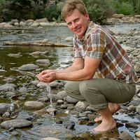
Critical Zone Q&A with researcher Adrian Harpold
19 Oct 2016 - University of Nevada Reno's Adrian Harpold reflects on his past and present time researching at Critical Zone Observatories.
2015
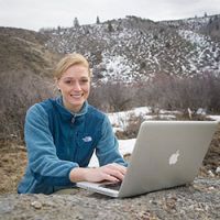
I Chose ISU: Clarissa Enslin, Geosciences Master’s Student
13 Jul 2015 - A South African native and an All-American swimmer as an undergraduate, Idaho State University master's student Clarissa Enslin chose ISU because of t
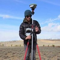
Understanding Vegetation-Snow Interactions and Critical Zone Sensitivity to Climate Change
01 Apr 2015 - Chris Tennant, Idaho State University, was awarded a NSF SAVI (Science Across Virtual Institutes) grant for cross-CZO research.
2014
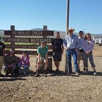
Czech Researchers Visit Reynolds CZO
05 Jun 2014 - Boise State University’s Department of Geosciences recently hosted faculty and students from the Czech Republic’s Global Change Research...
-
Reynolds Events - GIS / Remote Sensing
Environmental Field Methods Course in Idaho
Environmental Field Methods Course (3 credits) in Idaho-Learn Critical Zone Skills
Idaho State University, Pocatello, Idaho.
Explore Further

