Nancy F. Glenn

Professor, Boise State University
Glenn's page
PhD, Geo-Engineering, University of Nevada, Reno, 2000
MS, Geotechnical/Civil Engineering, University of California, Berkley, 1996
BS, Geological Engineering, Colorado State University, 1994
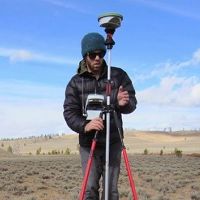
I am a remote sensing scientist and my research focuses on soil and vegetation characterization with LiDAR and hyperspectral imagery for ecological structure and function, surficial processes, and modeling. My research lab also develops LiDAR point cloud analysis and visualization tools for terrain and vegetation modeling.
-
CZO Publications
Papers/Books
2020 (In Review)
Understanding the effect of fire on vegetation composition and gross primary production in a semi-arid shrubland ecosystem using the Ecosystem Demography (EDv22) model. Pandit, K., Dashti, H., Hudak, A.T., Glenn, N.F., Flores, A.N., and D.J. Shinneman (2020): Biogeosciences Discuss.
2019
Empirical methods for remote sensing of nitrogen in drylands may lead to unreliable interpretation of ecosystem function. Dashti, H., Glenn, N.F., Ustin, S., Mitchell, J.J., Qi, Y., Ilangakoon, N.T., Flores, A.N., Silvan-Cardenas, J., Zhao, K., Spaete, L.P., and M.A. de Graaff (2019): IEEE Transactions on Geoscience and Remote Sensing
2019
Regional scale dryland vegetation classification with an integrated lidar-hyperspectral approach. Dashti, H., Poley, A., Glenn, N.F., Ilangakoon, N., Spaete, L., Roberts, D., Enterkine, J., Flores, A.N., Ustin, S.L., and J.J. Mitchell (2019): Remote Sensing
2019
Developing and optimizing shrub parameters representing sagebrush (Artemisia spp) ecosystems in the northern Great Basin using the Ecosystem Demography (EDv22) model. Pandit, K., Dashti, H., Glenn, N.F., Flores, A.N., Maguire, K.C., Shinneman, D.J., Flerchinger, G.N., and A.W. Fellows (2019): Geosci. Model Dev.
2018
Constraining plant functional types in a semi-arid ecosystem with waveform lidar. Ilangakoon, N.T., Glenn, N.F., Dashti, H., Painter, T.H., Mikesell, T.D., Spaete, L.P., Mitchell, J.J. and K. Shannon (2018): Remote Sensing of Environment
2017
Regional sensitivities of seasonal snowpack to elevation, aspect, and vegetation cover in western North America. Christopher J. Tennant, Adrian A. Harpold, Kathleen Ann Lohse, Sarah E. Godsey, Benjamin T. Crosby, Laurel G. Larsen, Paul D. Brooks, Robert W. Van Kirk, Nancy F. Glenn (2017): Water Resources Research 53 Cross-CZO National
2017
Form and function relationships revealed by long-term research in a semiarid mountain catchment. McNamara, J.P., Benner, S.G., Poulos, M.J., Chandler, D., Marshall, H.P., Flores, A.N., Seyfried, M., and N.F. Glenn (2017): WIREs Water
2017
Form and function relationships revealed by long-term research in a semiarid mountain catchment. McNamara, J.P., Benner, S.G., Poulos, M.J., Chandler, D., Marshall, H.P., Flores, A.N., Seyfried, M., and N.F. Glenn (2017): WIREs Water
2015
Laser vision: lidar as a transformative tool to advance critical zone science. Harpold, A. A., Marshall, J. A., Lyon, S. W., Barnhart, T. B., Fisher, B. A., Donovan, M., Brubaker, K. M., Crosby, C. J., Glenn, N. F., Glennie, C. L., Kirchner, P. B., Lam, N., Mankoff, K. D., McCreight, J. L., Molotch, N. P., Musselman, K. N., Pelletier, J., Russo, T., Sangireddy, H., Sjöberg, Y., Swetnam, T., and West, N. (2015): Hydrol. Earth Syst. Sci., 19, 2881-2897 Cross-CZO National
2015
Aboveground Biomass Estimates of Sagebrush Using Terrestrial and Airborne LiDAR Data in a Dryland Ecosystem. Li, A., Glenn, N.F., Olsoy, P.J., Mitchell, J.J., and R. Shrestha (2015): Agricultural and Forest Meteorology
2015
Reynolds Creek Critical Zone Observatory Annual Report 2015. Lohse, K. (2015): Reynolds Creek CZO, University of Idaho
2015
Combining airborne LiDAR and hyperspectral data across local sites for upscaling shrubland structural information: lessons for HyspIRI . Mitchell, J., Spaete, L., Shrestha, R., and N. Glenn (2015): Remote Sensing of Environment
2014
Aboveground total and green biomass of dryland shrub derived from terrestrial laser scanning. Olsoy, P.J., Glenn, N.F., Clark, P.E., Derryberry, D.R. (2014): ISPRS Journal of Photogrammetry and Remote Sensing 88: 166–173
2013
Improved visibility calculations with tree trunk obstruction modeling from aerial LiDAR. Murgoitio, J, R Shrestha, N Glenn, and L Spaete (2013): International Journal of Geographical Information Science, 27 (10): 1865-1883
2013
Airborne LiDAR and terrestrial laser scanning derived vegetation obstruction factors for visibility models. Murgoitio, J, R Shrestha, N Glenn, and L Spaete (2013): Transactions in GIS
2011
Errors in LiDAR-derived shrub height and crown area on sloped terrain. Glenn, N, L Spaete, T Sankey, D Derryberry, S Hardegree, and J Mitchell (2011): Journal of Arid Environments, 75 (4): 377-382
2011
Landsat-5 TM and LiDAR fusion for sub-pixel Juniper tree cover estimates in a western rangeland. Sankey, T and N Glenn (2011): Photogrammetric Engineering & Remote Sensing, 77 (12): 1241-1248
2011
Vegetation and slope effects on accuracy of a LiDAR-derived DEM in the sagebrush steppe. Spaete, L, N Glenn, D Derryberry, T Sankey, J Mitchell, and S Hardegree (2011): Remote Sensing Letters, 2 (4): 317-326
2010
Characterizing western juniper expansion via a fusion of Landsat 5 Thematic Mapper and lidar data. Sankey, T, N Glenn, S Ehinger, A Boehm, and S Hardegree (2010): Rangeland Ecology & Management, 63 (5): 514-523
Papers and books that explicitly acknowledge a CZO grant are highlighted in PALE ORANGE.
Other CZO Publications
2018
Reynolds Creek Critical Zone Observatory Annual Report 2018. Lohse, K.A., Benner. S., Flores, A., Glenn, N.F., Seyfried, M.S. (2018): Reynolds Creek CZO, University of Idaho
2017
Reynolds Creek Critical Zone Observatory Annual Report 2017. Lohse, K. (2017): Reynolds Creek CZO, University of Idaho
2016
Full waveform lidar processing of ecosystem structure in the western United States. Ilangakoon, N., and N.F. Glenn (2016): NASA Airborne Snow Observatory (ASO) Workshop
2016
Spatial Pattern of Soil Organic Acquired from Hyperspectral Imagery at Reynolds Creek Critical one Observatory (RC-CZO). Li, A., Will, R., Glenn, N., Benner, S., and L. Spaete (2016): Whisper 2016, Los Angeles, CA
2016
Reynolds Creek Critical Zone Observatory Annual Report 2016. Lohse, K. (2016): Reynolds Creek CZO, University of Idaho
2016
Above-ground Carbon Loss from the 2015 Soda Fire. Poley, A., Glenn, N., and A. Li (2016): The Sagebrush Ecosystem Conservation: All Lands, All Hands Conference, Salt Lake City, UT
2015
Improving Ecosystem Dynamic Models in a Semi-arid Ecosystem by Integrating Different Sources of Remotely Sensed Data. Dashti, H., Glenn, N., Jessica, M., Spaete, L., Flores, A., Zhou, Q., and M. Masarik (2015): CSDMS Annual Meeting, Boulder, CO
2015
Estimation of sagebrush biochemical and biophysical parameters using hyperspectral imagery and inversion of radiative transfer models. Dashti, H., Glenn, N.F., Jessica, M., and L. Spaete (2015): 57th Idaho Academy of Science and Engineering (IASE) Annual Meeting and Symposium, Boise, ID
2015
Landsat 8 Coupled With LiDAR Estimate Semi-Arid Rangeland Biomass and Cover. Dhakal, S., Li, A., Spaete, L., Shinneman, D., Arkle, R., Pilliod, D., McIlroy, S., Baun, C., and N.F. Glenn (2015): American Geophysical Union, San Francisco, CA
2015
Characterization of low-height vegetation with waveform LiDAR. Ilangakoon, N., Glenn, N.F., and L. Spaete (2015): (IASE) Annual Symposium, Boise State University
2015
Quantification of Sagebrush Leaf Area Index (LAI) from Terrestrial Laser Scanning. Ilangakoon, N., Glenn, N.F., and P. Olsoy (2015): Great Basin Conference, Boise, ID
2015
Individual and Plot Level Shrub Characterization with Full Waveform LiDAR. Ilangakoon, N., Glenn, N.F., Dashti, D., and L. Spaete (2015): NASA ARSET Workshop, Pocatello, ID
2015
Spatial Patterns of Vegetation Biomass and Soil Organic Carbon Acquired from Airborne Lidar and Hyperspectral Imagery at Reynolds Creek Critical Zone Observatory. Li, A., Will, R., Glenn, N., Benner, S., Spaete< L., and N. Ilangakoon (2015): American Geophysical Union, San Francisco, CA
2015
Reynolds Creek Critical Zone Observatory Annual Report 2015. Lohse, K. (2015): Reynolds Creek CZO, University of Idaho
2015
Mapping SOC (Soil Organic Carbon) using LiDAR-derived vegetation indices in a random forest regression model. Will, R., Glenn, N., Benner, S., Pierce, J.L., Spaete, L., and A. Li (2015): American Geophysical Union, San Francisco, CA
2015
Mapping the organic carbon content of soils (SOC) in the Reynolds Creek Watershed. Will, R., Stanbery, C., Seyfried, M., Pierce, J., Lohse, K., Flores, A., Glenn, N., Spaete, L., Patton, N., Black, C., Good, A., and S. Benner (2015): Great Basin Conference, Boise, ID
2015
Deriving spatiotemporally distributed net ecosystem exchange estimates combining eddy flux and sensing data. Zhou, Q., Flores, A., Flerchinger, G., and N. Glenn (2015): 4th Annual
2014
Mapping the organic carbon content of soils (SOC) in the Reynolds Creek Watershed. Will, R., Stanbery, C., Seyfried, M., Pierce, J., Lohse, K., Flores, A., Glenn, N., Spaete, L., Patton, N., Black, C., Good, A., and S. Benner (2014): All Hands Meeting, Fish Camp, CA
2013
Reynolds Creek Carbon Critical Zone Observatory. Lohse, KA, M Seyfried, A Flores, S Benner, N Glenn. (2013): NSF Proposal
-
News
Understanding Vegetation-Snow Interactions and Critical Zone Sensitivity to Climate Change
01 Apr 2015 - Chris Tennant, Idaho State University, was awarded a NSF SAVI (Science Across Virtual Institutes) grant for cross-CZO research.
Czech Researchers Visit Reynolds CZO
05 Jun 2014 - Boise State University’s Department of Geosciences recently hosted faculty and students from the Czech Republic’s Global Change Research...
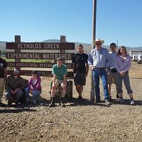
Introducing Reynolds Creek CZO
03 Mar 2014 - New Reynolds Creek CZO leverages USDA ARS spatial and temporal hydroclimate data to improve prediction of soil carbon and critical zone processes
Community Workshop: The Next Generation of LiDAR Analysis for Critical Zone Research
27 Feb 2014 - A three-day workshop on LiDAR processing techniques will be held in Boulder, CO May 12th-14th, 2014 Early-career CZ researchers should apply to attend
Explore Further
