ABOUT
Do not fill out this information.
On this particular page, the Initial Text and Image fields for this template are not used (inactive). A Carousel Slideshow is displayed instead.
To edit the Carousel Slideshow, Choose Edit Existing > Carousel Slides. Then navigate to your CZO's entry entitled "About"
History
Erosion of the Land and Erosion of the People: Illinois in the Great Depression
Overview
Intensively managed landscapes, regions of significant land use change, serve as sources of economic prosperity. However, the intensity of land use change is responsible for unintended deterioration of our land and water environments. The Intensively Managed Landscapes-Critical Zone Observatory (IML-CZO) aims to understand the present-day dynamics of this change in the context of long-term natural coevolution of the landscape, soil, and biota. The CZO will enable us to assess the short- and long-term resilience of the crucial ecological, hydrological, and climatic “services” provided by the Critical Zone, the “skin” of the earth that extends from the treetops to the bedrock. An observational network of three sites in Illinois, Iowa, and Minnesota that capture the geological diversity of the low-relief, glaciated, and tile-drained landscape will allow for novel scientific and technological advances in understanding the Critical Zone. The IML-CZO will also provide leadership in developing the next generation of scientists and practitioners and in advancing management strategies aimed at reducing the vulnerability of the system to present and emerging trends in human activities.
Study Sites
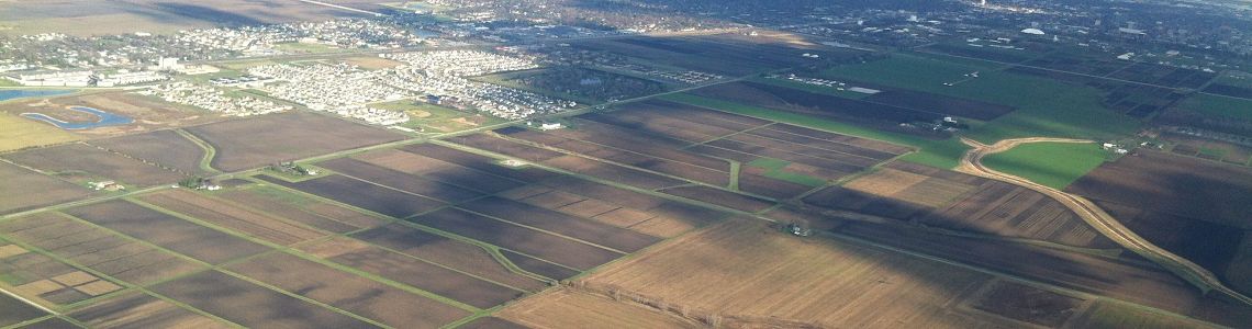
The IML-CZO includes two core sites—the 3,690-km2 Upper Sangamon River Basin in Illinois and the 270-km2 Clear Creek Watershed in Iowa—and a third participating site, the 44,000-km2 Minnesota River Basin. These three sites, all characterized by low-relief landscapes with poorly drained soils, represent the broad range of physiographic variations found throughout the glaciated Midwest, and thereby provide an opportunity to advance understanding of the Critical Zone in this important region.
Focal Science Questions
Through novel measurements, analysis, and modeling, the IML-CZO Program aims to address the following questions:
- How do different time scales of geologic evolution and anthropogenic (human) influence interact to determine the trajectory of critical zone structure and function?
- How is the coevolution of biota (both vegetation and microbes) and the soil affected by intensive management?
- How have the natural dynamic patterns of heterogeneity and connectivity across transition zones been changed by anthropogenic impacts?
- How do these changes affect the residence times and aggregate fluxes of water, carbon, nutrients, and sediment?
Observations
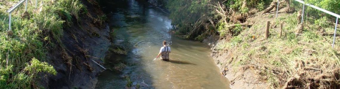
Members of the IML-CZO team are using historical data, existing observational networks, new instrumentation, remote sensing, sampling and laboratory analyses, and novel sensing technologies (e.g., open source hardware and unmanned vehicles) to study a number of variables related to climate and weather, hydrology, geology, geomorphology, soils, water chemistry, biogeochemistry, ecology, and land management.
Education and Public Engagement
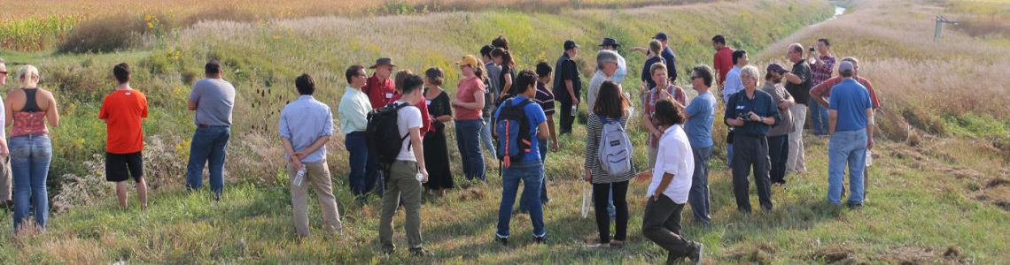
A primary aim of the IML-CZO Project is to engage a broad spectrum of students at the elementary, middle school, high school, and college levels, as well as the general public. These aims will be accomplished through educational programs, student internships, professional development programs, field tours and exhibitions, speaking opportunities at public events and gatherings, and partnerships with volunteers groups and nongovernmental organizations. Partners in this effort include several state agencies in Illinois, Iowa, and Minnesota, including the National Great Rivers Research and Education Center (East Alton, Ill.), the Partnership for River Restoration and Science in the Upper Midwest, the Science Museum of Minnesota (St. Paul, Minn.), and the Agricultural Watershed Institute (Decatur, Ill.).
Partnership
The IML-CZO program is a joint effort by a growing team of faculty and scientists from several institutions, including the University of Illinois at Urbana-Champaign, the University of Iowa, Purdue University, Northwestern University, Pennsylvania State University, the University of Minnesota, Utah State University, the University of Tennessee, the Illinois State Water Survey, the Illinois State Geological Survey, and the U.S. Geological Survey. For a list of individuals see Partners.
Banner Image
The banner image at the top of every IML page:

Humboldt, Illinois September 2012. Melinda Swinford (Into the Storm Photography). Image from Flickr and used with permission.
For further information please contact:
Professor Praveen Kumar (Director), Department of Civil and Environmental Engineering, University of Illinois at Urbana-Champaign (e-mail: kumar1@illinois.edu; phone: +1-217-333-4688)
Professor Thanos Papanicolaou (Co-director), Department of Civil and Environmental Engineering, University of Tennessee (e-mail: tpapanic@utk.edu; phone: +1-865-974-7836)
Schematic representation of land use transitions in a region (DeFries et al., 2004).
Humboldt, Illinois September 2012. Melinda Swinford (Into the Storm Photography). Image from Flickr and used with permission.
Intensively Managed Landscapes CZO
Illinois/Iowa/Minnesota
Established 2013
"The Intensively Managed Landsapes CZO works to understand how land-use changes affect the long-term resilience of the critical zone."
Science Questions:
- How does the coupled interaction of geologic materials, landscape form, and the soil continuum respond to climate, vegetation, and human activities in the critical zone?
- What is the dynamic relation between active and stabilized forms of SOM in IMLs and how does that relationship vary in activity centers and activity intervals? What are their effects on biotic and abiotic activities as they relate to SOM storage?
- How does the coupled interaction of surface water and groundwater control fluxes of water and solutes within the critical zone? How do the signatures of key materials that are exported (e.g., SOM and DOC) relate to those stored in the landscape?
- How are the sources, fluxes, and sinks of sediment in IMLs distributed in space and time? How do geomorphic, biogeochemical, hydrologic, and human processes interact with sediment production, transfer, and storage rates?
Explore Further
