EOS: Answer to California Landscape Riddle Lies Underground
Answer to California Landscape Riddle Lies Underground
By Elizabeth Thompson 30 May 2019
A sharp divide lies in Northern California. Near the coast, moderate temperatures and plentiful annual rainfall give rise to a lush forest. But then there’s an abrupt break—suddenly, the forest opens into a wide savanna, a grass-dominated biome typical of drier climates. These two areas experience nearly identical temperatures and rainfall. What accounts for the sudden shift to open grassland far out of its normal climatic range? A team of researchers looked below the surface for answers.
These two landscapes are in a Mediterranean climate: Precipitation falls in winter, and the Sun shines most intensely over a dry summer. That means that plants don’t have access to rain when they most need it. In climates like this, plants depend on water stored in the ground during the wet season to make it through dry times.
Hahm et al. propose that the sharp landscape change in Northern California is chiefly due to differences in the critical zone, the layer spanning from the top of the vegetation canopy downward to fresh bedrock, where plants can access stored water. The critical zone includes the soil, as well as weathered bedrock that contains clay and has been fractured and cracked enough to store water.
The researchers monitored water dynamics at representative sites in the forested and savanna regions, drilling boreholes and installing wells in each area and remotely sensing vegetation patterns across the larger landscapes. They found that the vegetation differences could be linked to the type of rock beneath each region, in particular to the depth and extent of weathering of the bedrock.
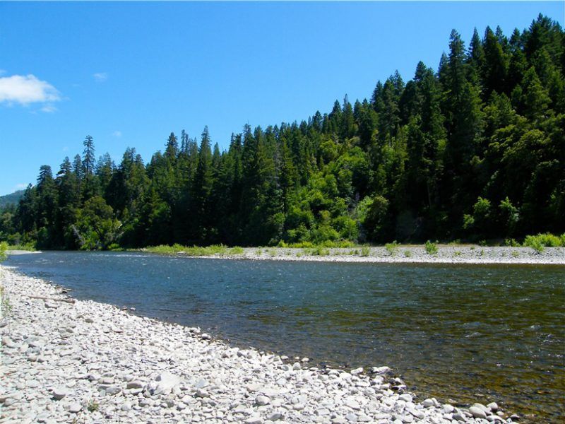
The forested swath grew over a belt of sedimentary bedrock that is weathered up to 30 meters deep. During the rainy part of the year, water finds its way deep into the weathered bedrock and remains through the dry season, ready for plants to draw up as they need it.
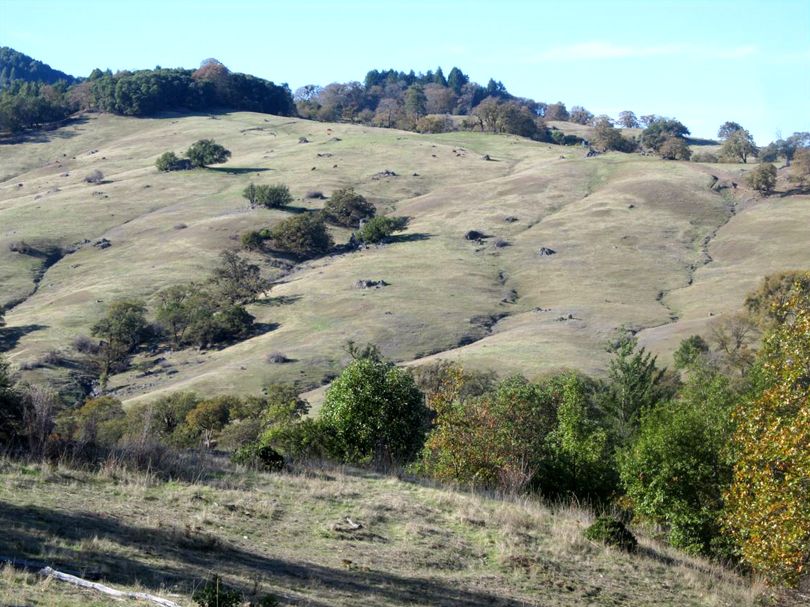
The dry savanna landscape, in contrast, lies over bedrock of similar composition that has been severely mechanically sheared during tectonic processes such that the rocks do not weather easily and may even seal up their own cracks. Fresh, unweathered bedrock rests just 2 to 4 meters below the surface. During the rainy winter, the critical zone is saturated with water to the point of flooding. In the summer, it does not take long for the thin critical zone to dry out. The grasses and deciduous oaks of the savanna are better adapted to survive in the floods and dryness of this zone than the evergreen trees of the neighboring forest, but there are also a few pockets of sandstone within the savanna that support evergreens just like the lush forest nearby.
According to the researchers, bedrock can form the base of an ecosystem, even defying dominant factors like climate. The plants and animals that depend on a landscape, as well as the humans who live and use water in the area, rely on the interactions of rock and water that shape their world. (Water Resources Research, https://doi.org/10.1029/2018WR023760, 2019)
—Elizabeth Thompson, Freelance Writer
Citation: Thompson, E. (2019), Answer to California landscape riddle lies underground, Eos, 100, https://doi.org/10.1029/2019EO124369. Published on 30 May 2019.
The Eel River passes through an oak savanna. Credit: Jesse Hahm
News Source:
READ MORE from EOS >>
News Category:
RESEARCH
People Involved
CZO
-

Eel, INVESTIGATOR, COLLABORATOR
-

Eel, INVESTIGATOR, COLLABORATOR
-

Eel, INVESTIGATOR, COLLABORATOR
-

Eel, INVESTIGATOR
-

Eel, INVESTIGATOR
Non-CZO
Sky M. Lovill - University of California, Berkeley
Alexander B. Bryk - University of California, Berkeley
David L. Bish - Indiana University
Juergen Schieber - Indiana University
Publications
2019
Lithologically Controlled Subsurface Critical Zone Thickness and Water Storage Capacity Determine Regional Plant Community Composition. Hahm, W.J., Rempe, D.M., Dralle, D.N., Dawson, T.E., Lovill, S.M., Bryk, A.B., Bish, D.L., Schieber, J. & Dietrich, W.E. (2019): Water Resources Research 55
Explore Further
