Rivendell
Rivendell is our critical zone laboratory where we can investigate in detail mechanisms controlling the currencies that then get released to the atmosphere and to the surrounding drainage channels. This proposed CZO leverages and builds upon the investment already made in Rivendell
0.004 km2 Area
400 - 470 m Elev
Parent Field Area:
Angelo Coast Range Reserve ▲
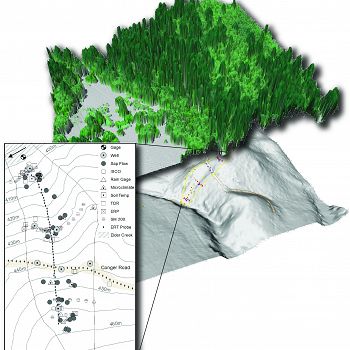
Sensor locations overlayed on 3D LiDAR visualization of Rivendell site. Image: Collin Bode, (NCED/NCALM/ERCZO, UC Berkeley)
Lithology
sandstone, other sedimentary
Biome
coniferous forest
Land Use
forest land
-
Setting & Research
In 2007, with the support of W.M. Keck Foundation and the National Center for Earth-surface Dynamics (NCED), we began an intensive monitoring program of the critical zone on a small (~ 4000 m2) steep sub-basin, nicknamed “Rivendell”, on a north-facing hillslope adjacent to Elder Creek. Elder Creek is a tributary of the South Fork Eel River in Northern California within the Angelo Coast Range Reserve.
The ~30 degree hillslope at the Rivendell installation site is underlain primarily by nearly vertically dipping mudstone (argillite). Cosmogenic dating of sediments, direct measurement of bedrock erosion and modeling document active channel incision driving hillslope processes, with a local pace of about 0.2 to 0.4 mm/yr.
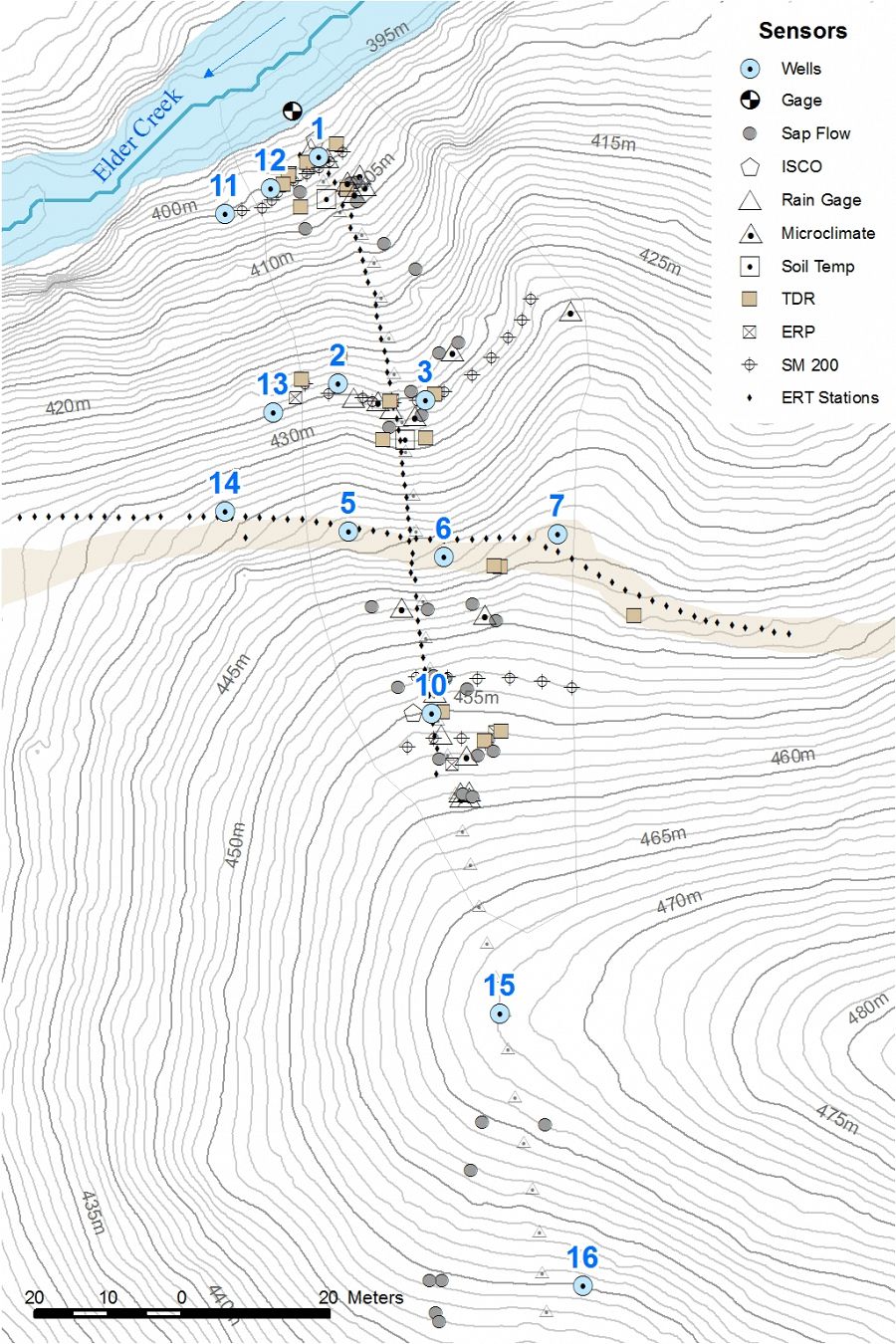
We have drilled a network of 12 wells as deep as 30 m down to fresh bedrock. We have also automated four ISCO samplers to collect water samples (daily or more frequently during runoff events) for water chemical analysis, and carried out repeated campaigns to sample water for isotope analysis.
A wireless radio network, powered by tree-top solar panels, supports a dense sensor network for environmental monitoring. Our installation includes extensive soil and rock moisture monitoring devices, sap flow sensors on 30 trees, and 4 meteorological stations. The entire system, some 700 sensors, together with a USGS stream gauge, record data at 5-15 minute frequency. These data are transmitted to UC Berkeley and placed into a sensor database (http://sensor.berkeley.edu) in near real-time.
-
Overview Maps
Rivendell Sensor Deployment

Sensors & infrastructure at Rivendell
See full size (in new tab/window)
-
Dynamic Map
To fully zoom into a small area, you may need to visit the "Map" button and uncheck "Terrain" view.
-
Data
Eel River to Rivendell - GIS/Map Data - Research and Watershed GIS Boundaries (2004-2015)
1 components • Rivendell, Angelo Coast Range Reserve, Eel River Watershed • GIS / Remote Sensing • Collin Bode; USGSRivendell - Air Temperature - Air temperature and relative humidity measurements (2010-2016)
1 components • Rivendell • Climatology / Meteorology • Link, PercyRivendell - Rainfall Chemistry, Stream Water Chemistry, Throughfall Chemistry, Groundwater Chemistry - Solute chemistry (2007-2015)
1 components • Rivendell • Water Chemistry • Kim, Hyojin; Bishop, Jim; Dietrich, William; Fung, InezRivendell - Soil Moisture, Rock Moisture - Soil and rock moisture measured in well holes (2015-2016)
1 components • Rivendell • Geomorphology • Rempe, DaniellaRivendell - Stable Isotopes - Tree water, rain, stream, soil, & saprolite water (2010-2014)
1 components • Rivendell • Biogeochemistry, Biology / Ecology, Climatology / Meteorology, Geomorphology • Oshun, Jasper; Dietrich, Bill; Dawson, ToddRivendell - Water Potential, Tree Growth & Physiology - Stem psychrometers (2014)
1 components • Rivendell • Biology / Ecology • Todd, Dawson E.; Williams, Cameron; Wong, Christopher S.Rivendell - Groundwater Depth - Well water levels (12 wells) (2008-2015)
12 components • Rivendell • Hydrology • Dietrich, William; Rempe, Daniella; Oshun, Jasper; Salve, RohitRivendell - Tree Growth & Physiology - Tree growth measurements using piston dendrometers (2015-2016)
1 components • Rivendell, Sagehorn-Russell Ranch • Biology / Ecology • Hahm, JesseRivendell - Rock Moisture, Soil Moisture - Soil and Rock Moisture TDR (2008-2015)
3 components • Rivendell • Geomorphology, Hydrology, Soil Science / Pedology • Dietrich, William; Salve, Rohit; Rempe, Daniella; Oshun, Jasper
Explore Further

