Watershed re-instrumentation and sampling
A fundamental challenge for the Calhoun-CZO lies in quantifying how hydrologic responses of eroded catchments have changed during 50-years of reforestation.
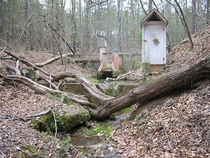
Image: Historic Weir 1.
This group is tagged with:
Biogeochemistry
Hydrology
Water Chemistry
Geochemistry / Mineralogy
Geophysics
GIS / Remote Sensing
Biology / Ecology
Soil Science / Pedology
-
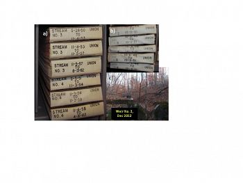
From the late 1940s to the early 1960s, precipitation and streamflow were measured by USFS scientists on three 10 to 15-ha catchments in the Calhoun Experimental Forest. After gathering more than 10 years of data, the USFS abruptly closed the Calhoun Experimental Forest but strip chart records were carefully archived by hydrologists at Coweeta Hydrologic Laboratory. These strip charts will be digitized and converted to flow rates and water volumes. Weirs, approach sections, and stilling wells will be restored and re-instrumented with float potentiometers, pressure transducers, and data loggers. Flow rates, response times, and flow volumes will provide evidence for how catchment hydrologic responses have evolved since the 1950s.
An advanced sampling plan will be developed for georeferenced collections of soil solids, soil water, and soil gases to efficiently map soil physical and chemical properties, soil lateral and vertical hydrologic fluxes, and dynamics of soil CO2 and O2.
Historic precipitation and streamflow records are being digitized to study recovery from erosion over six decades.
Historic precipitation and streamflow records are being digitized to study recovery from erosion over six decades.
-
Contacts
-
Calhoun, Christina, INVESTIGATOR
-
Calhoun, INVESTIGATOR
3 People
STAFF, Data Manager, Field Manager
.(JavaScript must be enabled to view this email address), 919-613-8703
Duke
ecology, natural history
GRAD STUDENT
.(JavaScript must be enabled to view this email address),
Duke
watershed hydrology, biogeochemistry
GRAD STUDENT
.(JavaScript must be enabled to view this email address)
DU Nicholas School
Soil Biogeochemistry and Hydrology
Alumni-Former
GRAD STUDENT
.(JavaScript must be enabled to view this email address)
Duke
environmental science, engineering
GRAD STUDENT
.(JavaScript must be enabled to view this email address)
hydrometeorology
-
Explore Further


