Lower White Clay Creek
This field area includes floodplain and tidal sites, as well as the USGS site near Newark, DE.
12 °C Temp
1145 mm Precip
Parent Field Area:
Christina River Basin ▲
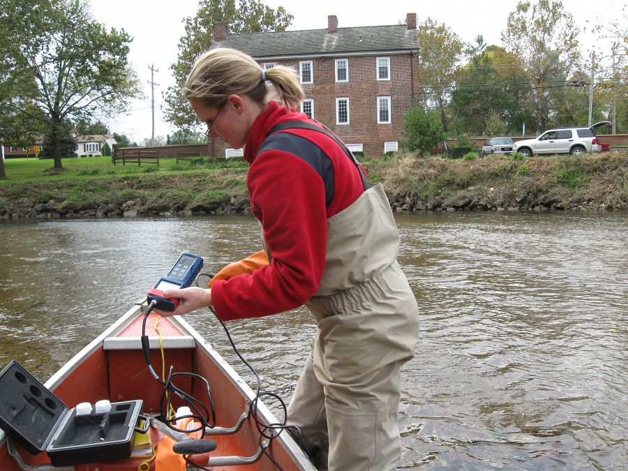
Audrey Sawyer (CRB-CZO Investigator) working in a tidal section of White Clay Creek just before it enters the Christina River above Wilmington, DE.
Lithology
metasediments
Biome
deciduous forest
Land Use
agricultural land, forest land, urban or built-up land
-
Setting & Research
.
-
Data
Christina River Basin - Stream Suspended Sediment (1993-2012)
20 components • Boulton Run, Christina River Basin, Forest Endmember: Spring Brook, White Clay Creek @ SWRC, Construction Endmember: White Clay Creek below landfill, Lower White Clay Creek, Agricultural Endmember: South Branch Doe Run • Water Chemistry, Geomorphology, Biogeochemistry, Hydrology, Geochemistry / Mineralogy • Aufdenkampe, A.K.; Newbold, J.D.; Anderson, B. A.; Richardson, D.; Damiano, S.G. -
Partner Organizations


-
Climate
12 °C Mean Annual Temp 1145 mm Mean Annual Precipitation There is an exceptionally long climate record for the Christina River Basin. Our figures are based on 115 years of NOAA data back to 1894 with at least one station per year having at least 360 days of non-missing records in the given year. Visit the climate tab for the Christina River Basin to view plots of climate data.
Explore Further
