Riparian Buffer Experiment @ Stroud Preserve/Georgia Farm
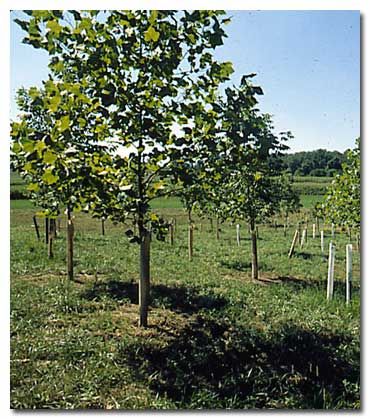
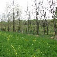
The Stroud Preserve riparian reforestation project is a demonstration of the three-zone Riparian Forest Buffer System (RFBS) developed by the U.S.D.A. Forest Service. Between 1992 and 2009, the project involved three experimental agricultural watersheds in the Stroud Preserve, a southeastern Pennsylvania farm protected by conservation easements.
12 °C Temp
1145 mm Precip
Parent Field Area:
Christina River Basin ▲
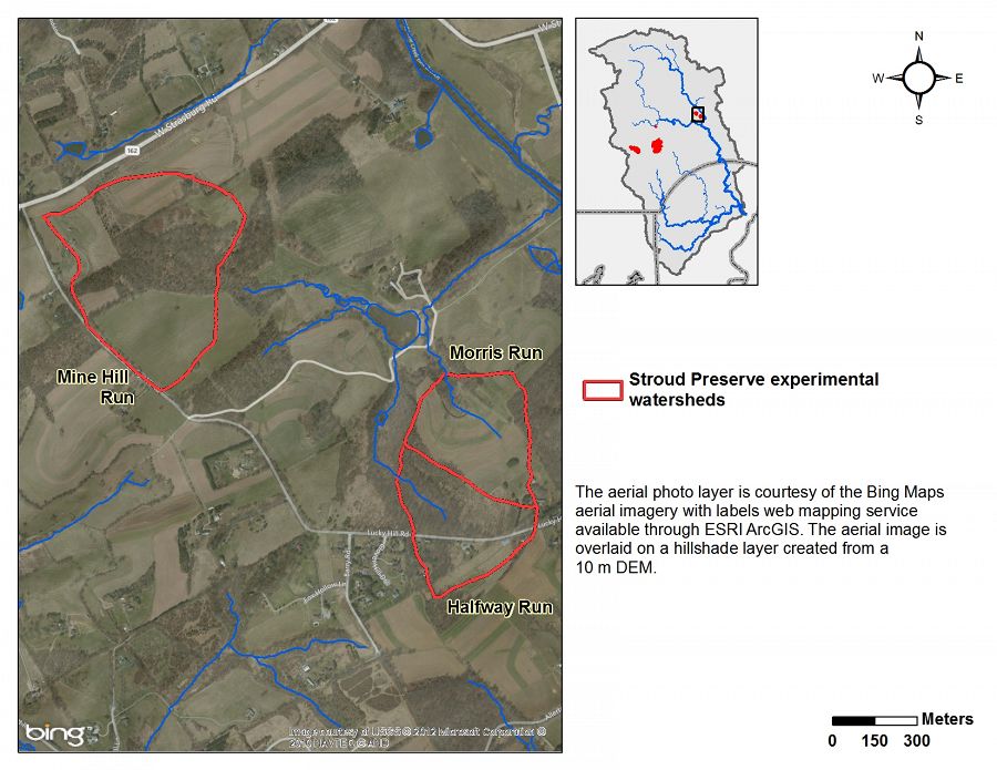
The reforested buffer surrounds the headwaters of Morris Run, in one of three experimental watersheds on the Stroud Preserve, near West Chester, Pennsylvania, USA.
Lithology
metasediments
Soil Order
Inceptisol, Ultisol
Biome
deciduous forest
Land Use
agricultural land, forest land, urban or built-up land
Areas within Riparian Buffer Experiment @ Stroud Preserve/Georgia Farm
-
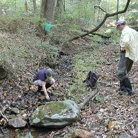
Setting & Research
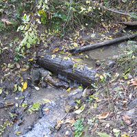
The streams are in the drainage of the Brandywine River, which flows into the Delaware Estuary. Prior to 1992, all three watersheds were primarily in crop production (maize, soybeans, hay) under a soil conservation plan including contouring and crop rotation. Water quality was compromised by elevated nutrients and suspended sediments. The primary objectives of the riparian reforestation project were to:
- Evaluate the non-point source reductions of the RFBS in the relatively high-relief terrain of the Mid-Atlantic Piedmont
- Assess the time required after reforestation to achieve significant mitigation
- Establish specific guidelines for planting and managing forest buffers zones in the mid-Atlantic region
Read the project brochure or the final report for the riparian buffer project.
Stroud Preserve Aerial Map
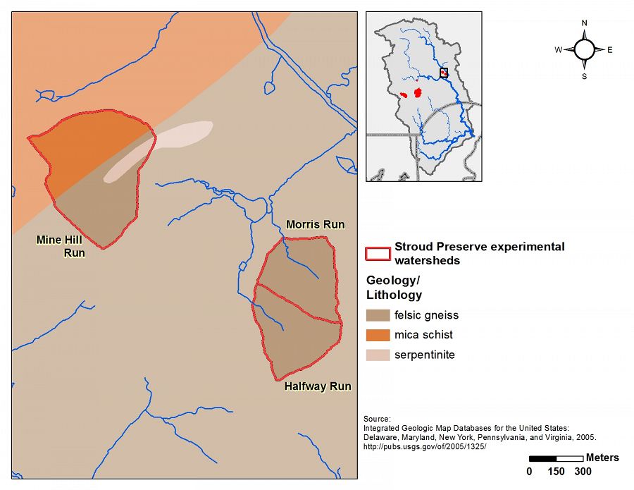
Stroud Preserve Geology
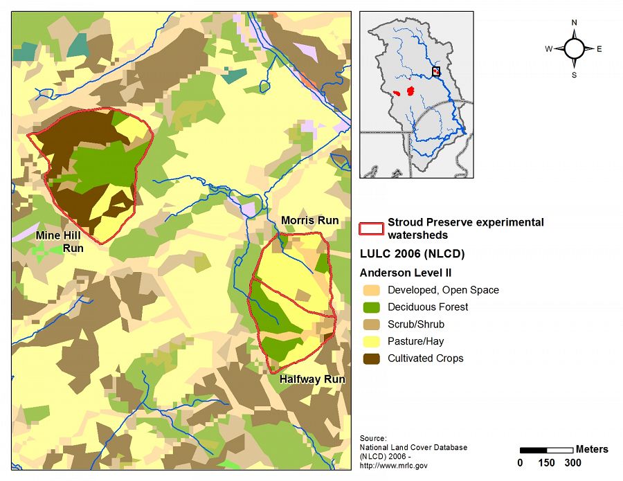
Stroud Preserve Land Use/Land Cover
Stroud Preserve Soils
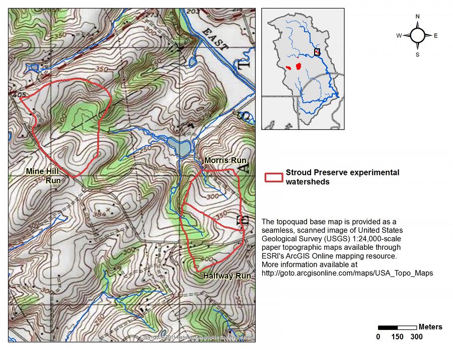
Stroud Preserve Topography
-
Overview Maps
Map Overlays
-
-
Dynamic Map
To fully zoom into a small area, you may need to visit the "Map" button and uncheck "Terrain" view.
-
Data
Christina River Basin - Stream Water Temperatures (2007-2014)
8 components • Christina River Basin, Halfway Run, Mine Hill Run, Morris Run, White Clay Creek @ SWRC, Forest Endmember: Spring Brook, Riparian Buffer Experiment @ Stroud Preserve/Georgia Farm • Water Chemistry • Sweeney, B.; Funk, D.; Newbold, J. D.; Kaplan, L. A.; Damiano, S. G.; Kline, F.; West, H. -
Partner Organizations


-
Geology
- metasediments

Stroud Preserve Geology
-
Topography
- m elevation
Elevation data are based on 10m DEM data from USGS National Elevation Data.
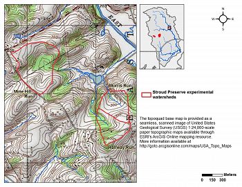
Stroud Preserve Topography
Mine Hill Run Elevation (m)
Min: 78; max: 119; mean: 98
Morris Run Elevation (m)
Min: 79; max: 116; mean: 96
Halfway Run Elevation (m)
Min: 87; max: 127; mean: 107
-
Climate
12 °C Mean Annual Temp 1145 mm Mean Annual Precipitation There is an exceptionally long climate record for the Christina River Basin. Our figures are based on 115 years of NOAA data back to 1894 with at least one station per year having at least 360 days of non-missing records in the given year. Visit the climate tab for the entire Christina River Basin to view plots of climate data.
-
Soil
- Inceptisol
- Ultisol
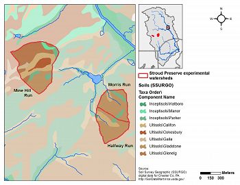
Stroud Preserve Soils
-
Human Impacts
- agricultural land
- forest land
- urban or built-up land
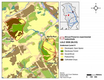
Stroud Preserve Land Use/Land Cover
Mine Hill Run Land Use/ Land Cover Types (Level I) Category % Developed, Open Space 2.0 Forest 28.1 Shrub/Scrub 7.0 Agriculture 62.9
Morris Run Land Use/ Land Cover Types (Level I)Category % Developed, Open Space 14.9 Forest 9.4 Shrub/Scrub 11.8 Agriculture 64.0
Halfway Run Land Use/ Land Cover Types (Level I)Category % Developed, Open Space 13.0 Forest 46.0 Shrub/Scrub 6.8 Agriculture 34.2 Land use/cover data from the National Land Cover Dataset for 2006.


Explore Further
