ARCHIVED CONTENT: In December 2020, the CZO program was succeeded by the Critical Zone Collaborative Network (CZ Net)
×
CCZO multi-layer geospatial pdf map updated!
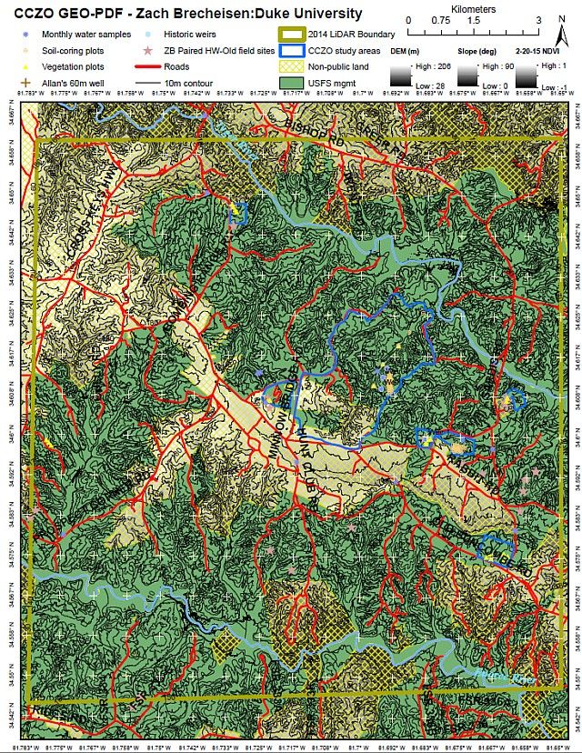
Zach has updated the map again!
See the link below to download version 3.0. Note that when you open this in Adobe Acrobat Reader, in the dark gray area on the left of the screen, the 3rd icon down allows you to show/hide whichever of the layers you'd like.
Some notes from Zach on notable improvements in the new version:
- Seamlined 1933 aerial photography mosaic raster layer
- Seamlined aerial mosaic transparent over slope map for "3D" 1933 image raster inspired by Mike Coughlan & Don Nelson
- Soil gas sampling locations as point features (most of my bore holes are located)
- My newly discovered & delineated reference hardwood watersheds as polygons
- Revision of CCZO "Research Area" designations in accordance with current/pending USFS permitting as polygons
- Much smaller file size! (~34mb)
See the link to the older news item for more about the map.
News Category:
INFRASTRUCTURE |
DATA

Explore Further
