Critical Zone Profile - ANDREW STUMPF (Quaternary geologist, senior investigator)
Through field studies and associated laboratory testing, Andrew Stumpf seeks to quantify the processes that have influenced Earth's surface. Using a variety of high-resolution geological, geophysical, hydrogeological, and geochemical methods, Stumpf creates conceptual and dynamic models that describe the evolution of landscapes. Recently, Stumpf has been collaborating with colleagues to determine the legacy of glaciated landscapes.
In an era of limited energy, mineral, and water resources, increasing population, and a changing climate, Andrew Stumpf’s research provides reliable, detailed information to address important societal issues, such as:
- Planning for sustainable land use
- Mitigating geohazards
- Locating new energy, water, and mineral resources
- Characterizing site conditions for urban and transportation infrastructure
- Protecting sensitive lands and waters
- Supporting local and regional economic development
“Throughout high school and then into university, I enjoyed learning about the physical geography of different regions of the world. The power of water and ice, subconsciously I guess, made such an impression that it led me to continue my career researching how these forces have shaped the places we live.” - Andrew Stumpf
I grew up in southwestern Ontario, Canada, in a landscape not unlike the U.S. Midwest. I was fortunate to live a couple of blocks from the edge of a city, so a short walk led to the undisturbed and tranquil environment of rural areas. Traveling frequently to visit relatives near Toronto, I gained a grand appreciation for the unique, glaciated landscape found in the Great Lakes region. I have been extremely lucky to engage in research at different sites throughout North America and overseas, ranging from the so-called “flat lands” of the U.S. to locales in the coastal mountains of British Columbia.
Because many sites I have worked at required multiple visits over several years, changes to the landscapes are very evident, even between subsequent field seasons. Landscapes are complex and active systems that respond to external forces at various scales. Human impacts, whether direct or subsidiary, alter the systems—leading them down a certain pathway. For example, at field sites in Illinois within the Intensively Managed Landscapes CZO, I have noticed changes from year to year, especially on land farmed for corn and soybeans. Runoff during extreme weather events moves large amounts of sediment and organic debris across the landscape. Landscapes covered by native prairie grasses and forbs are much more stable than those covered by invasive species or planted in cover crops, and hark back to a time before the land was drained and cultivated.
To fully identify and comprehend all the interconnections between landscapes and their surroundings, geologists and other geoscientists probe the earth to determine the type of base material, its physical and chemical properties, and the overall history of its formation. Whether the landscape is covered by intact rock, regolith (soil), or secondary materials (e.g., glacial till) derived by erosion or other weathering processes, these materials form the structure that underpins the hydrology, chemistry, and biology of the terrestrial ecosystem.
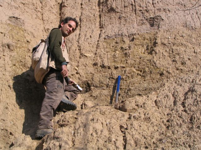
Taking a sample of glacial outwash for Optical Stimulated Luminescence dating. This information will help build a chronology of glacial advances for the last (Wisconsinan) glaciation.
The most notable trend or observation I see across all landscapes that I have worked at is that they go through cycles of erosion and deposition that do not always depend on external forcings, climate, biology, and human disturbance. I get the sense that larger-scale geomorphic conditions overprint the local conditions. For example, banks along a stream may erode for several years, but over time become stable again as a new equilibrium is reached. This process appears to be only partially in sync with changes in stream water level.
For example, glaciers and their associated meltwater preferentially “condition” a landscape’s topography by strongly influencing the organization of processes and landforms, which continually adjust over time to eventually be in equilibrium. In other words, glaciation leads to predictable spatial patterns on the landscape—creating a hydrologic and geomorphic template that constrains the expression of future changes. The legacy set at the time of glacial retreat is ultimately a cause of these spatial patterns, which in turn affect the landscape’s physical, chemical, and biological systems.
Detailed study of the critical zone is essential to quantify fluxes of water, energy, and sediment occurring today and throughout geologic time. Without this information, it is difficult to model the landscape’s spatial heterogeneities and temporal variations and to understand the interactions and feedback among chemical, physical, and biological processes—which exert both positive and negative feedback on landscapes.
CZO scientists compile essential data sets that are necessary to test predictive models developed within the CZO network and by external partners. There is a great need globally to develop efficient and sustainable land-use plans. Being able to model hydrologic, ecological, geochemical, and geomorphic processes from the nano- to watershed-scales is a challenge that the CZO scientists are well-equipped to undertake.
“Throughout my career I have been amazed by the level of interest stakeholders and the general public have in my research. They are continually looking for reliable factual information to better understand how the physical environment around them came to be.”
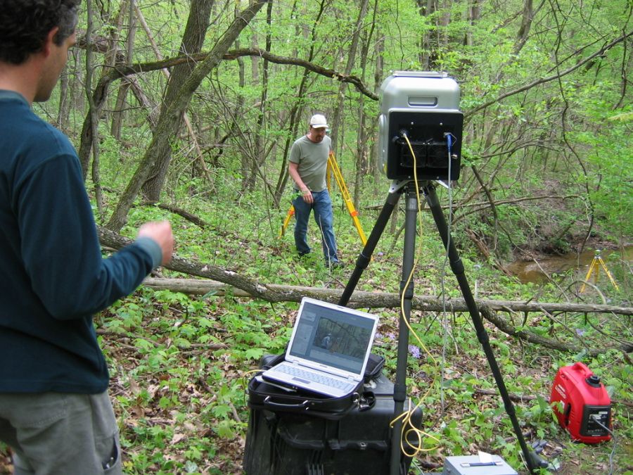
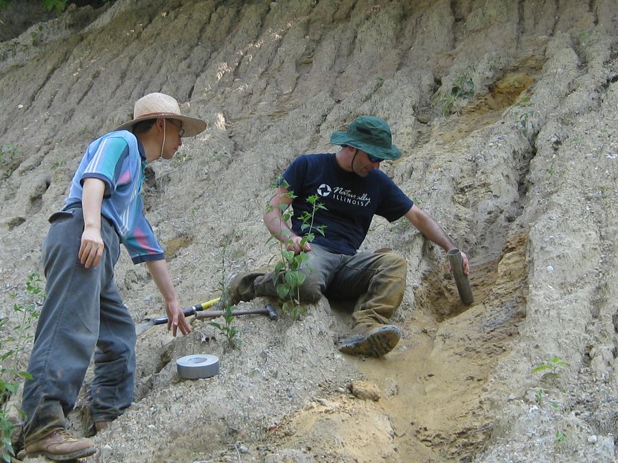
Mapping the elevation of Holocene stream terraces using a terrestrial lidar scanner. Photo by Chris Stohr.
The CZO network provides opportunities to collaborate within a community of researchers with unique expertise and overlapping goals. Utilizing a common infrastructure and set of methods improves the network’s efficiency and maintains a comparable database of measurements. The CZO program also maintains a social media presence, which helps to publicize potential sources of funding and collaboration opportunities and provides a platform to disperse innovative scientific results. I think there is also great potential to use social media (Twitter, Facebook, YouTube, etc.) to disseminate certain types of information to the public, especially when important results need to be communicated quickly.
A key to elevating the CZO Program at the national level is building a larger stakeholder network. Traditionally, we have sought partnerships with policymakers and funding programs that are connected with our science themes. We will need to broaden our collaboration to larger and more diverse communities. This could include the financial and insurance sectors, which have significant control over and oversight of natural and managed landscapes.
:: By Linda Copman, staff writer ::
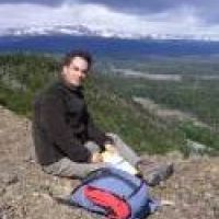
Andrew Stumpf
Taking a sample of glacial outwash for Optical Stimulated Luminescence dating. This information will help build a chronology of glacial advances for the last (Wisconsinan) glaciation.
Mapping the elevation of Holocene stream terraces using a terrestrial lidar scanner. Photo by Chris Stohr.


Related News
Explore Further
