ARCHIVED CONTENT: In December 2020, the CZO program was succeeded by the Critical Zone Collaborative Network (CZ Net)
×
Holcombe’s Branch floodplain profiles
Dan Richter has been excavating soils profiles up and down the banks of Holcombe's Branch in the Calhoun historic watersheds area, which will help to tease apart the effects of the land use history on the soils along the floodplain below.
News Category:
RESEARCH |
INFRASTRUCTURE
Photos
Holcombe’s Branch
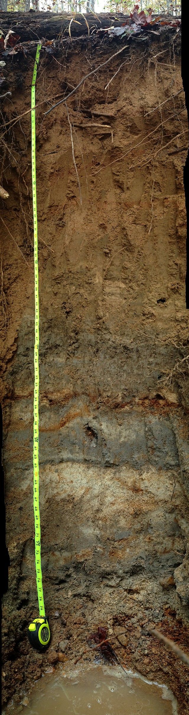
Holcombe's Branch floodplain profile >6' with approximately a meter of historic sediment from farming in the Piedmont of South Carolina, 1780s to present. Note the striking redox activity of the lower profile. Excavated by Dan Richter, who took this panoramic photograph on 5 November 2015.
Photographs from the Holcombe's Branch watersheds.

Explore Further
