K-12 Activity: Humans and Soil Change
The CZOs have been cooperating with the American Geosciences Institute (AGI) since 2013 to create hands-on learning exercises using CZO data for use in secondary education classrooms. The one-page, double-sided exercises have been included in AGI's Earth Sciences Week packets and sent to 10,000 teachers nationwide.
For 2020's AGI Earth Sciences Week, a new exercise, "Humans and Soil Change” has been created by Katherine O’Neill of Roanoke College and the Calhoun CZO. The activity familiarizes students with some of the environmental and human factors that contribute to accelerated rates of soil erosion, using the southern Piedmont as a case study.
View the 2-page PDF version of the activity here.
Supplemental information for this activity:
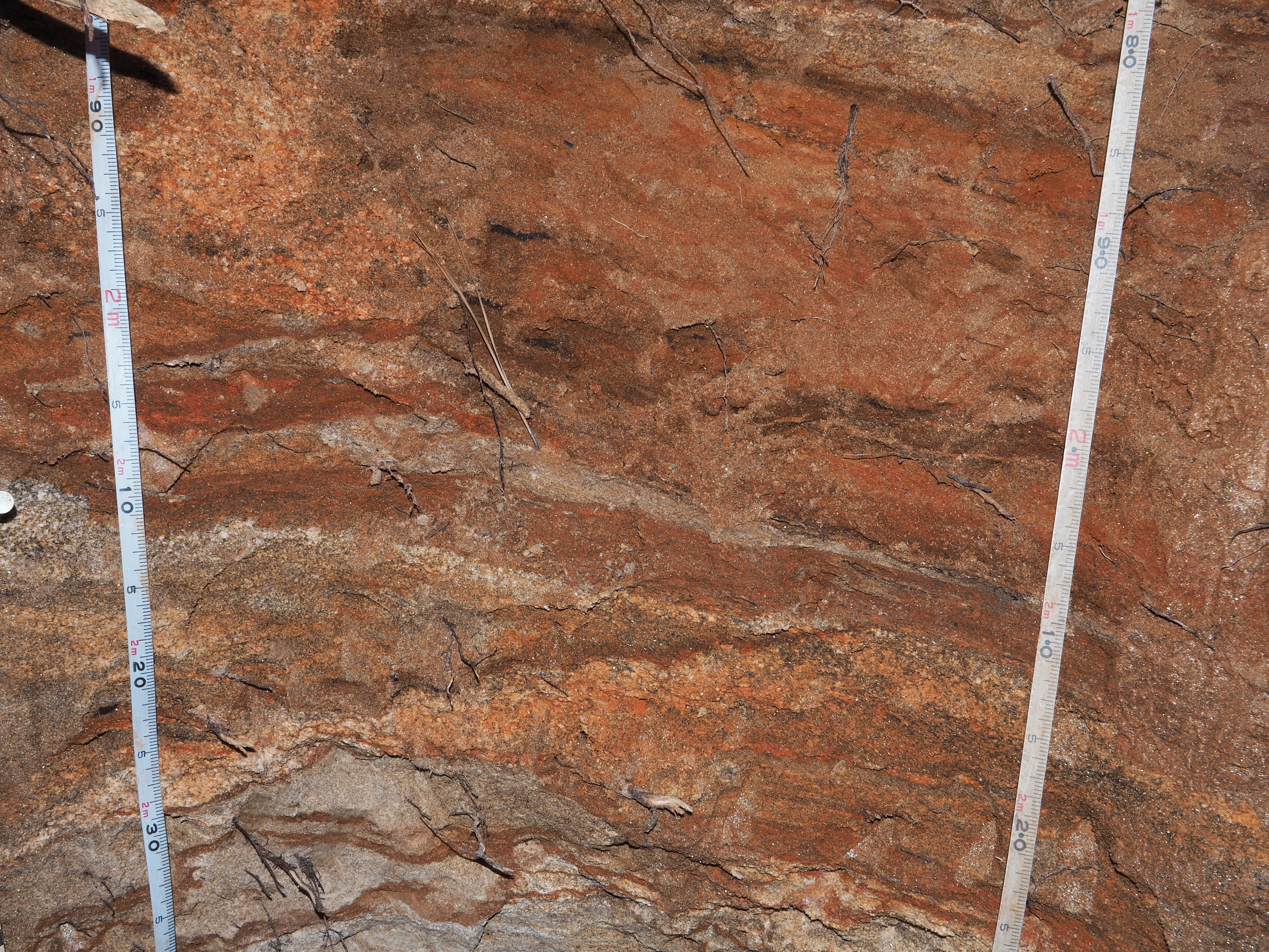
3. Examine soil profiles A and B
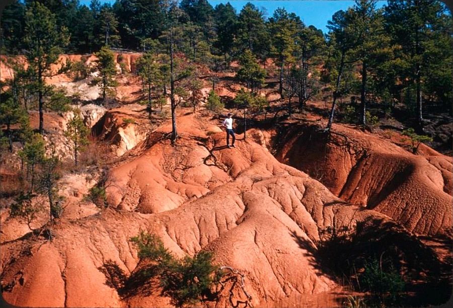
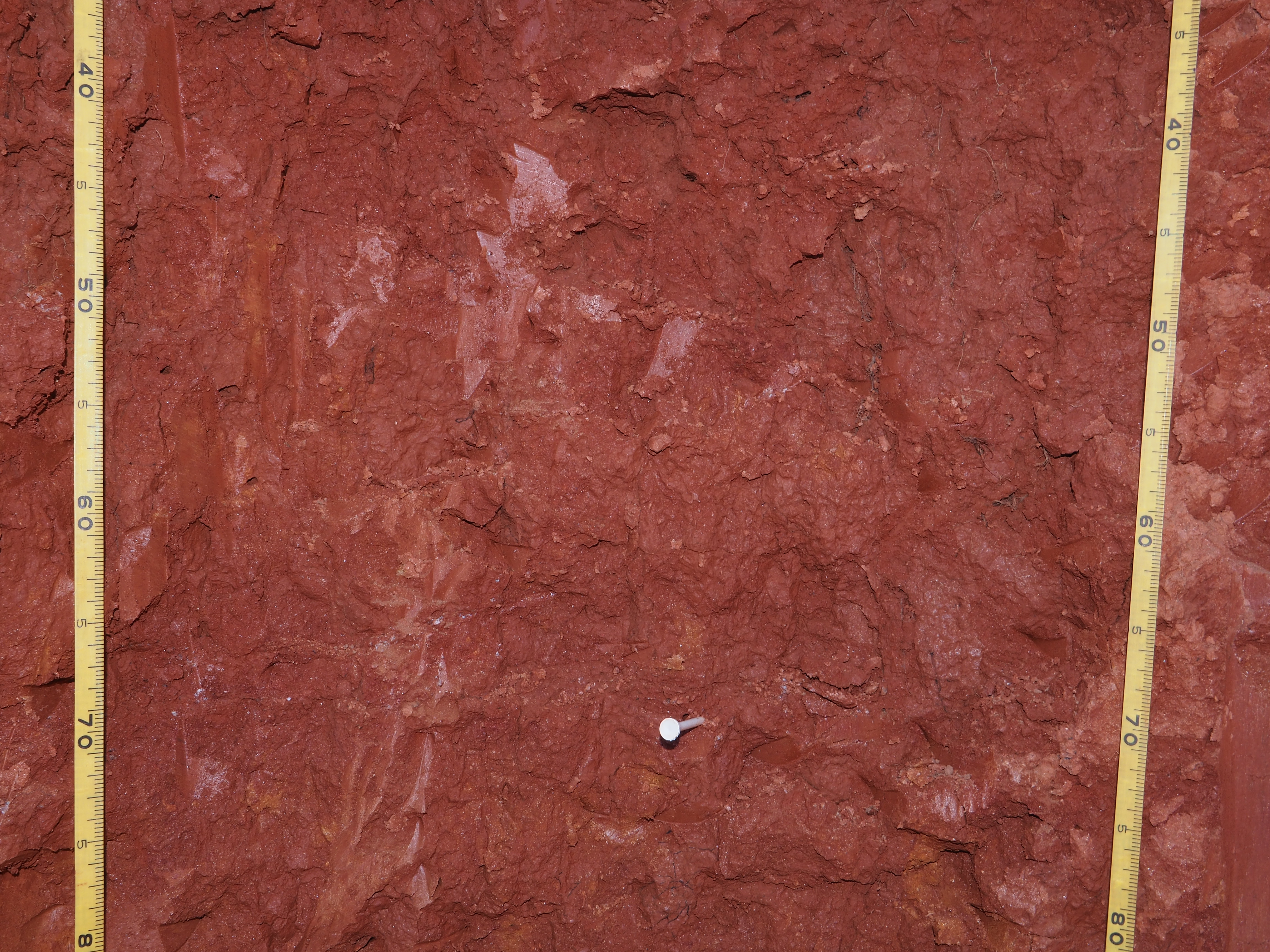
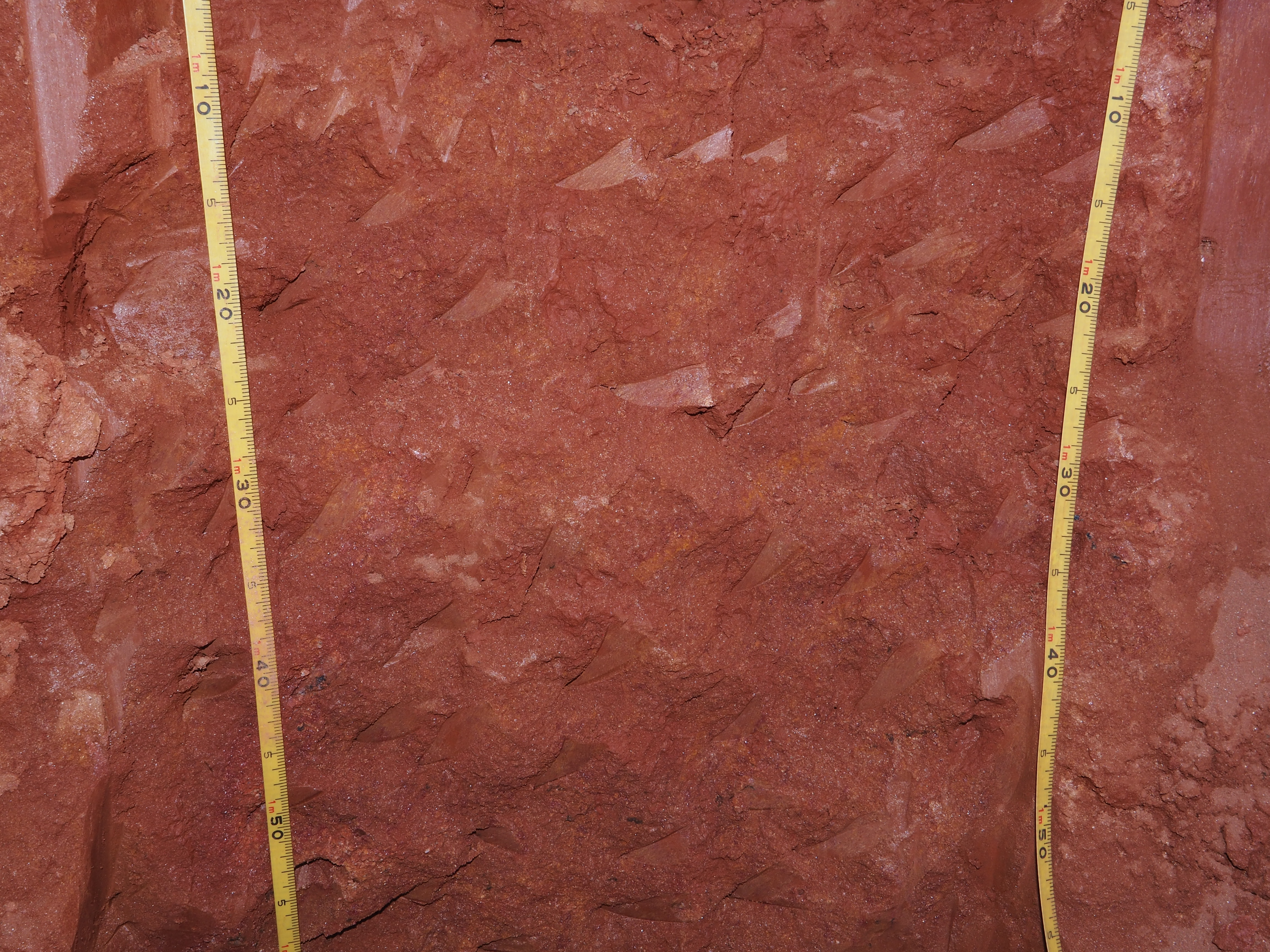
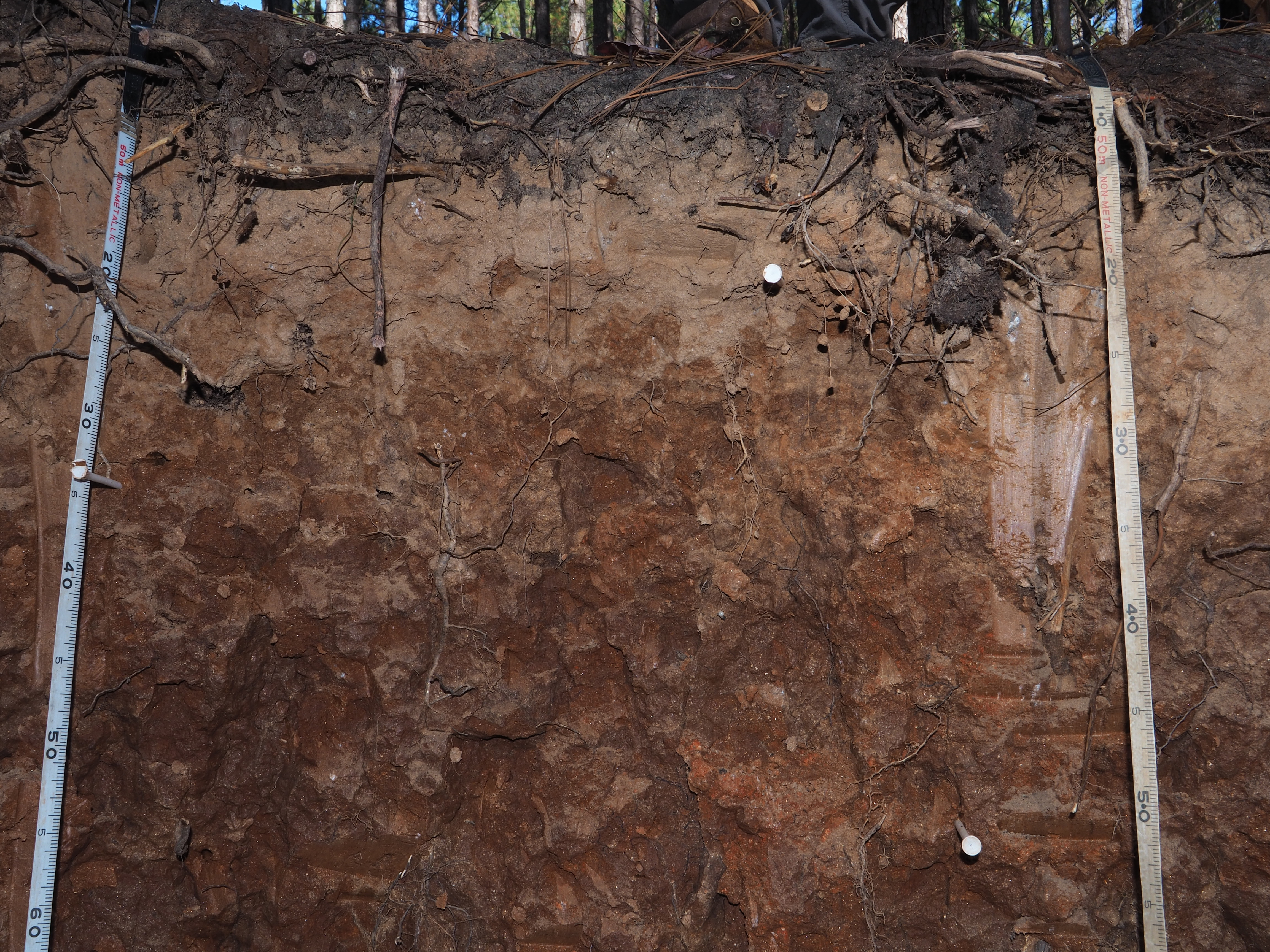
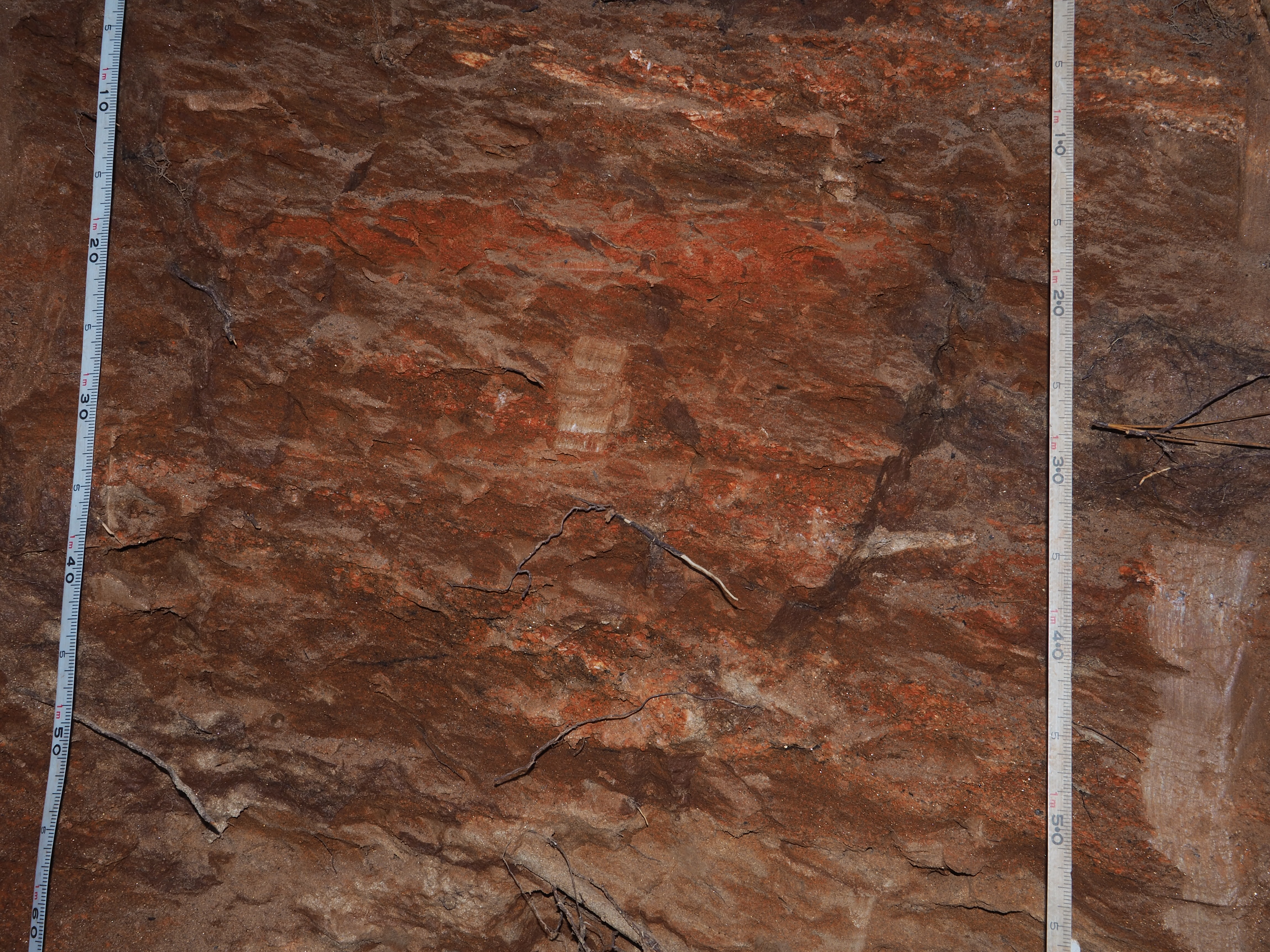
The soils at the CCZO are ancient, deep, and highly weathered. The darker colors at the surface indicate higher levels of soil organic matter, which is important in storing plant nutrients. Which parts of the soil profile are most impacted by erosion? What effect might this have on the future ability of the soil to store nutrients and grow plants?
For a more in-depth look at each, view each of the profiles' soil horizons.
- Soil Profile A: This profile is found under a forested area at the Calhoun CZO.
Profile A Horizons: A | B | C | D | E
- Soil Profile B: This profile is found under an agricultural area at the Calhoun CZO.
Profile B Horizons: A | B | C | D | E | F
Note: Links are to high resolution photos and may take a minute to load.
Additional information on soils:
- K-12 resources on soil horizons: https://www.soils4teachers.org/soil-horizons/
- Additional soil profile images from the Calhoun CZO at https://nicholas.duke.edu/cczo/soilpits/soil-pit-profiles-2016.html
Images from activity:
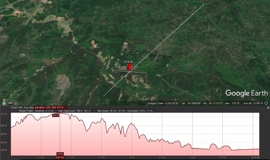
Figure 1. Land cover and elevation profile along a transect at the CCZO.
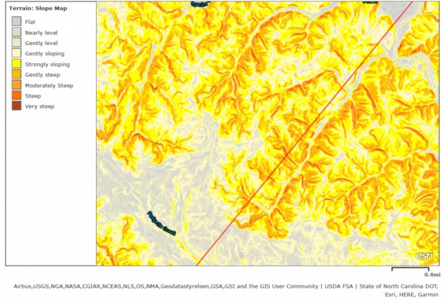
Figure 2. Slope along a transect at the CCZO. The lines in Figs 1 and 2 may be used as references.
Figure 1. Land cover and elevation profile along a transect at the CCZO.
Figure 2. Slope along a transect at the CCZO. The lines in Figs 1 and 2 may be used as references.
News Category:
EDUCATION/OUTREACH
People Involved
CZO
-

Calhoun, INVESTIGATOR
-

Calhoun, INVESTIGATOR
-

National, STAFF
Explore Further
