Stakeholders & Resource Managers
The Reynolds Creek Experimental Watershed is a “working” as opposed to a pristine, watershed. Most of the land in the watershed (77%) is owned by either the state or federal government, and, in this case, managed by the Bureau of Land Management (BLM). The remaining, privately held land is managed by local ranchers, who live in or adjacent to the watershed and derive their livelihood from cattle ranching. In addition to cattle grazing, a small part of the valley is used to raise hay and there is some timber harvesting.
The USDA ARS Northwest Watershed Research Center (NWRC) holds regular stakeholder meetings with owners and BLM to communicate activities and has undertaken a prescribed fire management program in cooperation with the Bureau of Land Management (BLM).
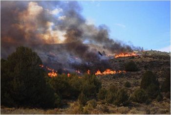
Prescribed fires in Reynolds Creek Experimental Watershed as part of current land management practices to reduce juniper
USDA ARS Northwest Watershed Research Center (NWRC)
The mission of the NWRC is to provide knowledge and technology for management of semi-arid rangeland watersheds; to quantitatively describe the hydrologic processes and interactive influences of climate, soils, vegetation, topography, and management on rangeland systems; to develop information, simulation models, and tools that can be used by action agencies and producers in determining optimum management strategies; and to maintain long-term databases for scientific applications. Because much of the land is private and public land (BLM), the NWRC holds regular stakeholder meetings to communicate and discuss activities and identify new areas of research activities that might affect different stakeholders.
Fire and the Prescribed Fire Program
Fire frequency and extent are increasing in the Western US with changes in climate (Westerling et al., 2006) and vegetation (introduced species such as Bromus tectorum (cheatgrass) (Allen et al., 2011). Use of prescribed fire as a management practice has emerged as a tool to control fuel loads (McIver et al., 2010). The Northwest Watershed Research Center (NWRC) has undertaken a prescribed fire management program in cooperation with the Bureau of Land Management (BLM). The Northwest Watershed Research Center (NWRC) selects sites, conducts experiments and monitors and evaluates fire effects, while the BLM assists in site selection and conducts the fires. The primary ecohydrological criteria for site selection is that precipitation be sufficient such that invasive species such as cheatgrass, and yellow star thistle do not expand as a result of the fire. To date, three fires (2002, 2004 and 2007) have been conducted in the RCEW. The next fire is scheduled for 2015. The temporal sequence of past fires and the ability to participate in the planning of future fires provides an opportunity for research into the effects of fire on soil carbon.
News
FEATURED
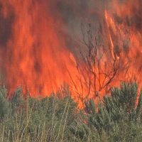
“Voices of Fire,” a documentary film about wildfire in the West, is now available on YouTube!
05 Sep 2017 - Hugo Sindelar's documentary film about the Soda Fire, which burned the northern portion of Reynolds Creek and a total of 280,000 acres in just 7 days.

FEATURED
Voices of Fire - A Documentary Video
12 Feb 2016 - "Voices of Fire" follows the devastating effects of the Soda Fire on the economy, ecology, and landscape in southwestern Idaho.
FEATURED
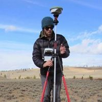
Understanding Vegetation-Snow Interactions and Critical Zone Sensitivity to Climate Change
01 Apr 2015 - Chris Tennant, Idaho State University, was awarded a NSF SAVI (Science Across Virtual Institutes) grant for cross-CZO research.
Water Resources Research Special Collection: Concentration-discharge relations in the critical zone
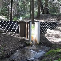
30 Oct 2017 - Water Resources Research published a new special collection in September 2017 featuring concentration-discharge research from multiple CZOs.
2017 CZO Webinar Series: Critical Zone and Society
06 Apr 2017 - 2017 CZO Webinar Series: Critical Zone and Society.
Explore Further
