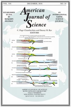
Sullivan et al., 2016
Oxidative Dissolution under the Channel Leads Geomorphological Evolution at the Shale Hills Catchment
Sullivan, P.L., Hynek, S., Gu, X., Singha, K., White, T.S., West, N., Kim, H., Kirby, E., Clarke, B.; Duffy, C.; Brantley, S.L. (2016)
American Journal of Science, 316 (10): 981-1026
-
Calhoun, Shale Hills, INVESTIGATOR, COLLABORATOR
-
Luquillo, Shale Hills, INVESTIGATOR
-
Boulder, Shale Hills, INVESTIGATOR
-
National, Shale Hills, INVESTIGATOR, STAFF
-
Shale Hills, INVESTIGATOR, COLLABORATOR
-
Luquillo, Shale Hills, INVESTIGATOR
-
Shale Hills, INVESTIGATOR
-
Shale Hills, INVESTIGATOR
-
Shale Hills, INVESTIGATOR
-
National, Eel, Luquillo, Shale Hills, INVESTIGATOR, COLLABORATOR
Abstract
The hydrologic connectivity between hillslopes and streams impacts the geomorphological evolution of catchments. Here, we propose a conceptual model for hydrogeomorphological evolution of the Susquehanna Shale Hills Critical Zone Observatory (SSHCZO), a first-order catchment developed on shale in central Pennsylvania, U.S.A. At SSHCZO, the majority of available water (the difference between incoming meteoric water and outgoing evapotranspiration) flows laterally to the catchment outlet as interflow, while the rest is transported by regional groundwater flow. Interflow, shallow hillslope flow, is limited to the upper 5 to 8 m of highly fractured bedrock, thought to have formed during periglacial conditions in the late Pleistocene. In contrast, groundwater flowpaths are influenced by the primary permeability of the varying stratigraphic units. Both flowpaths respond to weathering-related secondary permeability. O2-rich interflow mixes with deep O2-poor groundwater under the catchment outlet at depths of 5–8 m. Penetration of this oxygenated interflow under the valley results in pyrite oxidation, release of sulfuric acid, dissolution of minerals, and weakening of bedrock. This is hypothesized to enhance channel incision and, in turn, to promote drainage of deep groundwater from the ridges. Drainage subsequently lowers the catchment water table, advancing the cascade of reactions that produce regolith. Weathering in the catchment is characterized by both sharp and diffuse reaction fronts. Relatively sharp fronts (pyrite, carbonate) mark where vertical, unsaturated flow changes to horizontal, saturated flow, while diffuse fronts (illite, chlorite, feldspar) mark where flow is largely vertical and unsaturated. According to this model, catchment morphology reflects subsurface pyrite reactions due to mixing of interflow and groundwater flow under the valley floor that ultimately results in clay weathering and regolith production nearer the land surface.
Citation
Sullivan, P.L., Hynek, S., Gu, X., Singha, K., White, T.S., West, N., Kim, H., Kirby, E., Clarke, B.; Duffy, C.; Brantley, S.L. (2016): Oxidative Dissolution under the Channel Leads Geomorphological Evolution at the Shale Hills Catchment . American Journal of Science, 316 (10): 981-1026. DOI: 10.2475/10.2016.02
 This Paper/Book acknowledges NSF CZO grant support.
Explore Further


