Critical Zone Profile - JOANMARIE DEL VECCHIO (geomorphologist, graduate student)
Joanmarie Del Vecchio was preparing to attend law school when she took her first weekend-long geology field trip, camped out under the stars in the Mojave Desert and realized her true calling. She received a B.A. in Geology from Pomona College in Claremont, California, investigating soil formation and tectonic geomorphology in the eastern San Gabriel Mountains. Since July 2015, she has been an M.S. student at the Pennsylvania State University working at the Susquehanna Shale Hills Critical Zone Observatory (CZO), advised by associate professor Roman DiBiase. Even when she is not explicitly being instructed to study them, she is hiking mountains and paddling rivers.

Joanmarie Del Vecchio, Penn State
Joanmarie Del Vecchio, Penn State
"My goal is to understand how erosion and hydrology differed during the cold, glaciated periods this landscape was exposed to." - Joanmarie Del Vecchio
As a geomorphologist, I study the processes occurring within the Critical Zone (CZ) on various timescales. The Shale Hills CZO, located in the Valley Ridge Province of central Pennsylvania, has been exposed to number of glacial and interglacial cycles. Here, the conversion of bedrock into mobile soil occurs slowly enough that the observed modern surface and shallow subsurface show the product of these climate cycles. My goal is to understand how erosion and hydrology differed during the cold, glaciated periods this landscape was exposed to.
To study how ice-driven erosion affected rates and patterns of landscape evolution, we look at two rock types within the CZO– shale and quartzite. It is most likely that the iconic boulder fields dotting the ridges of central Pennsylvania were formed by the fracturing and transport of rock by ice and frost. We are looking to clarify how factors, such as water availability and aspect, control the rates and patterns of these processes. We can then compare these rates to fluxes in the modern temperate environment to better understand the relative importance of climate fluctuations in the evolution of landscapes that have undergone significant cooling.
A longstanding question in geomorphology is whether climate or tectonics controls landscape form. Geologists need to isolate the mechanisms dictating how changes in climate impact erosion and sediment transport. Some researchers use sedimentary records on floodplains and in oceans to see trends and connect them to climate change. However, climate signals might get lost as sediments travel from erosional sources to depositional sinks. Also, younger sedimentary records might over- or under-estimate the frequency and size of important geomorphic processes, so we have to study sedimentary records that span many years of climate changes with short paths from source to sink. Studying the connection between climate and erosion will help us understand how landscapes respond to rapid changes in climate, like we are seeing in this century. Such a framework provides information to model and predict the possible size and severity of natural disasters with a changing climate.
Earth science and social science are linked by our use of the natural world, and the CZO network attempts to strengthen that link.
Geomorphologists join a multidisciplinary team of scientists across the CZO network to monitor and model basic Earth surface processes both past and present. This effort to understand how resilient a landscape can be to various natural and anthropogenic perturbations is vital to the preservation of natural resources like soil and water. CZ science is important for geomorphologists because we are often concerned with how climate or tectonics impact processes like erosion and stream incision. CZOs allow geomorphologists to study the CZ in real time, helping to interpret data over multiple spatial or temporal timescales.
As a Masters student, it is an incredible opportunity to be involved with the CZO network. The wealth of data and infrastructure available to me has allowed me to jump right into doing interesting work. The ability to confer with an interdisciplinary team of scientists at the Shale Hills CZO and geomorphologists within the network is invaluable for making sense of my results. The CZO framework allows me to incorporate different methods and datasets to answer my science questions. It also provides a great networking and career-building opportunity by meeting other CZO scientists at workshops and conferences.
CZ scientists are constantly working to better understand the timescales of processes altering Earth’s surface. If we can quantify rates and magnitudes of processes in our soil, air, and water; we can better predict how quickly each piece will respond when forced to adapt to climate or land use change. In this way, the CZO network of scientists can better inform policy decisions surrounding topics like water quality and agricultural practices. Earth science and social science are linked by our use of the natural world, and the CZO network attempts to strengthen that link.
Joanmarie Del Vecchio, Penn State
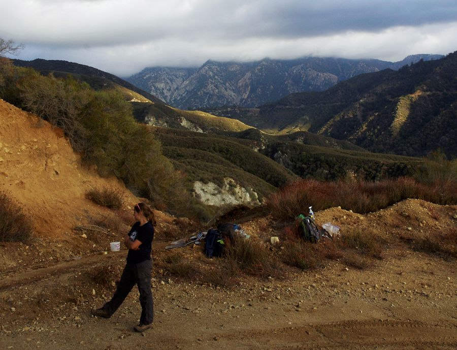
Pondering the CZ.
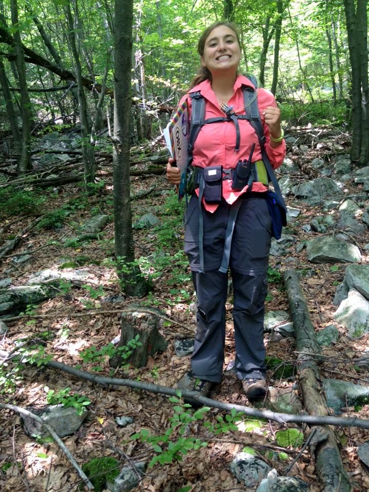
Joanmarie mapping boulders at the sandstone catchment, Garner Run of the Shale Hills CZO
News Category:
PEOPLE
Related News
Joanmarie Del Vecchio receives GSA Quaternary Geology and Geomorphology Division Research Award
01 Jul 2016 - Joanmarie Del Vecchio, M.S. candidate in Geosciences, has been awarded the 2016 GSA Quaternary Geology and Geomorphology Division Research...
Critical Zone Profiles - Meet the people doing CZO science
27 Mar 2016 - Get a sense of the people and the work. See links to 35+ individual profiles across the network.

Explore Further
