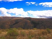
How thick is the skin of the earth?
26 Aug 2018
News Source: Idaho State University
A team of Idaho State University researchers working at the Reynolds Creek Critical Zone Observatory in partnership with the USDA Agricultural Research Service has discovered a simple method for predicting the spatial distribution of soil thickness across a landscape.
Until now, it has been a large unknown because there were no good, inexpensive ways to estimate soil thickness accurately and economically across a landscape. Other methods are computationally intensive, analytically expensive, or literally backbreaking so that they are limited in scope. This method allows prediction of soil thickness anywhere with just LiDAR data – fine resolution topographic data – and as few as one soil pit.
News Source:
READ MORE from Idaho State University >>
News Category:
RESEARCH
Publications
2018
Predicting soil thickness on soil mantled hillslopes. Patton, N.P., Lohse, K.A., S.E. Godsey, Crosby, B.T., and Seyfried, M. (2018): Nature Communications 9: 3329
Explore Further

