Yu & Rhoads, 2018
Floodplains as a Source of Fine Sediment in Grazed Landscapes: Tracing the Source of Suspended Sediment in the Headwaters of a Intensively Managed Agricultural Landscape
Yu, M. and Rhoads, B.L. (2018)
Geomorphology
-

IML, GRAD STUDENT
-

IML, INVESTIGATOR
Abstract
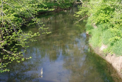
Deployment of tube sampler (white tube near bottom of photo) within the Sangamon River at the outlet of the Saybrook watershed.
The flux of fine sediment within agricultural watersheds is an important factor determining the environmental quality of streams and rivers. Despite this importance, the contributions of sediment sources to suspended sediment loads within intensively managed agricultural watersheds remain poorly understood. This study assesses the provenance of fine suspended sediment in the headwater portion of a river flowing through an agricultural landscape in Illinois. Sediment source samples were collected from five sources: croplands, forested floodplains, grasslands, upper grazed floodplains, and lower grazed floodplains. Event-based and aggregated suspended sediment samples were collected from the stream at the watershed outlet. Quantitative geochemical fingerprinting techniques and a mixing model were employed to estimate the relative contributions of sediment from the five sources to the suspended sediment loads. To account for possible effects of small sample sizes, the analysis was repeated with only two sources: grazed floodplains and croplands/grasslands/forested floodplains. Results based on mean values of tracers indicate that the vast majority of suspended sediment within the stream (>95%) is derived from erosion of channel banks and the soil surface within areas of grazed floodplains. Uncertainty analysis based on Monte Carlo simulations indicates that mean values of tracer properties, which do not account for sampling variability in these properties, probably overestimate contributions from the two major sources. Nevertheless, this analysis still supports the conclusion that floodplain erosion accounts for the largest percentage of instream sediment (≈55–75%). Although grazing occurs over only a small portion of the total watershed area, grazed floodplains, which lie in close proximity to the stream channel, are an important source of sediment in this headwater steam system. Efforts to reduce fluxes of fine sediment in this intensively managed landscape should focus on eroding floodplain surfaces and channel banks within heavily grazed reaches of the stream.
Citation
Yu, M. and Rhoads, B.L. (2018): Floodplains as a Source of Fine Sediment in Grazed Landscapes: Tracing the Source of Suspended Sediment in the Headwaters of a Intensively Managed Agricultural Landscape. Geomorphology. DOI: doi.org/10.1016/j.geomorph.2018.01.022
 This Paper/Book acknowledges NSF CZO grant support.
Explore Further
