Catchment characteristics to be modeled by Laura Clemente-Harding, PhD student Geography

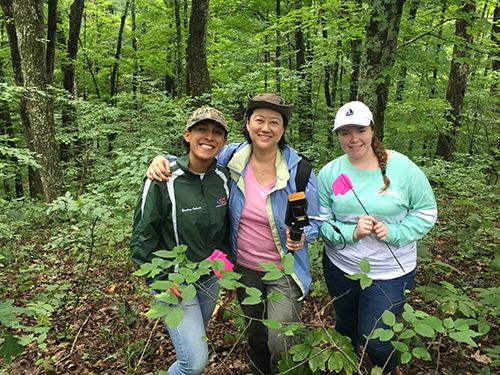
Over three days in the Shale Hills catchment, Clemente-Harding along with her colleagues at the Geospatial Research Laboratory Engineer Research and Development Center, an intense data collection campaign was completed. The group included two summer interns (from Northern Virginia Community College and from the University of Puerto Rico, Mayagüez) plus five additional scientists who captured leaf area index (LAI) measurements, collected soil cores for chemical analyses, utilized lidar mapping via Leica C10 (tripod mounted) and Geoslam Zeb Revo (hand-held backpack) techniques, and measured soil water content using time-domain reflectometry (TDR) within the Cosmic-ray Soil Moisture Observing System (COSMOS) footprint. Field measurements will be correlated with Cosmic Ray Neutron Probe soil moisture data and satellite imagery to model estimates of soil moisture and vegetation biomass. The team aims to develop and test models a priori that utilize remote sensing to predict landscape characteristics.
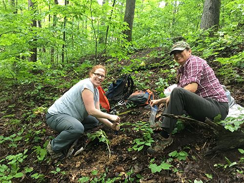
Collecting shallow soil cores for soil moisture and chemical analysis.
Team using the GeoSlam hand-held LiDAR.
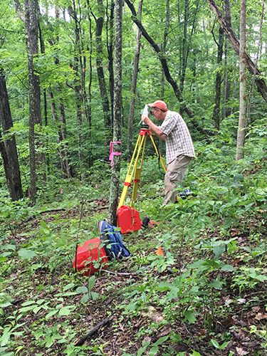
Leica C10 (tripod mounted) LIDAR.
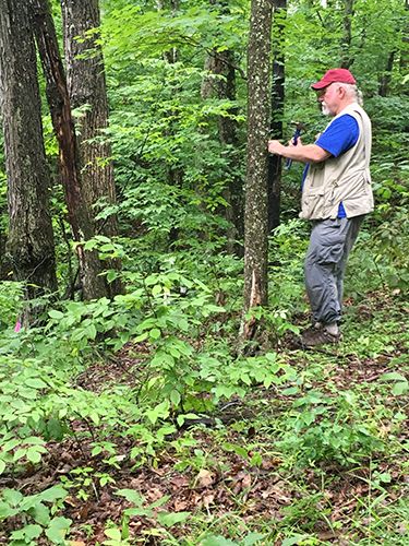
Tree survey to compliment microtopography measurements.
News Category:
RESEARCH |
EDUCATION/OUTREACH
Discipline Tags and CZOs
Modeling / Computational Science
Hydrology
GIS / Remote Sensing
Geochemistry / Mineralogy
Shale Hills
Explore Further
