Wales, UK
The Wales transect site is located near Llanidloes, Wales, United Kingdom. The sampling site is within the Hafren Forest at an elevation of 1352 ft. The forest is a 4,000 ha area actively logged by the Forestry Commission and used for recreation. Historical uses include copper and lead mining and sheep grazing in some parts of the watershed. The source of the River Severn, which terminates near Bristol, UK, is found at the top of the watershed, not far from Pumlumon, the highest mountain in mid-Wales. The watershed has been extensively monitored by the Centre for Ecology and Hydrology for 40 years and is commonly referred to as Plynlimon. Sitka Spruce is the dominant vegetation and the underlying shale is called the Gwestyn Formation, which is equivalent to the Rose Hill Shale but has undergone some regional metamorphism. The climate is cold and very wet, with 60% of rain falling between October and March; air frost has been recorded in every month. Mean annual precipitation is 250 cm and mean annual temperature is 7.2 °C.
7.2 °C Temp
2500 mm Precip
Parent Field Area:
Shale Transect ▲
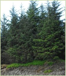
Sitka Spruce is the dominant vegetation and the underlying shale is called the Gwestyn Formation.
-
Setting & Research
The Wales transect site is located near Llanidloes, Wales, United Kingdom. The sampling site is within the Hafren Forest at an elevation of 1352 ft. The forest is a 4,000 ha area actively logged by the Forestry Commission and used for recreation. Historical uses include copper and lead mining and sheep grazing in some parts of the watershed.
The source of the River Severn, which terminates near Bristol, UK, is found at the top of the watershed, not far from Pumlumon, the highest mountain in mid-Wales. The watershed has been extensively monitored by the Centre for Ecology and Hydrology for 40 years and is commonly referred to as Plynlimon. Sitka Spruce is the dominant vegetation and the underlying shale is called the Gwestyn Formation, which is equivalent to the Rose Hill Shale but has undergone some regional metamorphism. The climate is cold and very wet, with 60% of rain falling between October and March; air frost has been recorded in every month. Mean annual precipitation is 250 cm and mean annual temperature is 7.2 °C. The site is located at 52.47360 latitude and -03.69292 longitude.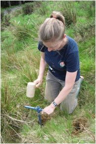
Ashlee Dere (Penn State) collecting a bulk density core.
Ashlee Dere (Penn State) collecting a bulk density core.
-
Dynamic Map
To fully zoom into a small area, you may need to visit the "Map" button and uncheck "Terrain" view.
-
Data
No datasets for this field area have been entered yet
-
Photos
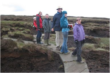
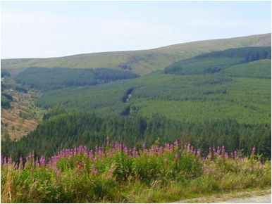
Shale Transect Site - Wales, UK

CZO investigators and collaborators look at peat near the source of the River Severn at the Plynlimon transect site. From left to right: Katerina Michaelides, University of Bristol; Brian Reynolds, CEH; Simon Grant, CEH; Steve Bannwart, University of Sheffield; Ashlee Dere, Penn State; Jennifer Williams, Penn State.

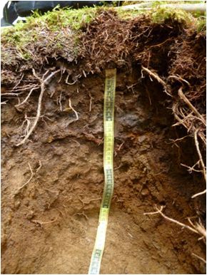
Soil pit

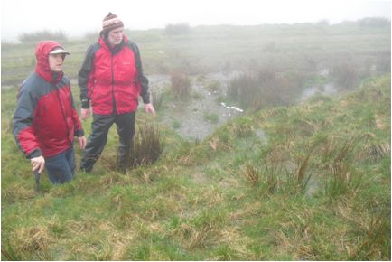
Tim White (feft - Penn State) and Brian Reynolds (right -CEH) observe overland flow during a rainstorm in the grassland Wye catchment at Plynlimon.

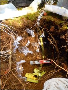
Shale chips buried at multiple depths in the forest soil at Plynlimon.

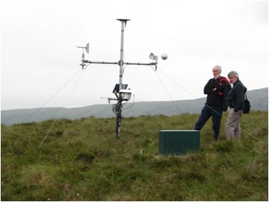
Brian Reynolds (left - CEH) and Chris Duffy (right - Penn State) examine the meteorological station at Carreg Wen, located at the top of the forested Severn catchment in Plynlimon.

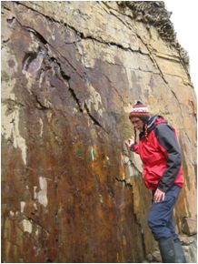
Brian Reynolds (CEH) stands near fractures in the Gwestyn Shale, the local equivalent to the Rose Hill Shale found in PA.

View looking west in the forested Severn catchment . The head of the catchment is to the right in this photo..
-
Partner Organizations
Explore Further
